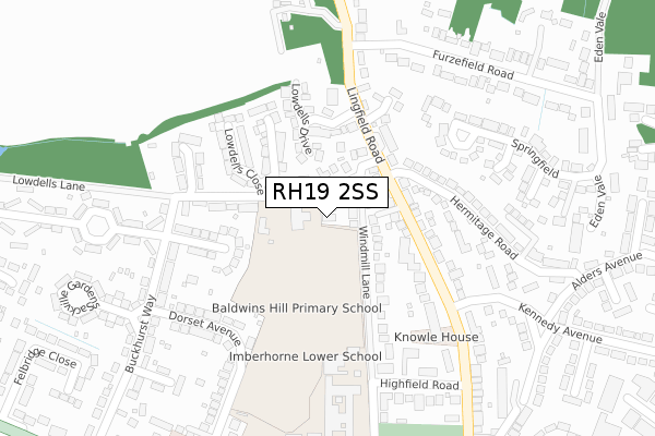
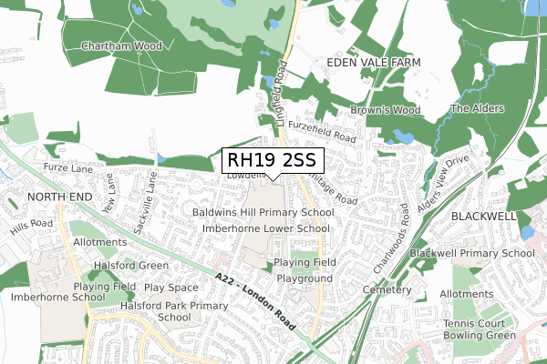
RH19 2SS is located in the East Grinstead Baldwins electoral ward, within the local authority district of Mid Sussex and the English Parliamentary constituency of Mid Sussex. The Sub Integrated Care Board (ICB) Location is NHS Sussex ICB - 70F and the police force is Sussex. This postcode has been in use since September 2017.


GetTheData
Source: OS Open Zoomstack (Ordnance Survey)
Licence: Open Government Licence (requires attribution)
Attribution: Contains OS data © Crown copyright and database right 2024
Source: Open Postcode Geo
Licence: Open Government Licence (requires attribution)
Attribution: Contains OS data © Crown copyright and database right 2024; Contains Royal Mail data © Royal Mail copyright and database right 2024; Source: Office for National Statistics licensed under the Open Government Licence v.3.0
| Easting | 538579 |
| Northing | 139440 |
| Latitude | 51.137465 |
| Longitude | -0.020552 |
GetTheData
Source: Open Postcode Geo
Licence: Open Government Licence
| Country | England |
| Postcode District | RH19 |
| ➜ RH19 open data dashboard ➜ See where RH19 is on a map ➜ Where is East Grinstead? | |
GetTheData
Source: Land Registry Price Paid Data
Licence: Open Government Licence
| Ward | East Grinstead Baldwins |
| Constituency | Mid Sussex |
GetTheData
Source: ONS Postcode Database
Licence: Open Government Licence
| January 2024 | Violence and sexual offences | On or near Lingfield Road | 228m |
| January 2024 | Violence and sexual offences | On or near Lingfield Road | 228m |
| January 2024 | Anti-social behaviour | On or near Dormans Park Road | 417m |
| ➜ Get more crime data in our Crime section | |||
GetTheData
Source: data.police.uk
Licence: Open Government Licence
| Hermitage Road (Lingfield Road) | East Grinstead | 134m |
| Hermitage Road (Lingfield Road) | East Grinstead | 134m |
| Furzefield Road (Lingfield Road) | East Grinstead | 250m |
| Furzefield Road (Lingfield Road) | East Grinstead | 254m |
| Imberhorne Lower School (Windmill Lane) | East Grinstead | 300m |
| East Grinstead Station | 1.3km |
| Dormans Station | 2.3km |
| Lingfield Station | 4.4km |
GetTheData
Source: NaPTAN
Licence: Open Government Licence
➜ Broadband speed and availability dashboard for RH19 2SS
| Percentage of properties with Next Generation Access | 100.0% |
| Percentage of properties with Superfast Broadband | 100.0% |
| Percentage of properties with Ultrafast Broadband | 0.0% |
| Percentage of properties with Full Fibre Broadband | 0.0% |
Superfast Broadband is between 30Mbps and 300Mbps
Ultrafast Broadband is > 300Mbps
| Median download speed | 31.0Mbps |
| Average download speed | 29.0Mbps |
| Maximum download speed | 49.56Mbps |
| Median upload speed | 8.5Mbps |
| Average upload speed | 5.9Mbps |
| Maximum upload speed | 9.84Mbps |
| Percentage of properties unable to receive 2Mbps | 0.0% |
| Percentage of properties unable to receive 5Mbps | 0.0% |
| Percentage of properties unable to receive 10Mbps | 0.0% |
| Percentage of properties unable to receive 30Mbps | 0.0% |
➜ Broadband speed and availability dashboard for RH19 2SS
GetTheData
Source: Ofcom
Licence: Ofcom Terms of Use (requires attribution)
GetTheData
Source: ONS Postcode Database
Licence: Open Government Licence


➜ Get more ratings from the Food Standards Agency
GetTheData
Source: Food Standards Agency
Licence: FSA terms & conditions
| Last Collection | |||
|---|---|---|---|
| Location | Mon-Fri | Sat | Distance |
| Lowdells Lane | 17:15 | 12:00 | 118m |
| Railway Station | 17:15 | 12:15 | 1,257m |
| Railway Approach | 17:15 | 12:15 | 1,340m |
GetTheData
Source: Dracos
Licence: Creative Commons Attribution-ShareAlike
| Facility | Distance |
|---|---|
| Baldwins Hill Primary School Lowdells Lane, East Grinstead Grass Pitches | 48m |
| Imberhorne Lower School Windmill Lane, East Grinstead Grass Pitches, Sports Hall, Outdoor Tennis Courts | 295m |
| St. Marys C Of E Primary School Windmill Lane, East Grinstead Grass Pitches | 543m |
GetTheData
Source: Active Places
Licence: Open Government Licence
| School | Phase of Education | Distance |
|---|---|---|
| Baldwins Hill Primary School, East Grinstead Lowdells Lane, Baldwins Hill, East Grinstead, RH19 2AP | Primary | 52m |
| St Mary's CofE Primary School, East Grinstead Windmill Lane, East Grinstead, RH19 2DS | Primary | 543m |
| Halsford Park Primary School Manor Road, East Grinstead, RH19 1LR | Primary | 735m |
GetTheData
Source: Edubase
Licence: Open Government Licence
The below table lists the International Territorial Level (ITL) codes (formerly Nomenclature of Territorial Units for Statistics (NUTS) codes) and Local Administrative Units (LAU) codes for RH19 2SS:
| ITL 1 Code | Name |
|---|---|
| TLJ | South East (England) |
| ITL 2 Code | Name |
| TLJ2 | Surrey, East and West Sussex |
| ITL 3 Code | Name |
| TLJ28 | West Sussex (North East) |
| LAU 1 Code | Name |
| E07000228 | Mid Sussex |
GetTheData
Source: ONS Postcode Directory
Licence: Open Government Licence
The below table lists the Census Output Area (OA), Lower Layer Super Output Area (LSOA), and Middle Layer Super Output Area (MSOA) for RH19 2SS:
| Code | Name | |
|---|---|---|
| OA | E00161805 | |
| LSOA | E01031733 | Mid Sussex 001C |
| MSOA | E02006604 | Mid Sussex 001 |
GetTheData
Source: ONS Postcode Directory
Licence: Open Government Licence
| RH19 2DZ | Windmill Lane | 42m |
| RH19 2AW | Lowdells Lane | 65m |
| RH19 2EA | Lowdells Lane | 85m |
| RH19 2DY | Windmill Lane | 122m |
| RH19 2RZ | Lowdells Drive | 137m |
| RH19 2EQ | Lingfield Road | 141m |
| RH19 2EB | Lingfield Road | 148m |
| RH19 2HE | Baldwins Field | 152m |
| RH19 2EJ | Lingfield Road | 153m |
| RH19 2BS | Hermitage Road | 158m |
GetTheData
Source: Open Postcode Geo; Land Registry Price Paid Data
Licence: Open Government Licence