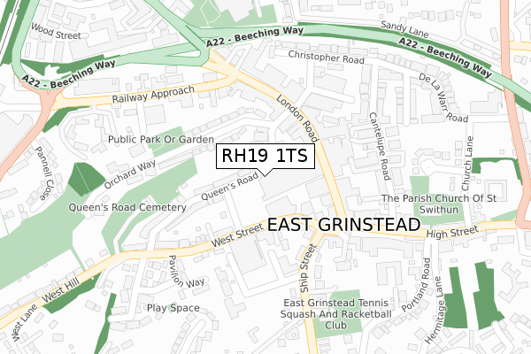
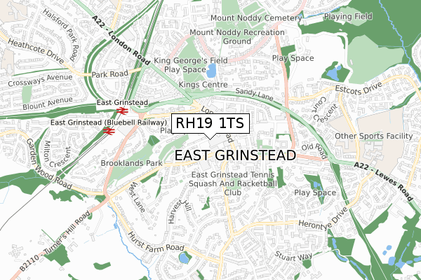
RH19 1TS is located in the East Grinstead Town electoral ward, within the local authority district of Mid Sussex and the English Parliamentary constituency of Mid Sussex. The Sub Integrated Care Board (ICB) Location is NHS Sussex ICB - 70F and the police force is Sussex. This postcode has been in use since June 2019.


GetTheData
Source: OS Open Zoomstack (Ordnance Survey)
Licence: Open Government Licence (requires attribution)
Attribution: Contains OS data © Crown copyright and database right 2024
Source: Open Postcode Geo
Licence: Open Government Licence (requires attribution)
Attribution: Contains OS data © Crown copyright and database right 2024; Contains Royal Mail data © Royal Mail copyright and database right 2024; Source: Office for National Statistics licensed under the Open Government Licence v.3.0
| Easting | 539400 |
| Northing | 138057 |
| Latitude | 51.124838 |
| Longitude | -0.009359 |
GetTheData
Source: Open Postcode Geo
Licence: Open Government Licence
| Country | England |
| Postcode District | RH19 |
| ➜ RH19 open data dashboard ➜ See where RH19 is on a map ➜ Where is East Grinstead? | |
GetTheData
Source: Land Registry Price Paid Data
Licence: Open Government Licence
| Ward | East Grinstead Town |
| Constituency | Mid Sussex |
GetTheData
Source: ONS Postcode Database
Licence: Open Government Licence
| January 2024 | Anti-social behaviour | On or near Parking Area | 238m |
| January 2024 | Anti-social behaviour | On or near Parking Area | 238m |
| January 2024 | Anti-social behaviour | On or near High Street | 267m |
| ➜ Get more crime data in our Crime section | |||
GetTheData
Source: data.police.uk
Licence: Open Government Licence
| Whitehall (London Road) | East Grinstead | 59m |
| Whitehall (London Road) | East Grinstead | 81m |
| War Memorial (High Street) | East Grinstead | 137m |
| War Memorial (High Street) | East Grinstead | 159m |
| Bell Hammer (Ship Street) | East Grinstead | 202m |
| East Grinstead Station | 0.6km |
| Dormans Station | 3.5km |
GetTheData
Source: NaPTAN
Licence: Open Government Licence
| Percentage of properties with Next Generation Access | 100.0% |
| Percentage of properties with Superfast Broadband | 100.0% |
| Percentage of properties with Ultrafast Broadband | 100.0% |
| Percentage of properties with Full Fibre Broadband | 100.0% |
Superfast Broadband is between 30Mbps and 300Mbps
Ultrafast Broadband is > 300Mbps
| Percentage of properties unable to receive 2Mbps | 0.0% |
| Percentage of properties unable to receive 5Mbps | 0.0% |
| Percentage of properties unable to receive 10Mbps | 0.0% |
| Percentage of properties unable to receive 30Mbps | 0.0% |
GetTheData
Source: Ofcom
Licence: Ofcom Terms of Use (requires attribution)
GetTheData
Source: ONS Postcode Database
Licence: Open Government Licence


➜ Get more ratings from the Food Standards Agency
GetTheData
Source: Food Standards Agency
Licence: FSA terms & conditions
| Last Collection | |||
|---|---|---|---|
| Location | Mon-Fri | Sat | Distance |
| East Grinstead Delivery Office | 18:00 | 12:15 | 125m |
| Lloyds Bank High Street | 17:15 | 12:00 | 143m |
| Safeways | 17:30 | 12:15 | 147m |
GetTheData
Source: Dracos
Licence: Creative Commons Attribution-ShareAlike
| Facility | Distance |
|---|---|
| Puregym (East Grinstead) King Street, King Street, East Grinstead Health and Fitness Gym | 147m |
| Energie Fitness (East Grinstead) London Road, East Grinstead Swimming Pool, Health and Fitness Gym, Studio | 234m |
| East Grinstead Tennis, Squash & Racketball Club Ship Street, East Grinstead Squash Courts, Outdoor Tennis Courts | 266m |
GetTheData
Source: Active Places
Licence: Open Government Licence
| School | Phase of Education | Distance |
|---|---|---|
| Estcots Primary School Bourg-De-Peage Avenue, East Grinstead, RH19 3TY | Primary | 768m |
| Sackville School Lewes Road, East Grinstead, RH19 3TY | Secondary | 828m |
| The Meads Primary School The Meads Primary School, Mill Way, East Grinstead, RH19 4DD | Primary | 839m |
GetTheData
Source: Edubase
Licence: Open Government Licence
The below table lists the International Territorial Level (ITL) codes (formerly Nomenclature of Territorial Units for Statistics (NUTS) codes) and Local Administrative Units (LAU) codes for RH19 1TS:
| ITL 1 Code | Name |
|---|---|
| TLJ | South East (England) |
| ITL 2 Code | Name |
| TLJ2 | Surrey, East and West Sussex |
| ITL 3 Code | Name |
| TLJ28 | West Sussex (North East) |
| LAU 1 Code | Name |
| E07000228 | Mid Sussex |
GetTheData
Source: ONS Postcode Directory
Licence: Open Government Licence
The below table lists the Census Output Area (OA), Lower Layer Super Output Area (LSOA), and Middle Layer Super Output Area (MSOA) for RH19 1TS:
| Code | Name | |
|---|---|---|
| OA | E00161854 | |
| LSOA | E01031742 | Mid Sussex 001F |
| MSOA | E02006604 | Mid Sussex 001 |
GetTheData
Source: ONS Postcode Directory
Licence: Open Government Licence
| RH19 4BF | West Street | 47m |
| RH19 1AB | London Road | 76m |
| RH19 4EQ | West Street | 90m |
| RH19 4EY | West Street | 90m |
| RH19 1AP | Whitehall Parade | 105m |
| RH19 1BG | Queens Road | 114m |
| RH19 1AT | Dellaway Gardens | 122m |
| RH19 3BD | Institute Walk | 128m |
| RH19 3BE | Cantelupe Road | 131m |
| RH19 4EG | Ship Street | 132m |
GetTheData
Source: Open Postcode Geo; Land Registry Price Paid Data
Licence: Open Government Licence