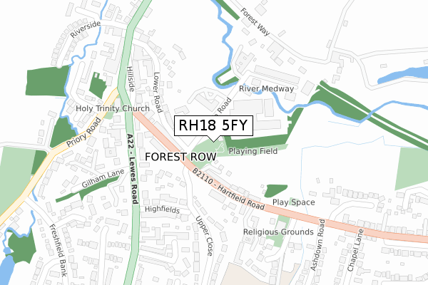
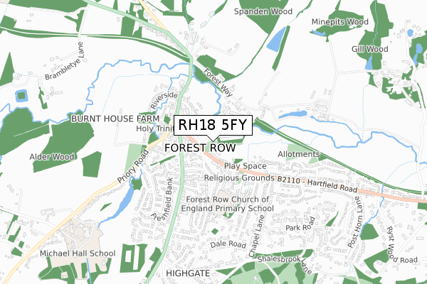
RH18 5FY is located in the Forest Row electoral ward, within the local authority district of Wealden and the English Parliamentary constituency of Wealden. The Sub Integrated Care Board (ICB) Location is NHS Sussex ICB - 97R and the police force is Sussex. This postcode has been in use since October 2019.


GetTheData
Source: OS Open Zoomstack (Ordnance Survey)
Licence: Open Government Licence (requires attribution)
Attribution: Contains OS data © Crown copyright and database right 2024
Source: Open Postcode Geo
Licence: Open Government Licence (requires attribution)
Attribution: Contains OS data © Crown copyright and database right 2024; Contains Royal Mail data © Royal Mail copyright and database right 2024; Source: Office for National Statistics licensed under the Open Government Licence v.3.0
| Easting | 542692 |
| Northing | 135085 |
| Latitude | 51.097320 |
| Longitude | 0.036476 |
GetTheData
Source: Open Postcode Geo
Licence: Open Government Licence
| Country | England |
| Postcode District | RH18 |
| ➜ RH18 open data dashboard ➜ See where RH18 is on a map | |
GetTheData
Source: Land Registry Price Paid Data
Licence: Open Government Licence
| Ward | Forest Row |
| Constituency | Wealden |
GetTheData
Source: ONS Postcode Database
Licence: Open Government Licence
| January 2024 | Anti-social behaviour | On or near Parking Area | 135m |
| January 2024 | Public order | On or near Petrol Station | 301m |
| January 2024 | Other theft | On or near Petrol Station | 301m |
| ➜ Get more crime data in our Crime section | |||
GetTheData
Source: data.police.uk
Licence: Open Government Licence
| Upper Close (Hartfield Road) | Forest Row | 93m |
| Upper Close (Hartfield Road) | Forest Row | 113m |
| Brambletye (London Road) | Forest Row | 272m |
| Brambletye (London Road) | Forest Row | 332m |
| Evelyn Clark House (Lewes Road) | Forest Row | 419m |
| East Grinstead Station | 5km |
GetTheData
Source: NaPTAN
Licence: Open Government Licence
GetTheData
Source: ONS Postcode Database
Licence: Open Government Licence


➜ Get more ratings from the Food Standards Agency
GetTheData
Source: Food Standards Agency
Licence: FSA terms & conditions
| Last Collection | |||
|---|---|---|---|
| Location | Mon-Fri | Sat | Distance |
| Hartfield Road Parade | 16:45 | 12:00 | 118m |
| Forest Row Po | 17:15 | 12:15 | 137m |
| The Square | 17:30 | 12:30 | 303m |
GetTheData
Source: Dracos
Licence: Creative Commons Attribution-ShareAlike
| Facility | Distance |
|---|---|
| Gaches Health Club (Closed) Station Road, Forest Row Health and Fitness Gym, Studio | 228m |
| Medway Park (Forest Row) Station Road, Forest Row Grass Pitches | 241m |
| Forest Row Sports Ground Shalesbrook Lane, Forest Row Grass Pitches, Outdoor Tennis Courts | 834m |
GetTheData
Source: Active Places
Licence: Open Government Licence
| School | Phase of Education | Distance |
|---|---|---|
| Forest Row Church of England Primary School Forest Row CE Primary School, School Lane, Hartfield Road, Forest Row, RH18 5EB | Primary | 387m |
| Michael Hall School Kidbrooke Park, Priory Road, Forest Row, RH18 5JA | Not applicable | 1.1km |
| Ashurst Wood Primary School School Lane, Ashurst Wood, East Grinstead, RH19 3QW | Primary | 1.7km |
GetTheData
Source: Edubase
Licence: Open Government Licence
The below table lists the International Territorial Level (ITL) codes (formerly Nomenclature of Territorial Units for Statistics (NUTS) codes) and Local Administrative Units (LAU) codes for RH18 5FY:
| ITL 1 Code | Name |
|---|---|
| TLJ | South East (England) |
| ITL 2 Code | Name |
| TLJ2 | Surrey, East and West Sussex |
| ITL 3 Code | Name |
| TLJ22 | East Sussex CC |
| LAU 1 Code | Name |
| E07000065 | Wealden |
GetTheData
Source: ONS Postcode Directory
Licence: Open Government Licence
The below table lists the Census Output Area (OA), Lower Layer Super Output Area (LSOA), and Middle Layer Super Output Area (MSOA) for RH18 5FY:
| Code | Name | |
|---|---|---|
| OA | E00107544 | |
| LSOA | E01021167 | Wealden 001A |
| MSOA | E02004403 | Wealden 001 |
GetTheData
Source: ONS Postcode Directory
Licence: Open Government Licence
| RH18 5DY | Hartfield Road | 112m |
| RH18 5DN | Hartfield Road | 141m |
| RH18 5DR | Upper Close | 142m |
| RH18 5DQ | Hartfield Road | 149m |
| RH18 5FS | Station Road | 181m |
| RH18 5DW | Station Road | 188m |
| RH18 5HE | Lower Road | 189m |
| RH18 5AA | Lewes Road | 191m |
| RH18 5AJ | Highfields | 216m |
| RH18 5DZ | Hartfield Road | 222m |
GetTheData
Source: Open Postcode Geo; Land Registry Price Paid Data
Licence: Open Government Licence