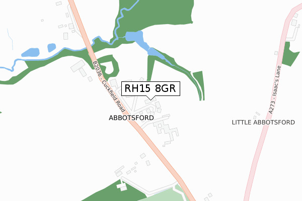
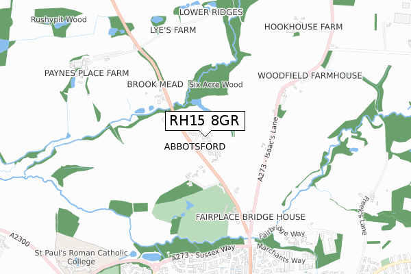
RH15 8GR is located in the Burgess Hill Dunstall electoral ward, within the local authority district of Mid Sussex and the English Parliamentary constituency of Mid Sussex. The Sub Integrated Care Board (ICB) Location is NHS Sussex ICB - 70F and the police force is Sussex. This postcode has been in use since March 2019.


GetTheData
Source: OS Open Zoomstack (Ordnance Survey)
Licence: Open Government Licence (requires attribution)
Attribution: Contains OS data © Crown copyright and database right 2024
Source: Open Postcode Geo
Licence: Open Government Licence (requires attribution)
Attribution: Contains OS data © Crown copyright and database right 2024; Contains Royal Mail data © Royal Mail copyright and database right 2024; Source: Office for National Statistics licensed under the Open Government Licence v.3.0
| Easting | 530447 |
| Northing | 120979 |
| Latitude | 50.973456 |
| Longitude | -0.143369 |
GetTheData
Source: Open Postcode Geo
Licence: Open Government Licence
| Country | England |
| Postcode District | RH15 |
| ➜ RH15 open data dashboard ➜ See where RH15 is on a map ➜ Where is Abbotsford? | |
GetTheData
Source: Land Registry Price Paid Data
Licence: Open Government Licence
| Ward | Burgess Hill Dunstall |
| Constituency | Mid Sussex |
GetTheData
Source: ONS Postcode Database
Licence: Open Government Licence
| The Saffrons (Sussex Way) | Burgess Hill | 692m |
| The Saffrons (Sussex Way) | Burgess Hill | 723m |
| Sussex Way | Burgess Hill | 746m |
| Sussex Way | Burgess Hill | 780m |
| Dunstall Avenue (London Road) | Burgess Hill | 929m |
| Wivelsfield Station | 1.9km |
| Burgess Hill Station | 2.5km |
| Haywards Heath Station | 4.5km |
GetTheData
Source: NaPTAN
Licence: Open Government Licence
| Percentage of properties with Next Generation Access | 100.0% |
| Percentage of properties with Superfast Broadband | 0.0% |
| Percentage of properties with Ultrafast Broadband | 0.0% |
| Percentage of properties with Full Fibre Broadband | 0.0% |
Superfast Broadband is between 30Mbps and 300Mbps
Ultrafast Broadband is > 300Mbps
| Percentage of properties unable to receive 2Mbps | 0.0% |
| Percentage of properties unable to receive 5Mbps | 0.0% |
| Percentage of properties unable to receive 10Mbps | 0.0% |
| Percentage of properties unable to receive 30Mbps | 100.0% |
GetTheData
Source: Ofcom
Licence: Ofcom Terms of Use (requires attribution)
GetTheData
Source: ONS Postcode Database
Licence: Open Government Licence


➜ Get more ratings from the Food Standards Agency
GetTheData
Source: Food Standards Agency
Licence: FSA terms & conditions
| Last Collection | |||
|---|---|---|---|
| Location | Mon-Fri | Sat | Distance |
| Gatehouse Lane | 16:45 | 11:00 | 1,469m |
| Leylands Road | 17:00 | 11:15 | 1,730m |
| Temple Grove | 16:45 | 11:00 | 1,887m |
GetTheData
Source: Dracos
Licence: Creative Commons Attribution-ShareAlike
| Facility | Distance |
|---|---|
| Abbotsford Community Special School (Closed) Cuckfield Road, Burgess Hill Grass Pitches | 97m |
| The Burgess Hill Golf Centre Cuckfield Road, Burgess Hill Golf | 405m |
| West End Meadow The Brooks, Burgess Hill Grass Pitches | 948m |
GetTheData
Source: Active Places
Licence: Open Government Licence
| School | Phase of Education | Distance |
|---|---|---|
| West Sussex Alternative Provision College Cuckfield Road, Burgess Hill, RH15 8RE | Not applicable | 185m |
| St Paul's Catholic College Jane Murray Way, Burgess Hill, RH15 8GA | Secondary | 1.1km |
| Sheddingdean Community Primary School Petworth Drive, Burgess Hill, RH15 8JT | Primary | 1.2km |
GetTheData
Source: Edubase
Licence: Open Government Licence
The below table lists the International Territorial Level (ITL) codes (formerly Nomenclature of Territorial Units for Statistics (NUTS) codes) and Local Administrative Units (LAU) codes for RH15 8GR:
| ITL 1 Code | Name |
|---|---|
| TLJ | South East (England) |
| ITL 2 Code | Name |
| TLJ2 | Surrey, East and West Sussex |
| ITL 3 Code | Name |
| TLJ28 | West Sussex (North East) |
| LAU 1 Code | Name |
| E07000228 | Mid Sussex |
GetTheData
Source: ONS Postcode Directory
Licence: Open Government Licence
The below table lists the Census Output Area (OA), Lower Layer Super Output Area (LSOA), and Middle Layer Super Output Area (MSOA) for RH15 8GR:
| Code | Name | |
|---|---|---|
| OA | E00161783 | |
| LSOA | E01031728 | Mid Sussex 011B |
| MSOA | E02006614 | Mid Sussex 011 |
GetTheData
Source: ONS Postcode Directory
Licence: Open Government Licence
| RH15 8RE | Cuckfield Road | 79m |
| RH15 8RA | Isaacs Lane | 444m |
| RH15 8TB | The Saffrons | 739m |
| RH15 8TN | Langridge Way | 787m |
| RH15 8TD | The Gilligans | 788m |
| RH15 8TP | Fry Crescent | 798m |
| RH15 8TJ | Cornford Close | 799m |
| RH15 8QT | Woodcroft | 803m |
| RH15 8TL | Wisden Avenue | 804m |
| RH15 8QX | London Road | 830m |
GetTheData
Source: Open Postcode Geo; Land Registry Price Paid Data
Licence: Open Government Licence