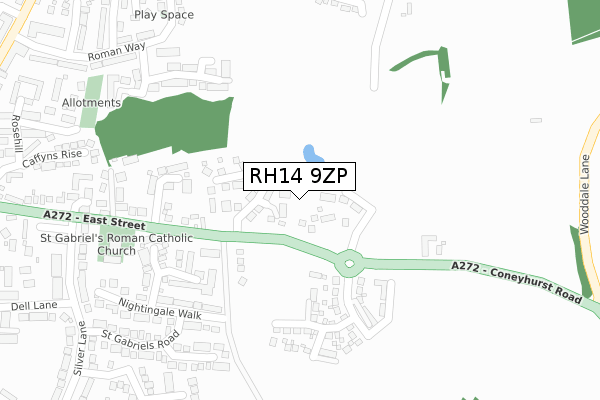
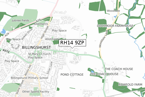
RH14 9ZP is located in the Billingshurst electoral ward, within the local authority district of Horsham and the English Parliamentary constituency of Horsham. The Sub Integrated Care Board (ICB) Location is NHS Sussex ICB - 70F and the police force is Sussex. This postcode has been in use since October 2019.


GetTheData
Source: OS Open Zoomstack (Ordnance Survey)
Licence: Open Government Licence (requires attribution)
Attribution: Contains OS data © Crown copyright and database right 2024
Source: Open Postcode Geo
Licence: Open Government Licence (requires attribution)
Attribution: Contains OS data © Crown copyright and database right 2024; Contains Royal Mail data © Royal Mail copyright and database right 2024; Source: Office for National Statistics licensed under the Open Government Licence v.3.0
| Easting | 509264 |
| Northing | 125986 |
| Latitude | 51.022868 |
| Longitude | -0.443448 |
GetTheData
Source: Open Postcode Geo
Licence: Open Government Licence
| Country | England |
| Postcode District | RH14 |
| ➜ RH14 open data dashboard ➜ See where RH14 is on a map ➜ Where is Billingshurst? | |
GetTheData
Source: Land Registry Price Paid Data
Licence: Open Government Licence
| Ward | Billingshurst |
| Constituency | Horsham |
GetTheData
Source: ONS Postcode Database
Licence: Open Government Licence
21, NEWMAN WAY, BILLINGSHURST, RH14 9ZP 2021 30 APR £715,000 |
10, NEWMAN WAY, BILLINGSHURST, RH14 9ZP 2020 27 NOV £575,000 |
22, NEWMAN WAY, BILLINGSHURST, RH14 9ZP 2020 12 OCT £710,000 |
24, NEWMAN WAY, BILLINGSHURST, RH14 9ZP 2020 14 AUG £750,000 |
9, NEWMAN WAY, BILLINGSHURST, RH14 9ZP 2020 14 AUG £586,000 |
8, NEWMAN WAY, BILLINGSHURST, RH14 9ZP 2020 17 JUL £600,000 |
25, NEWMAN WAY, BILLINGSHURST, RH14 9ZP 2020 26 JUN £640,000 |
23, NEWMAN WAY, BILLINGSHURST, RH14 9ZP 2020 19 JUN £677,000 |
27, NEWMAN WAY, BILLINGSHURST, RH14 9ZP 2020 27 MAR £613,000 |
26, NEWMAN WAY, BILLINGSHURST, RH14 9ZP 2020 20 JAN £460,000 |
GetTheData
Source: HM Land Registry Price Paid Data
Licence: Contains HM Land Registry data © Crown copyright and database right 2024. This data is licensed under the Open Government Licence v3.0.
| June 2022 | Other theft | On or near Easton Crescent | 240m |
| June 2022 | Public order | On or near School Lane | 264m |
| June 2022 | Violence and sexual offences | On or near School Lane | 264m |
| ➜ Get more crime data in our Crime section | |||
GetTheData
Source: data.police.uk
Licence: Open Government Licence
| East Street | Billingshurst | 107m |
| East Street W Bound (East Street) | Billingshurst | 111m |
| East Street East Bound (East Street) | Billingshurst | 432m |
| East Street West Bound (East Street) | Billingshurst | 435m |
| Village Hall (High Street) | Billingshurst | 503m |
| Billingshurst Station | 1km |
GetTheData
Source: NaPTAN
Licence: Open Government Licence
GetTheData
Source: ONS Postcode Database
Licence: Open Government Licence


➜ Get more ratings from the Food Standards Agency
GetTheData
Source: Food Standards Agency
Licence: FSA terms & conditions
| Last Collection | |||
|---|---|---|---|
| Location | Mon-Fri | Sat | Distance |
| Silver Lane | 16:45 | 09:30 | 579m |
| Jengers Mead | 17:15 | 12:00 | 582m |
| Billingshurst Delivery Office | 18:00 | 12:30 | 589m |
GetTheData
Source: Dracos
Licence: Creative Commons Attribution-ShareAlike
| Facility | Distance |
|---|---|
| Manor Field (Closed) Coombe Hill, Billingshurst Grass Pitches | 631m |
| Station Road Football Field (Closed) Station Road, Billingshurst Grass Pitches | 907m |
| Billingshurst Leisure Centre Station Road, Billingshurst Sports Hall, Swimming Pool, Health and Fitness Gym, Artificial Grass Pitch, Outdoor Tennis Courts | 965m |
GetTheData
Source: Active Places
Licence: Open Government Licence
| School | Phase of Education | Distance |
|---|---|---|
| Billingshurst Primary School Upper Station Road, Billingshurst, RH14 9RE | Primary | 774m |
| Billingshurst Primary School Upper Station Road, Billingshurst, RH14 9RE | Primary | 826m |
| Weald School, The Station Road, Billingshurst, RH14 9RY | Secondary | 1km |
GetTheData
Source: Edubase
Licence: Open Government Licence
The below table lists the International Territorial Level (ITL) codes (formerly Nomenclature of Territorial Units for Statistics (NUTS) codes) and Local Administrative Units (LAU) codes for RH14 9ZP:
| ITL 1 Code | Name |
|---|---|
| TLJ | South East (England) |
| ITL 2 Code | Name |
| TLJ2 | Surrey, East and West Sussex |
| ITL 3 Code | Name |
| TLJ28 | West Sussex (North East) |
| LAU 1 Code | Name |
| E07000227 | Horsham |
GetTheData
Source: ONS Postcode Directory
Licence: Open Government Licence
The below table lists the Census Output Area (OA), Lower Layer Super Output Area (LSOA), and Middle Layer Super Output Area (MSOA) for RH14 9ZP:
| Code | Name | |
|---|---|---|
| OA | E00161213 | |
| LSOA | E01031611 | Horsham 010A |
| MSOA | E02006597 | Horsham 010 |
GetTheData
Source: ONS Postcode Directory
Licence: Open Government Licence
| RH14 9DA | East Street | 127m |
| RH14 9GT | Windmill Place | 164m |
| RH14 9GQ | Treetops | 195m |
| RH14 9TU | Easton Crescent | 214m |
| RH14 9QL | School Lane | 250m |
| RH14 9QJ | East Street | 258m |
| RH14 9TY | Nightingale Walk | 261m |
| RH14 9TT | Gorselands | 317m |
| RH14 9QF | Luggs Close | 325m |
| RH14 9JY | Caffyns Rise | 329m |
GetTheData
Source: Open Postcode Geo; Land Registry Price Paid Data
Licence: Open Government Licence