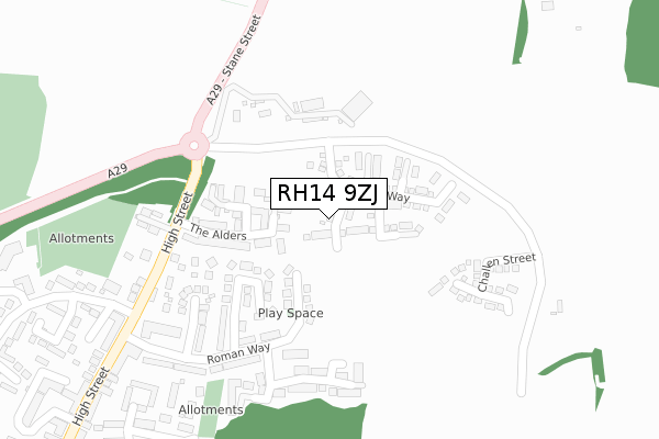
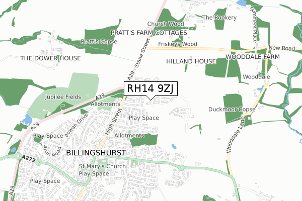
RH14 9ZJ is located in the Billingshurst electoral ward, within the local authority district of Horsham and the English Parliamentary constituency of Horsham. The Sub Integrated Care Board (ICB) Location is NHS Sussex ICB - 70F and the police force is Sussex. This postcode has been in use since November 2018.


GetTheData
Source: OS Open Zoomstack (Ordnance Survey)
Licence: Open Government Licence (requires attribution)
Attribution: Contains OS data © Crown copyright and database right 2024
Source: Open Postcode Geo
Licence: Open Government Licence (requires attribution)
Attribution: Contains OS data © Crown copyright and database right 2024; Contains Royal Mail data © Royal Mail copyright and database right 2024; Source: Office for National Statistics licensed under the Open Government Licence v.3.0
| Easting | 509188 |
| Northing | 126299 |
| Latitude | 51.025696 |
| Longitude | -0.444437 |
GetTheData
Source: Open Postcode Geo
Licence: Open Government Licence
| Country | England |
| Postcode District | RH14 |
| ➜ RH14 open data dashboard ➜ See where RH14 is on a map ➜ Where is Billingshurst? | |
GetTheData
Source: Land Registry Price Paid Data
Licence: Open Government Licence
| Ward | Billingshurst |
| Constituency | Horsham |
GetTheData
Source: ONS Postcode Database
Licence: Open Government Licence
10, PUTTOCK WAY, BILLINGSHURST, RH14 9ZJ 2024 31 JAN £553,000 |
11, PUTTOCK WAY, BILLINGSHURST, RH14 9ZJ 2023 27 OCT £540,000 |
12, PUTTOCK WAY, BILLINGSHURST, RH14 9ZJ 2020 28 AUG £490,000 |
14, PUTTOCK WAY, BILLINGSHURST, RH14 9ZJ 2020 3 FEB £450,000 |
10, PUTTOCK WAY, BILLINGSHURST, RH14 9ZJ 2020 9 JAN £475,000 |
11, PUTTOCK WAY, BILLINGSHURST, RH14 9ZJ 2019 19 DEC £450,000 |
16, PUTTOCK WAY, BILLINGSHURST, RH14 9ZJ 2019 6 NOV £454,950 |
9, PUTTOCK WAY, BILLINGSHURST, RH14 9ZJ 2019 24 SEP £485,000 |
GetTheData
Source: HM Land Registry Price Paid Data
Licence: Contains HM Land Registry data © Crown copyright and database right 2024. This data is licensed under the Open Government Licence v3.0.
| June 2022 | Public order | On or near Norman Close | 165m |
| June 2022 | Criminal damage and arson | On or near Saxon Close | 196m |
| June 2022 | Criminal damage and arson | On or near Saxon Close | 196m |
| ➜ Get more crime data in our Crime section | |||
GetTheData
Source: data.police.uk
Licence: Open Government Licence
| High Street North (High Street) | Billingshurst | 310m |
| Village Hall (High Street) | Billingshurst | 325m |
| East Street | Billingshurst | 423m |
| East Street W Bound (East Street) | Billingshurst | 429m |
| Jengers Mead (High Street) | Billingshurst | 468m |
| Billingshurst Station | 1.2km |
GetTheData
Source: NaPTAN
Licence: Open Government Licence
➜ Broadband speed and availability dashboard for RH14 9ZJ
| Percentage of properties with Next Generation Access | 100.0% |
| Percentage of properties with Superfast Broadband | 100.0% |
| Percentage of properties with Ultrafast Broadband | 100.0% |
| Percentage of properties with Full Fibre Broadband | 100.0% |
Superfast Broadband is between 30Mbps and 300Mbps
Ultrafast Broadband is > 300Mbps
| Median download speed | 360.0Mbps |
| Average download speed | 360.0Mbps |
| Maximum download speed | 360.00Mbps |
| Median upload speed | 360.0Mbps |
| Average upload speed | 360.0Mbps |
| Maximum upload speed | 360.00Mbps |
| Percentage of properties unable to receive 2Mbps | 0.0% |
| Percentage of properties unable to receive 5Mbps | 0.0% |
| Percentage of properties unable to receive 10Mbps | 0.0% |
| Percentage of properties unable to receive 30Mbps | 0.0% |
➜ Broadband speed and availability dashboard for RH14 9ZJ
GetTheData
Source: Ofcom
Licence: Ofcom Terms of Use (requires attribution)
GetTheData
Source: ONS Postcode Database
Licence: Open Government Licence


➜ Get more ratings from the Food Standards Agency
GetTheData
Source: Food Standards Agency
Licence: FSA terms & conditions
| Last Collection | |||
|---|---|---|---|
| Location | Mon-Fri | Sat | Distance |
| Jengers Mead | 17:15 | 12:00 | 497m |
| Billingshurst Delivery Office | 18:00 | 12:30 | 605m |
| Mill Lane | 17:15 | 09:30 | 807m |
GetTheData
Source: Dracos
Licence: Creative Commons Attribution-ShareAlike
| Facility | Distance |
|---|---|
| Manor Field (Closed) Coombe Hill, Billingshurst Grass Pitches | 423m |
| Billingshurst Jubilee Fields Newbridge Road, Billingshurst Grass Pitches | 928m |
| Forge Way Playing Field (Closed) Forge Way, Billingshurst Grass Pitches | 1.1km |
GetTheData
Source: Active Places
Licence: Open Government Licence
| School | Phase of Education | Distance |
|---|---|---|
| Billingshurst Primary School Upper Station Road, Billingshurst, RH14 9RE | Primary | 968m |
| Billingshurst Primary School Upper Station Road, Billingshurst, RH14 9RE | Primary | 991m |
| Weald School, The Station Road, Billingshurst, RH14 9RY | Secondary | 1.2km |
GetTheData
Source: Edubase
Licence: Open Government Licence
The below table lists the International Territorial Level (ITL) codes (formerly Nomenclature of Territorial Units for Statistics (NUTS) codes) and Local Administrative Units (LAU) codes for RH14 9ZJ:
| ITL 1 Code | Name |
|---|---|
| TLJ | South East (England) |
| ITL 2 Code | Name |
| TLJ2 | Surrey, East and West Sussex |
| ITL 3 Code | Name |
| TLJ28 | West Sussex (North East) |
| LAU 1 Code | Name |
| E07000227 | Horsham |
GetTheData
Source: ONS Postcode Directory
Licence: Open Government Licence
The below table lists the Census Output Area (OA), Lower Layer Super Output Area (LSOA), and Middle Layer Super Output Area (MSOA) for RH14 9ZJ:
| Code | Name | |
|---|---|---|
| OA | E00161218 | |
| LSOA | E01031614 | Horsham 010D |
| MSOA | E02006597 | Horsham 010 |
GetTheData
Source: ONS Postcode Directory
Licence: Open Government Licence
| RH14 9QY | Norman Close | 167m |
| RH14 9GU | The Alders | 225m |
| RH14 9SN | High Seat Copse | 230m |
| RH14 9QU | Roman Way | 233m |
| RH14 9SD | High Seat Gardens | 239m |
| RH14 9SA | Saxon Close | 244m |
| RH14 9PJ | High Street | 283m |
| RH14 9GT | Windmill Place | 317m |
| RH14 9HN | Stane Street | 318m |
| RH14 9PN | Little East Street | 321m |
GetTheData
Source: Open Postcode Geo; Land Registry Price Paid Data
Licence: Open Government Licence