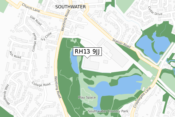
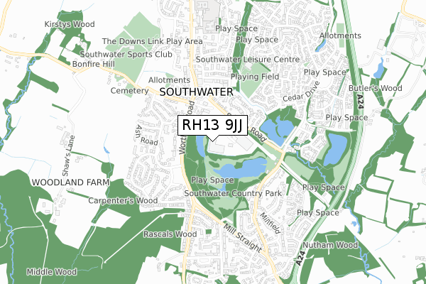
RH13 9JJ is located in the Southwater South & Shipley electoral ward, within the local authority district of Horsham and the English Parliamentary constituency of Horsham. The Sub Integrated Care Board (ICB) Location is NHS Sussex ICB - 70F and the police force is Sussex. This postcode has been in use since June 2019.


GetTheData
Source: OS Open Zoomstack (Ordnance Survey)
Licence: Open Government Licence (requires attribution)
Attribution: Contains OS data © Crown copyright and database right 2024
Source: Open Postcode Geo
Licence: Open Government Licence (requires attribution)
Attribution: Contains OS data © Crown copyright and database right 2024; Contains Royal Mail data © Royal Mail copyright and database right 2024; Source: Office for National Statistics licensed under the Open Government Licence v.3.0
| Easting | 515770 |
| Northing | 125992 |
| Latitude | 51.021650 |
| Longitude | -0.350722 |
GetTheData
Source: Open Postcode Geo
Licence: Open Government Licence
| Country | England |
| Postcode District | RH13 |
| ➜ RH13 open data dashboard ➜ See where RH13 is on a map ➜ Where is Southwater? | |
GetTheData
Source: Land Registry Price Paid Data
Licence: Open Government Licence
| Ward | Southwater South & Shipley |
| Constituency | Horsham |
GetTheData
Source: ONS Postcode Database
Licence: Open Government Licence
| June 2022 | Violence and sexual offences | On or near Bakers Close | 208m |
| June 2022 | Violence and sexual offences | On or near Little Bridges Close | 263m |
| June 2022 | Anti-social behaviour | On or near College Road | 314m |
| ➜ Get more crime data in our Crime section | |||
GetTheData
Source: data.police.uk
Licence: Open Government Licence
| College Road (Worthing Road) | Southwater | 180m |
| College Road (Worthing Road) | Southwater | 208m |
| Cock Inn (Worthing Road) | Southwater | 229m |
| Cock Inn (Worthing Road) | Southwater | 244m |
| Worthing Road (Church Lane) | Southwater | 288m |
| Christs Hospital Station | 3.4km |
| Horsham Station | 5.4km |
GetTheData
Source: NaPTAN
Licence: Open Government Licence
GetTheData
Source: ONS Postcode Database
Licence: Open Government Licence


➜ Get more ratings from the Food Standards Agency
GetTheData
Source: Food Standards Agency
Licence: FSA terms & conditions
| Last Collection | |||
|---|---|---|---|
| Location | Mon-Fri | Sat | Distance |
| Cedar Drive | 16:15 | 07:30 | 550m |
| Charlock Way | 17:00 | 08:00 | 1,374m |
| Robin Hood | 17:00 | 09:30 | 1,977m |
GetTheData
Source: Dracos
Licence: Creative Commons Attribution-ShareAlike
| Facility | Distance |
|---|---|
| Southwater Cricket Club Church Lane, Southwater, Horsham Grass Pitches | 491m |
| The Ghyll Pevensey Road, Southwater, Horsham Sports Hall, Health and Fitness Gym, Grass Pitches, Studio | 504m |
| Southwater Sports Club Church Lane, Southwater Grass Pitches, Outdoor Tennis Courts | 728m |
GetTheData
Source: Active Places
Licence: Open Government Licence
| School | Phase of Education | Distance |
|---|---|---|
| Southwater Infant Academy Worthing Road, Southwater, Horsham, RH13 9JH | Primary | 678m |
| Southwater Junior Academy Worthing Road, Southwater, Horsham, RH13 9JH | Primary | 815m |
| Castlewood Primary School Castlewood Road, Southwater, Horsham, RH13 9US | Primary | 1.1km |
GetTheData
Source: Edubase
Licence: Open Government Licence
The below table lists the International Territorial Level (ITL) codes (formerly Nomenclature of Territorial Units for Statistics (NUTS) codes) and Local Administrative Units (LAU) codes for RH13 9JJ:
| ITL 1 Code | Name |
|---|---|
| TLJ | South East (England) |
| ITL 2 Code | Name |
| TLJ2 | Surrey, East and West Sussex |
| ITL 3 Code | Name |
| TLJ28 | West Sussex (North East) |
| LAU 1 Code | Name |
| E07000227 | Horsham |
GetTheData
Source: ONS Postcode Directory
Licence: Open Government Licence
The below table lists the Census Output Area (OA), Lower Layer Super Output Area (LSOA), and Middle Layer Super Output Area (MSOA) for RH13 9JJ:
| Code | Name | |
|---|---|---|
| OA | E00161565 | |
| LSOA | E01031683 | Horsham 009F |
| MSOA | E02006596 | Horsham 009 |
GetTheData
Source: ONS Postcode Directory
Licence: Open Government Licence
| RH13 9JB | Southwater Business Park | 187m |
| RH13 9DX | Bakers Close | 189m |
| RH13 9DY | Andrews Lane | 213m |
| RH13 9HG | Worthing Road | 221m |
| RH13 9HQ | Station Road | 228m |
| RH13 9UB | Amberglade | 233m |
| RH13 9HE | Worthing Road | 247m |
| RH13 9HH | Little Bridges Close | 247m |
| RH13 9EF | Ivy Close | 262m |
| RH13 9LN | Station Road | 276m |
GetTheData
Source: Open Postcode Geo; Land Registry Price Paid Data
Licence: Open Government Licence