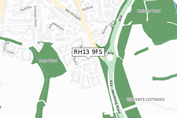
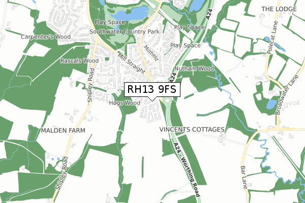
RH13 9FS is located in the Southwater South & Shipley electoral ward, within the local authority district of Horsham and the English Parliamentary constituency of Horsham. The Sub Integrated Care Board (ICB) Location is NHS Sussex ICB - 70F and the police force is Sussex. This postcode has been in use since July 2018.


GetTheData
Source: OS Open Zoomstack (Ordnance Survey)
Licence: Open Government Licence (requires attribution)
Attribution: Contains OS data © Crown copyright and database right 2024
Source: Open Postcode Geo
Licence: Open Government Licence (requires attribution)
Attribution: Contains OS data © Crown copyright and database right 2024; Contains Royal Mail data © Royal Mail copyright and database right 2024; Source: Office for National Statistics licensed under the Open Government Licence v.3.0
| Easting | 516141 |
| Northing | 125096 |
| Latitude | 51.013522 |
| Longitude | -0.345721 |
GetTheData
Source: Open Postcode Geo
Licence: Open Government Licence
| Country | England |
| Postcode District | RH13 |
| ➜ RH13 open data dashboard ➜ See where RH13 is on a map ➜ Where is Southwater? | |
GetTheData
Source: Land Registry Price Paid Data
Licence: Open Government Licence
| Ward | Southwater South & Shipley |
| Constituency | Horsham |
GetTheData
Source: ONS Postcode Database
Licence: Open Government Licence
2, FAIRES CLOSE, SOUTHWATER, HORSHAM, RH13 9FS 2019 5 APR £370,000 |
36, FAIRES CLOSE, SOUTHWATER, HORSHAM, RH13 9FS 2019 28 FEB £419,000 |
GetTheData
Source: HM Land Registry Price Paid Data
Licence: Contains HM Land Registry data © Crown copyright and database right 2024. This data is licensed under the Open Government Licence v3.0.
| August 2023 | Criminal damage and arson | On or near The Fieldings | 259m |
| May 2023 | Other theft | On or near Wealdon Close | 415m |
| March 2023 | Vehicle crime | On or near The Fieldings | 259m |
| ➜ Get more crime data in our Crime section | |||
GetTheData
Source: data.police.uk
Licence: Open Government Licence
| Cripplegate Corner (Mill Straight) | Southwater | 318m |
| Millfield South (Cripplegate Lane) | Southwater | 322m |
| Cripplegate Corner (Mill Straight) | Southwater | 363m |
| Treetops (Andrews Road) | Southwater | 464m |
| Foxfield Cottages | Southwater | 467m |
| Christs Hospital Station | 4.3km |
GetTheData
Source: NaPTAN
Licence: Open Government Licence
➜ Broadband speed and availability dashboard for RH13 9FS
| Percentage of properties with Next Generation Access | 100.0% |
| Percentage of properties with Superfast Broadband | 100.0% |
| Percentage of properties with Ultrafast Broadband | 100.0% |
| Percentage of properties with Full Fibre Broadband | 100.0% |
Superfast Broadband is between 30Mbps and 300Mbps
Ultrafast Broadband is > 300Mbps
| Median download speed | 360.0Mbps |
| Average download speed | 360.0Mbps |
| Maximum download speed | 360.00Mbps |
| Median upload speed | 360.0Mbps |
| Average upload speed | 360.0Mbps |
| Maximum upload speed | 360.00Mbps |
| Percentage of properties unable to receive 2Mbps | 0.0% |
| Percentage of properties unable to receive 5Mbps | 0.0% |
| Percentage of properties unable to receive 10Mbps | 0.0% |
| Percentage of properties unable to receive 30Mbps | 0.0% |
➜ Broadband speed and availability dashboard for RH13 9FS
GetTheData
Source: Ofcom
Licence: Ofcom Terms of Use (requires attribution)
GetTheData
Source: ONS Postcode Database
Licence: Open Government Licence


➜ Get more ratings from the Food Standards Agency
GetTheData
Source: Food Standards Agency
Licence: FSA terms & conditions
| Last Collection | |||
|---|---|---|---|
| Location | Mon-Fri | Sat | Distance |
| Cedar Drive | 16:15 | 07:30 | 1,286m |
| Charlock Way | 17:00 | 08:00 | 2,152m |
| Robin Hood | 17:00 | 09:30 | 2,855m |
GetTheData
Source: Dracos
Licence: Creative Commons Attribution-ShareAlike
| Facility | Distance |
|---|---|
| The Ghyll Pevensey Road, Southwater, Horsham Sports Hall, Health and Fitness Gym, Grass Pitches, Studio | 1.4km |
| Southwater Cricket Club Church Lane, Southwater, Horsham Grass Pitches | 1.4km |
| Southwater Sports Club Church Lane, Southwater Grass Pitches, Outdoor Tennis Courts | 1.7km |
GetTheData
Source: Active Places
Licence: Open Government Licence
| School | Phase of Education | Distance |
|---|---|---|
| Southwater Infant Academy Worthing Road, Southwater, Horsham, RH13 9JH | Primary | 1.6km |
| Southwater Junior Academy Worthing Road, Southwater, Horsham, RH13 9JH | Primary | 1.8km |
| Castlewood Primary School Castlewood Road, Southwater, Horsham, RH13 9US | Primary | 1.9km |
GetTheData
Source: Edubase
Licence: Open Government Licence
The below table lists the International Territorial Level (ITL) codes (formerly Nomenclature of Territorial Units for Statistics (NUTS) codes) and Local Administrative Units (LAU) codes for RH13 9FS:
| ITL 1 Code | Name |
|---|---|
| TLJ | South East (England) |
| ITL 2 Code | Name |
| TLJ2 | Surrey, East and West Sussex |
| ITL 3 Code | Name |
| TLJ28 | West Sussex (North East) |
| LAU 1 Code | Name |
| E07000227 | Horsham |
GetTheData
Source: ONS Postcode Directory
Licence: Open Government Licence
The below table lists the Census Output Area (OA), Lower Layer Super Output Area (LSOA), and Middle Layer Super Output Area (MSOA) for RH13 9FS:
| Code | Name | |
|---|---|---|
| OA | E00161227 | |
| LSOA | E01031611 | Horsham 010A |
| MSOA | E02006597 | Horsham 010 |
GetTheData
Source: ONS Postcode Directory
Licence: Open Government Licence
| RH13 9AH | Worthing Road | 154m |
| RH13 9LY | The Fieldings | 224m |
| RH13 9HF | Cripplegate Lane | 274m |
| RH13 9ET | Oak Close | 300m |
| RH13 9AB | The Meadows | 301m |
| RH13 9LZ | The Fieldings | 302m |
| RH13 9BF | Testers Close | 330m |
| RH13 9AF | Roman Lane | 330m |
| RH13 9HR | Cripplegate Lane | 333m |
| RH13 9HT | Millfield | 337m |
GetTheData
Source: Open Postcode Geo; Land Registry Price Paid Data
Licence: Open Government Licence