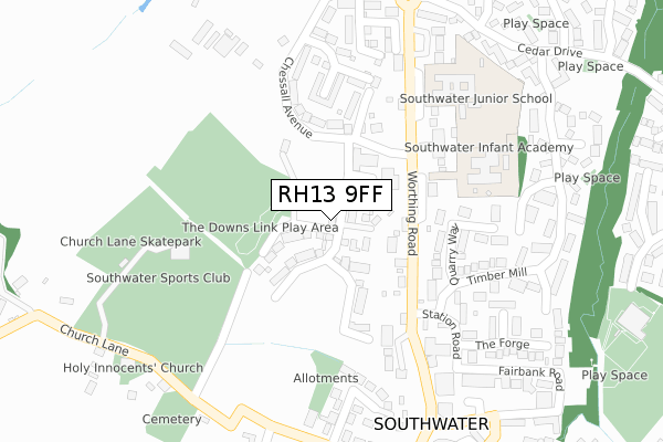
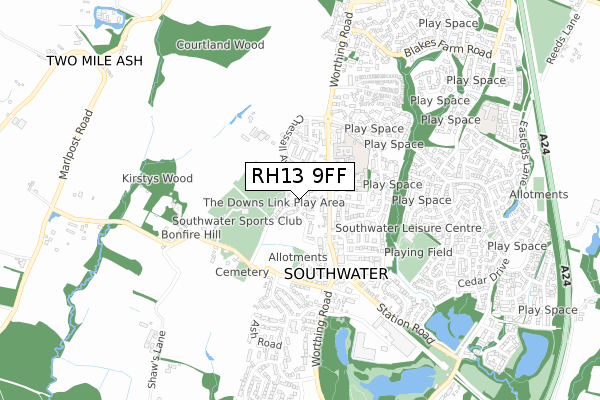
RH13 9FF is located in the Southwater South & Shipley electoral ward, within the local authority district of Horsham and the English Parliamentary constituency of Horsham. The Sub Integrated Care Board (ICB) Location is NHS Sussex ICB - 70F and the police force is Sussex. This postcode has been in use since June 2019.


GetTheData
Source: OS Open Zoomstack (Ordnance Survey)
Licence: Open Government Licence (requires attribution)
Attribution: Contains OS data © Crown copyright and database right 2024
Source: Open Postcode Geo
Licence: Open Government Licence (requires attribution)
Attribution: Contains OS data © Crown copyright and database right 2024; Contains Royal Mail data © Royal Mail copyright and database right 2024; Source: Office for National Statistics licensed under the Open Government Licence v.3.0
| Easting | 515437 |
| Northing | 126499 |
| Latitude | 51.026274 |
| Longitude | -0.355306 |
GetTheData
Source: Open Postcode Geo
Licence: Open Government Licence
| Country | England |
| Postcode District | RH13 |
| ➜ RH13 open data dashboard ➜ See where RH13 is on a map ➜ Where is Southwater? | |
GetTheData
Source: Land Registry Price Paid Data
Licence: Open Government Licence
| Ward | Southwater South & Shipley |
| Constituency | Horsham |
GetTheData
Source: ONS Postcode Database
Licence: Open Government Licence
42, KENSETT AVENUE, SOUTHWATER, HORSHAM, RH13 9FF 2022 28 APR £695,000 |
50, KENSETT AVENUE, SOUTHWATER, HORSHAM, RH13 9FF 2022 22 APR £660,000 |
37, KENSETT AVENUE, SOUTHWATER, HORSHAM, RH13 9FF 2021 30 NOV £735,000 |
46, KENSETT AVENUE, SOUTHWATER, HORSHAM, RH13 9FF 2021 29 OCT £920,000 |
35, KENSETT AVENUE, SOUTHWATER, HORSHAM, RH13 9FF 2021 29 OCT £745,000 |
29, KENSETT AVENUE, SOUTHWATER, HORSHAM, RH13 9FF 2021 28 OCT £750,000 |
33, KENSETT AVENUE, SOUTHWATER, HORSHAM, RH13 9FF 2021 27 OCT £735,000 |
48, KENSETT AVENUE, SOUTHWATER, HORSHAM, RH13 9FF 2021 26 OCT £895,000 |
44, KENSETT AVENUE, SOUTHWATER, HORSHAM, RH13 9FF 2021 22 OCT £740,000 |
2, KENSETT AVENUE, SOUTHWATER, HORSHAM, RH13 9FF 2021 30 SEP £695,000 |
GetTheData
Source: HM Land Registry Price Paid Data
Licence: Contains HM Land Registry data © Crown copyright and database right 2024. This data is licensed under the Open Government Licence v3.0.
| July 2023 | Violence and sexual offences | On or near Parking Area | 239m |
| June 2022 | Anti-social behaviour | On or near Supermarket | 321m |
| June 2022 | Other crime | On or near Supermarket | 321m |
| ➜ Get more crime data in our Crime section | |||
GetTheData
Source: data.police.uk
Licence: Open Government Licence
| Village Hall (Church Lane) | Southwater | 226m |
| Station Road (Quarry Way) | Southwater | 258m |
| Lintot Square (Worthing Road) | Southwater | 267m |
| Lintot Square (Worthing Road) | Southwater | 270m |
| Junior School (Worthing Road) | Southwater | 293m |
| Christs Hospital Station | 2.8km |
| Horsham Station | 5.1km |
GetTheData
Source: NaPTAN
Licence: Open Government Licence
| Percentage of properties with Next Generation Access | 100.0% |
| Percentage of properties with Superfast Broadband | 100.0% |
| Percentage of properties with Ultrafast Broadband | 90.9% |
| Percentage of properties with Full Fibre Broadband | 90.9% |
Superfast Broadband is between 30Mbps and 300Mbps
Ultrafast Broadband is > 300Mbps
| Percentage of properties unable to receive 2Mbps | 0.0% |
| Percentage of properties unable to receive 5Mbps | 0.0% |
| Percentage of properties unable to receive 10Mbps | 0.0% |
| Percentage of properties unable to receive 30Mbps | 0.0% |
GetTheData
Source: Ofcom
Licence: Ofcom Terms of Use (requires attribution)
GetTheData
Source: ONS Postcode Database
Licence: Open Government Licence


➜ Get more ratings from the Food Standards Agency
GetTheData
Source: Food Standards Agency
Licence: FSA terms & conditions
| Last Collection | |||
|---|---|---|---|
| Location | Mon-Fri | Sat | Distance |
| Cedar Drive | 16:15 | 07:30 | 730m |
| Charlock Way | 17:00 | 08:00 | 1,174m |
| Robin Hood | 17:00 | 09:30 | 1,573m |
GetTheData
Source: Dracos
Licence: Creative Commons Attribution-ShareAlike
| Facility | Distance |
|---|---|
| Southwater Sports Club Church Lane, Southwater Grass Pitches, Outdoor Tennis Courts | 163m |
| Southwater Cricket Club Church Lane, Southwater, Horsham Grass Pitches | 191m |
| Southwater Junior Academy Worthing Road, Southwater, Horsham Grass Pitches, Sports Hall | 407m |
GetTheData
Source: Active Places
Licence: Open Government Licence
| School | Phase of Education | Distance |
|---|---|---|
| Southwater Infant Academy Worthing Road, Southwater, Horsham, RH13 9JH | Primary | 358m |
| Southwater Junior Academy Worthing Road, Southwater, Horsham, RH13 9JH | Primary | 411m |
| Castlewood Primary School Castlewood Road, Southwater, Horsham, RH13 9US | Primary | 997m |
GetTheData
Source: Edubase
Licence: Open Government Licence
The below table lists the International Territorial Level (ITL) codes (formerly Nomenclature of Territorial Units for Statistics (NUTS) codes) and Local Administrative Units (LAU) codes for RH13 9FF:
| ITL 1 Code | Name |
|---|---|
| TLJ | South East (England) |
| ITL 2 Code | Name |
| TLJ2 | Surrey, East and West Sussex |
| ITL 3 Code | Name |
| TLJ28 | West Sussex (North East) |
| LAU 1 Code | Name |
| E07000227 | Horsham |
GetTheData
Source: ONS Postcode Directory
Licence: Open Government Licence
The below table lists the Census Output Area (OA), Lower Layer Super Output Area (LSOA), and Middle Layer Super Output Area (MSOA) for RH13 9FF:
| Code | Name | |
|---|---|---|
| OA | E00161558 | |
| LSOA | E01031683 | Horsham 009F |
| MSOA | E02006596 | Horsham 009 |
GetTheData
Source: ONS Postcode Directory
Licence: Open Government Licence
| RH13 9DT | Worthing Road | 187m |
| RH13 9DU | Pipers Close | 199m |
| RH13 9EN | Woodfield | 227m |
| RH13 9LP | Station Road | 252m |
| RH13 9BT | Church Lane | 253m |
| RH13 9ST | Quarry Way | 253m |
| RH13 9UA | Ghyll Court | 255m |
| RH13 9EA | Church Lane | 270m |
| RH13 9EB | Church Lane | 277m |
| RH13 9DZ | Worthing Road | 286m |
GetTheData
Source: Open Postcode Geo; Land Registry Price Paid Data
Licence: Open Government Licence