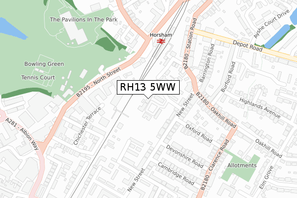
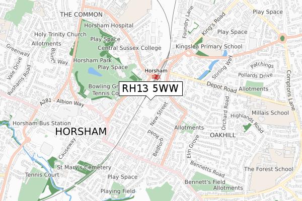
RH13 5WW is located in the Forest electoral ward, within the local authority district of Horsham and the English Parliamentary constituency of Horsham. The Sub Integrated Care Board (ICB) Location is NHS Sussex ICB - 70F and the police force is Sussex. This postcode has been in use since May 2019.


GetTheData
Source: OS Open Zoomstack (Ordnance Survey)
Licence: Open Government Licence (requires attribution)
Attribution: Contains OS data © Crown copyright and database right 2024
Source: Open Postcode Geo
Licence: Open Government Licence (requires attribution)
Attribution: Contains OS data © Crown copyright and database right 2024; Contains Royal Mail data © Royal Mail copyright and database right 2024; Source: Office for National Statistics licensed under the Open Government Licence v.3.0
| Easting | 517836 |
| Northing | 130780 |
| Latitude | 51.064267 |
| Longitude | -0.319722 |
GetTheData
Source: Open Postcode Geo
Licence: Open Government Licence
| Country | England |
| Postcode District | RH13 |
| ➜ RH13 open data dashboard ➜ See where RH13 is on a map ➜ Where is Horsham? | |
GetTheData
Source: Land Registry Price Paid Data
Licence: Open Government Licence
| Ward | Forest |
| Constituency | Horsham |
GetTheData
Source: ONS Postcode Database
Licence: Open Government Licence
| January 2024 | Violence and sexual offences | On or near Parking Area | 63m |
| January 2024 | Anti-social behaviour | On or near Parking Area | 63m |
| January 2024 | Anti-social behaviour | On or near Parking Area | 63m |
| ➜ Get more crime data in our Crime section | |||
GetTheData
Source: data.police.uk
Licence: Open Government Licence
| Railway Station (North Street) | Horsham | 154m |
| Railway Station (North Street) | Horsham | 157m |
| The Bedford Ph (Station Road) | Oakhill | 177m |
| Burford Road (Oakhill Road) | Oakhill | 230m |
| Oxford Road (Clarence Road) | Oakhill | 289m |
| Horsham Station | 0.2km |
| Littlehaven Station | 1.9km |
| Warnham Station | 3.3km |
GetTheData
Source: NaPTAN
Licence: Open Government Licence
| Percentage of properties with Next Generation Access | 100.0% |
| Percentage of properties with Superfast Broadband | 100.0% |
| Percentage of properties with Ultrafast Broadband | 100.0% |
| Percentage of properties with Full Fibre Broadband | 100.0% |
Superfast Broadband is between 30Mbps and 300Mbps
Ultrafast Broadband is > 300Mbps
| Percentage of properties unable to receive 2Mbps | 0.0% |
| Percentage of properties unable to receive 5Mbps | 0.0% |
| Percentage of properties unable to receive 10Mbps | 0.0% |
| Percentage of properties unable to receive 30Mbps | 0.0% |
GetTheData
Source: Ofcom
Licence: Ofcom Terms of Use (requires attribution)
GetTheData
Source: ONS Postcode Database
Licence: Open Government Licence


➜ Get more ratings from the Food Standards Agency
GetTheData
Source: Food Standards Agency
Licence: FSA terms & conditions
| Last Collection | |||
|---|---|---|---|
| Location | Mon-Fri | Sat | Distance |
| Station Road P O | 16:30 | 12:00 | 181m |
| New Street | 17:00 | 12:00 | 259m |
| Clarence Road | 17:00 | 12:00 | 312m |
GetTheData
Source: Dracos
Licence: Creative Commons Attribution-ShareAlike
| Facility | Distance |
|---|---|
| Curves For Women (Horsham) (Closed) Gladstone Road, Horsham Health and Fitness Gym | 350m |
| Pavilions In The Park Hurst Road, Horsham Swimming Pool, Health and Fitness Gym, Sports Hall, Studio | 352m |
| Horsham Park Horsham Grass Pitches, Outdoor Tennis Courts | 658m |
GetTheData
Source: Active Places
Licence: Open Government Licence
| School | Phase of Education | Distance |
|---|---|---|
| Horsham Nursery School Harwood Road, Horsham, RH13 5UT | Nursery | 710m |
| Kingslea Primary School Kings Road, Horsham, RH13 5PS | Primary | 790m |
| The College of Richard Collyer In Horsham Hurst Road, Horsham, RH12 2EJ | 16 plus | 853m |
GetTheData
Source: Edubase
Licence: Open Government Licence
The below table lists the International Territorial Level (ITL) codes (formerly Nomenclature of Territorial Units for Statistics (NUTS) codes) and Local Administrative Units (LAU) codes for RH13 5WW:
| ITL 1 Code | Name |
|---|---|
| TLJ | South East (England) |
| ITL 2 Code | Name |
| TLJ2 | Surrey, East and West Sussex |
| ITL 3 Code | Name |
| TLJ28 | West Sussex (North East) |
| LAU 1 Code | Name |
| E07000227 | Horsham |
GetTheData
Source: ONS Postcode Directory
Licence: Open Government Licence
The below table lists the Census Output Area (OA), Lower Layer Super Output Area (LSOA), and Middle Layer Super Output Area (MSOA) for RH13 5WW:
| Code | Name | |
|---|---|---|
| OA | E00161421 | |
| LSOA | E01031656 | Horsham 006D |
| MSOA | E02006593 | Horsham 006 |
GetTheData
Source: ONS Postcode Directory
Licence: Open Government Licence
| RH13 5EW | New Street | 55m |
| RH13 5ES | New Street | 67m |
| RH13 5ER | New Street | 90m |
| RH13 5EP | New Street | 95m |
| RH13 5QT | Station Close | 105m |
| RH12 1RD | North Street | 121m |
| RH13 5EG | New Street | 135m |
| RH13 5ET | Station Road | 138m |
| RH13 5EJ | New Street | 139m |
| RH13 5EA | New Street | 150m |
GetTheData
Source: Open Postcode Geo; Land Registry Price Paid Data
Licence: Open Government Licence