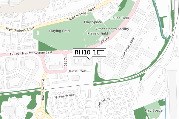
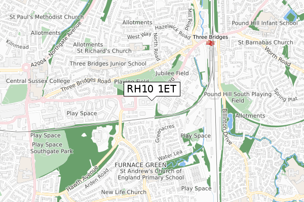
RH10 1ET is located in the Three Bridges electoral ward, within the local authority district of Crawley and the English Parliamentary constituency of Crawley. The Sub Integrated Care Board (ICB) Location is NHS Sussex ICB - 70F and the police force is Sussex. This postcode has been in use since October 2018.


GetTheData
Source: OS Open Zoomstack (Ordnance Survey)
Licence: Open Government Licence (requires attribution)
Attribution: Contains OS data © Crown copyright and database right 2024
Source: Open Postcode Geo
Licence: Open Government Licence (requires attribution)
Attribution: Contains OS data © Crown copyright and database right 2024; Contains Royal Mail data © Royal Mail copyright and database right 2024; Source: Office for National Statistics licensed under the Open Government Licence v.3.0
| Easting | 528311 |
| Northing | 136555 |
| Latitude | 51.113927 |
| Longitude | -0.168262 |
GetTheData
Source: Open Postcode Geo
Licence: Open Government Licence
| Country | England |
| Postcode District | RH10 |
| ➜ RH10 open data dashboard ➜ See where RH10 is on a map ➜ Where is Crawley? | |
GetTheData
Source: Land Registry Price Paid Data
Licence: Open Government Licence
| Ward | Three Bridges |
| Constituency | Crawley |
GetTheData
Source: ONS Postcode Database
Licence: Open Government Licence
| January 2024 | Violence and sexual offences | On or near Parking Area | 241m |
| January 2024 | Violence and sexual offences | On or near Parking Area | 491m |
| January 2024 | Violence and sexual offences | On or near Parking Area | 491m |
| ➜ Get more crime data in our Crime section | |||
GetTheData
Source: data.police.uk
Licence: Open Government Licence
| Squareabout (Paymaster General's Roundabout) | Three Bridges | 125m |
| Squareabout (Haslett Avenue East) | Three Bridges | 200m |
| Artel Croft (Three Bridges Road) | Three Bridges | 267m |
| Artel Croft (Three Bridges Road) | Three Bridges | 307m |
| Greenacres (Coltash Road) | Furnace Green | 308m |
| Three Bridges Station | 0.6km |
| Crawley Station | 1.3km |
| Ifield Station | 3.3km |
GetTheData
Source: NaPTAN
Licence: Open Government Licence
GetTheData
Source: ONS Postcode Database
Licence: Open Government Licence


➜ Get more ratings from the Food Standards Agency
GetTheData
Source: Food Standards Agency
Licence: FSA terms & conditions
| Last Collection | |||
|---|---|---|---|
| Location | Mon-Fri | Sat | Distance |
| Three Bridges Road | 18:15 | 11:15 | 296m |
| Coltash Road | 17:00 | 11:30 | 312m |
| Stephenson Way | 17:45 | 11:30 | 378m |
GetTheData
Source: Dracos
Licence: Creative Commons Attribution-ShareAlike
| Facility | Distance |
|---|---|
| Crawley Jubilee Field Jubilee Walk, Crawley Grass Pitches | 148m |
| Three Bridges Playing Field Haslett Avenue, Crawley Grass Pitches | 258m |
| Crawley Leisure Centre (Closed) Haslett Avenue, Crawley Sports Hall, Studio, Indoor Bowls, Athletics, Swimming Pool, Health and Fitness Gym, Artificial Grass Pitch, Squash Courts | 487m |
GetTheData
Source: Active Places
Licence: Open Government Licence
| School | Phase of Education | Distance |
|---|---|---|
| Three Bridges Primary School Gales Place, Three Bridges, Crawley, RH10 1QG | Primary | 486m |
| St Andrew's CofE Primary School Weald Drive, Furnace Green, Crawley, RH10 6NU | Primary | 667m |
| Serenity School Crawley Atlantic House, Hazelwick Avenue, Three Bridges, Crawley, RH10 1QQ | Not applicable | 828m |
GetTheData
Source: Edubase
Licence: Open Government Licence
The below table lists the International Territorial Level (ITL) codes (formerly Nomenclature of Territorial Units for Statistics (NUTS) codes) and Local Administrative Units (LAU) codes for RH10 1ET:
| ITL 1 Code | Name |
|---|---|
| TLJ | South East (England) |
| ITL 2 Code | Name |
| TLJ2 | Surrey, East and West Sussex |
| ITL 3 Code | Name |
| TLJ28 | West Sussex (North East) |
| LAU 1 Code | Name |
| E07000226 | Crawley |
GetTheData
Source: ONS Postcode Directory
Licence: Open Government Licence
The below table lists the Census Output Area (OA), Lower Layer Super Output Area (LSOA), and Middle Layer Super Output Area (MSOA) for RH10 1ET:
| Code | Name | |
|---|---|---|
| OA | E00161153 | |
| LSOA | E01032836 | Crawley 004G |
| MSOA | E02006578 | Crawley 004 |
GetTheData
Source: ONS Postcode Directory
Licence: Open Government Licence
| RH10 1TN | Stephenson Way | 180m |
| RH10 6SA | Dedisham Close | 211m |
| RH10 6RZ | Greenacres | 227m |
| RH10 6LG | Burwash Road | 232m |
| RH10 1UE | Beverley Mews | 234m |
| RH10 6LF | Burwash Road | 245m |
| RH10 6LQ | Burwash Road | 251m |
| RH10 6LD | Brambletye Road | 266m |
| RH10 1JT | Three Bridges Road | 271m |
| RH10 6SF | Greenacres | 275m |
GetTheData
Source: Open Postcode Geo; Land Registry Price Paid Data
Licence: Open Government Licence