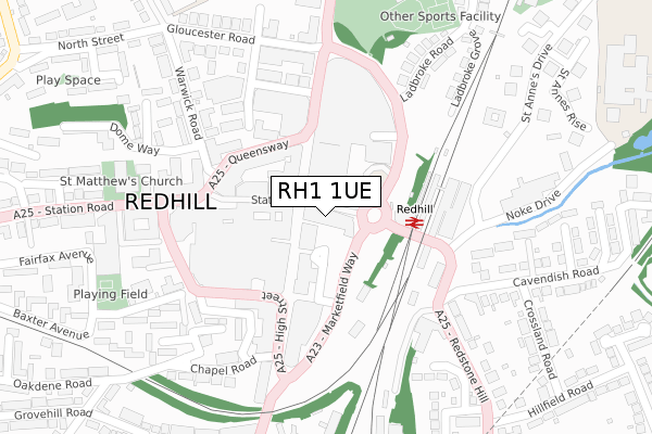
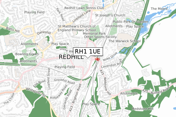
RH1 1UE is located in the Redhill East electoral ward, within the local authority district of Reigate and Banstead and the English Parliamentary constituency of Reigate. The Sub Integrated Care Board (ICB) Location is NHS Surrey Heartlands ICB - 92A and the police force is Surrey. This postcode has been in use since November 2017.


GetTheData
Source: OS Open Zoomstack (Ordnance Survey)
Licence: Open Government Licence (requires attribution)
Attribution: Contains OS data © Crown copyright and database right 2025
Source: Open Postcode Geo
Licence: Open Government Licence (requires attribution)
Attribution: Contains OS data © Crown copyright and database right 2025; Contains Royal Mail data © Royal Mail copyright and database right 2025; Source: Office for National Statistics licensed under the Open Government Licence v.3.0
| Easting | 527999 |
| Northing | 150596 |
| Latitude | 51.240191 |
| Longitude | -0.167723 |
GetTheData
Source: Open Postcode Geo
Licence: Open Government Licence
| Country | England |
| Postcode District | RH1 |
➜ See where RH1 is on a map ➜ Where is Redhill? | |
GetTheData
Source: Land Registry Price Paid Data
Licence: Open Government Licence
| Ward | Redhill East |
| Constituency | Reigate |
GetTheData
Source: ONS Postcode Database
Licence: Open Government Licence
| Queensway | Redhill | 149m |
| High Street | Redhill | 173m |
| Warwick Road (Queensway) | Redhill | 174m |
| High Street | Redhill | 183m |
| Redhill Railway Station (Redstone Hill) | Redhill | 209m |
| Redhill Station | 0.1km |
| Earlswood (Surrey) Station | 1.4km |
| Reigate Station | 2.5km |
GetTheData
Source: NaPTAN
Licence: Open Government Licence
| Percentage of properties with Next Generation Access | 0.0% |
| Percentage of properties with Superfast Broadband | 0.0% |
| Percentage of properties with Ultrafast Broadband | 0.0% |
| Percentage of properties with Full Fibre Broadband | 0.0% |
Superfast Broadband is between 30Mbps and 300Mbps
Ultrafast Broadband is > 300Mbps
| Percentage of properties unable to receive 2Mbps | 0.0% |
| Percentage of properties unable to receive 5Mbps | 0.0% |
| Percentage of properties unable to receive 10Mbps | 0.0% |
| Percentage of properties unable to receive 30Mbps | 100.0% |
GetTheData
Source: Ofcom
Licence: Ofcom Terms of Use (requires attribution)
GetTheData
Source: ONS Postcode Database
Licence: Open Government Licence


➜ Get more ratings from the Food Standards Agency
GetTheData
Source: Food Standards Agency
Licence: FSA terms & conditions
| Last Collection | |||
|---|---|---|---|
| Location | Mon-Fri | Sat | Distance |
| High Street | 18:00 | 12:30 | 65m |
| Redhill Railway Station | 18:00 | 11:45 | 102m |
| Station Road Meter Box | 18:30 | 12:00 | 168m |
GetTheData
Source: Dracos
Licence: Creative Commons Attribution-ShareAlike
| Risk of RH1 1UE flooding from rivers and sea | Low |
| ➜ RH1 1UE flood map | |
GetTheData
Source: Open Flood Risk by Postcode
Licence: Open Government Licence
The below table lists the International Territorial Level (ITL) codes (formerly Nomenclature of Territorial Units for Statistics (NUTS) codes) and Local Administrative Units (LAU) codes for RH1 1UE:
| ITL 1 Code | Name |
|---|---|
| TLJ | South East (England) |
| ITL 2 Code | Name |
| TLJ2 | Surrey, East and West Sussex |
| ITL 3 Code | Name |
| TLJ26 | East Surrey |
| LAU 1 Code | Name |
| E07000211 | Reigate and Banstead |
GetTheData
Source: ONS Postcode Directory
Licence: Open Government Licence
The below table lists the Census Output Area (OA), Lower Layer Super Output Area (LSOA), and Middle Layer Super Output Area (MSOA) for RH1 1UE:
| Code | Name | |
|---|---|---|
| OA | E00156117 | |
| LSOA | E01030612 | Reigate and Banstead 011C |
| MSOA | E02006385 | Reigate and Banstead 011 |
GetTheData
Source: ONS Postcode Directory
Licence: Open Government Licence
| RH1 1PD | Station Road | 4m |
| RH1 1RP | Marketfield Road | 36m |
| RH1 1NZ | Station Road | 40m |
| RH1 1PH | Station Road | 96m |
| RH1 1LY | London Road | 98m |
| RH1 1QH | Station Road | 114m |
| RH1 1TX | Queensway | 150m |
| RH1 1TY | Queensway | 150m |
| RH1 1RT | Cromwell Road | 191m |
| RH1 1RX | High Street | 202m |
GetTheData
Source: Open Postcode Geo; Land Registry Price Paid Data
Licence: Open Government Licence