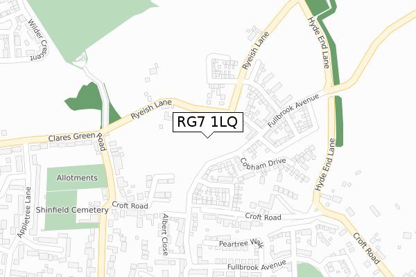
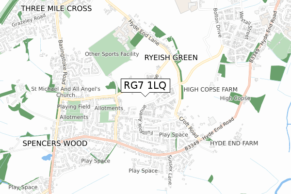
RG7 1LQ is located in the Shinfield South electoral ward, within the unitary authority of Wokingham and the English Parliamentary constituency of Wokingham. The Sub Integrated Care Board (ICB) Location is NHS Buckinghamshire, Oxfordshire and Berkshire West ICB - 15A and the police force is Thames Valley. This postcode has been in use since October 2018.


GetTheData
Source: OS Open Zoomstack (Ordnance Survey)
Licence: Open Government Licence (requires attribution)
Attribution: Contains OS data © Crown copyright and database right 2024
Source: Open Postcode Geo
Licence: Open Government Licence (requires attribution)
Attribution: Contains OS data © Crown copyright and database right 2024; Contains Royal Mail data © Royal Mail copyright and database right 2024; Source: Office for National Statistics licensed under the Open Government Licence v.3.0
| Easting | 472257 |
| Northing | 167010 |
| Latitude | 51.397533 |
| Longitude | -0.962736 |
GetTheData
Source: Open Postcode Geo
Licence: Open Government Licence
| Country | England |
| Postcode District | RG7 |
| ➜ RG7 open data dashboard ➜ See where RG7 is on a map ➜ Where is Spencers Wood? | |
GetTheData
Source: Land Registry Price Paid Data
Licence: Open Government Licence
| Ward | Shinfield South |
| Constituency | Wokingham |
GetTheData
Source: ONS Postcode Database
Licence: Open Government Licence
8, MOOR CLOSE, SPENCERS WOOD, READING, RG7 1LQ 2022 25 NOV £570,000 |
6, MOOR CLOSE, SPENCERS WOOD, READING, RG7 1LQ 2022 18 NOV £699,950 |
14, MOOR CLOSE, SPENCERS WOOD, READING, RG7 1LQ 2022 22 SEP £675,000 |
16, MOOR CLOSE, SPENCERS WOOD, READING, RG7 1LQ 2022 22 SEP £580,000 |
GetTheData
Source: HM Land Registry Price Paid Data
Licence: Contains HM Land Registry data © Crown copyright and database right 2024. This data is licensed under the Open Government Licence v3.0.
| June 2022 | Violence and sexual offences | On or near Ryeish Lane | 114m |
| June 2022 | Violence and sexual offences | On or near Ryeish Lane | 114m |
| June 2022 | Other theft | On or near Croft Road | 217m |
| ➜ Get more crime data in our Crime section | |||
GetTheData
Source: data.police.uk
Licence: Open Government Licence
| Albert Close (Fullbrook Avenue) | Spencer's Wood | 217m |
| Albert Close (Fullbrook Avenue) | Spencer's Wood | 220m |
| Peartree Walk (Fullbrook Avenue) | Spencer's Wood | 311m |
| Peartree Walk (Fullbrook Avenue) | Spencer's Wood | 319m |
| Appletree Lane | Spencer's Wood | 442m |
| Earley Station | 5.8km |
| Winnersh Triangle Station | 6.6km |
GetTheData
Source: NaPTAN
Licence: Open Government Licence
| Percentage of properties with Next Generation Access | 100.0% |
| Percentage of properties with Superfast Broadband | 100.0% |
| Percentage of properties with Ultrafast Broadband | 0.0% |
| Percentage of properties with Full Fibre Broadband | 0.0% |
Superfast Broadband is between 30Mbps and 300Mbps
Ultrafast Broadband is > 300Mbps
| Percentage of properties unable to receive 2Mbps | 0.0% |
| Percentage of properties unable to receive 5Mbps | 0.0% |
| Percentage of properties unable to receive 10Mbps | 0.0% |
| Percentage of properties unable to receive 30Mbps | 0.0% |
GetTheData
Source: Ofcom
Licence: Ofcom Terms of Use (requires attribution)
GetTheData
Source: ONS Postcode Database
Licence: Open Government Licence


➜ Get more ratings from the Food Standards Agency
GetTheData
Source: Food Standards Agency
Licence: FSA terms & conditions
| Last Collection | |||
|---|---|---|---|
| Location | Mon-Fri | Sat | Distance |
| Spencers Wood Post Office | 17:15 | 10:15 | 945m |
| Three Mile Cross Post Office | 17:00 | 08:30 | 1,154m |
| Shinfield Church | 17:15 | 08:00 | 1,382m |
GetTheData
Source: Dracos
Licence: Creative Commons Attribution-ShareAlike
| Facility | Distance |
|---|---|
| Ryeish Green Sports Hub Hyde End Lane, Ryeish Green, Reading Grass Pitches, Artificial Grass Pitch, Sports Hall, Health and Fitness Gym | 461m |
| Ryeish Green Leisure Centre (Closed) Hyde End Lane, Ryeish Green, Reading Sports Hall, Grass Pitches | 663m |
| Spencers Wood Recreation Ground Basingstoke Road, Spencers Wood Grass Pitches | 688m |
GetTheData
Source: Active Places
Licence: Open Government Licence
| School | Phase of Education | Distance |
|---|---|---|
| Oakbank Hyde End Lane, Ryeish Green, Reading, RG7 1ER | Secondary | 663m |
| Alder Grove Church of England Primary School Alder Grove, Shinfield, RG2 9RA | Primary | 906m |
| The Vine Christian School Mitford Close, Basingstoke Road, Three Mile Cross, Reading, RG7 1HF | Not applicable | 1.1km |
GetTheData
Source: Edubase
Licence: Open Government Licence
The below table lists the International Territorial Level (ITL) codes (formerly Nomenclature of Territorial Units for Statistics (NUTS) codes) and Local Administrative Units (LAU) codes for RG7 1LQ:
| ITL 1 Code | Name |
|---|---|
| TLJ | South East (England) |
| ITL 2 Code | Name |
| TLJ1 | Berkshire, Buckinghamshire and Oxfordshire |
| ITL 3 Code | Name |
| TLJ11 | Berkshire |
| LAU 1 Code | Name |
| E06000041 | Wokingham |
GetTheData
Source: ONS Postcode Directory
Licence: Open Government Licence
The below table lists the Census Output Area (OA), Lower Layer Super Output Area (LSOA), and Middle Layer Super Output Area (MSOA) for RG7 1LQ:
| Code | Name | |
|---|---|---|
| OA | E00084191 | |
| LSOA | E01016683 | Wokingham 017B |
| MSOA | E02003455 | Wokingham 017 |
GetTheData
Source: ONS Postcode Directory
Licence: Open Government Licence
| RG7 1EL | Ryeish Lane | 118m |
| RG7 1DU | Clares Green Road | 209m |
| RG7 1DR | Croft Road | 226m |
| RG2 9EX | Croft Road | 276m |
| RG7 1EW | Ryeish Lane | 294m |
| RG7 1FE | Fullbrook Avenue | 323m |
| RG2 9EY | Croft Road | 324m |
| RG7 1DP | Grovelands Road | 326m |
| RG7 1DX | Clares Green Road | 340m |
| RG7 1DQ | Elizabeth Rout Close | 361m |
GetTheData
Source: Open Postcode Geo; Land Registry Price Paid Data
Licence: Open Government Licence