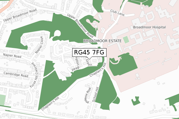
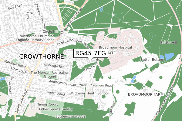
RG45 7FG is located in the Crowthorne electoral ward, within the unitary authority of Bracknell Forest and the English Parliamentary constituency of Bracknell. The Sub Integrated Care Board (ICB) Location is NHS Frimley ICB - D4U1Y and the police force is Thames Valley. This postcode has been in use since November 2018.


GetTheData
Source: OS Open Zoomstack (Ordnance Survey)
Licence: Open Government Licence (requires attribution)
Attribution: Contains OS data © Crown copyright and database right 2024
Source: Open Postcode Geo
Licence: Open Government Licence (requires attribution)
Attribution: Contains OS data © Crown copyright and database right 2024; Contains Royal Mail data © Royal Mail copyright and database right 2024; Source: Office for National Statistics licensed under the Open Government Licence v.3.0
| Easting | 484793 |
| Northing | 163946 |
| Latitude | 51.368256 |
| Longitude | -0.783318 |
GetTheData
Source: Open Postcode Geo
Licence: Open Government Licence
| Country | England |
| Postcode District | RG45 |
| ➜ RG45 open data dashboard ➜ See where RG45 is on a map ➜ Where is Crowthorne? | |
GetTheData
Source: Land Registry Price Paid Data
Licence: Open Government Licence
| Ward | Crowthorne |
| Constituency | Bracknell |
GetTheData
Source: ONS Postcode Database
Licence: Open Government Licence
2022 27 MAY £625,000 |
28, ARLOTT GREEN, CROWTHORNE, RG45 7FG 2019 29 MAR £549,995 |
11, ARLOTT GREEN, CROWTHORNE, RG45 7FG 2019 8 FEB £549,995 |
2018 20 DEC £549,995 |
GetTheData
Source: HM Land Registry Price Paid Data
Licence: Contains HM Land Registry data © Crown copyright and database right 2024. This data is licensed under the Open Government Licence v3.0.
| June 2022 | Violence and sexual offences | On or near Hospital | 168m |
| June 2022 | Violence and sexual offences | On or near Hospital | 168m |
| June 2022 | Violence and sexual offences | On or near Hospital | 168m |
| ➜ Get more crime data in our Crime section | |||
GetTheData
Source: data.police.uk
Licence: Open Government Licence
| High Street (Dukes Ride) | Crowthorne | 622m |
| High Street | Crowthorne | 645m |
| High Street (Dukes Ride) | Crowthorne | 765m |
| Brookers Row (Old Wokingham Road) | Crowthorne | 849m |
| Iron Duke (High Street) | Crowthorne | 857m |
| Crowthorne Station | 2.5km |
| Sandhurst Station | 2.8km |
| Blackwater Station | 4.1km |
GetTheData
Source: NaPTAN
Licence: Open Government Licence
| Percentage of properties with Next Generation Access | 100.0% |
| Percentage of properties with Superfast Broadband | 100.0% |
| Percentage of properties with Ultrafast Broadband | 96.3% |
| Percentage of properties with Full Fibre Broadband | 96.3% |
Superfast Broadband is between 30Mbps and 300Mbps
Ultrafast Broadband is > 300Mbps
| Percentage of properties unable to receive 2Mbps | 0.0% |
| Percentage of properties unable to receive 5Mbps | 0.0% |
| Percentage of properties unable to receive 10Mbps | 0.0% |
| Percentage of properties unable to receive 30Mbps | 0.0% |
GetTheData
Source: Ofcom
Licence: Ofcom Terms of Use (requires attribution)
GetTheData
Source: ONS Postcode Database
Licence: Open Government Licence


➜ Get more ratings from the Food Standards Agency
GetTheData
Source: Food Standards Agency
Licence: FSA terms & conditions
| Last Collection | |||
|---|---|---|---|
| Location | Mon-Fri | Sat | Distance |
| Napier Road | 16:30 | 11:45 | 600m |
| Dukes Ride Post Office | 17:15 | 12:00 | 689m |
| Pinewood Avenue | 16:00 | 11:00 | 836m |
GetTheData
Source: Dracos
Licence: Creative Commons Attribution-ShareAlike
| Facility | Distance |
|---|---|
| Cricket Field Grove (Closed) Cricket Field Grove, Crowthorne Grass Pitches | 101m |
| Broadmoor Hospital Sports Centre Crowthorne Health and Fitness Gym, Artificial Grass Pitch | 187m |
| Wild Moor Heath School Lower Broadmoor Road, Crowthorne Grass Pitches, Sports Hall | 356m |
GetTheData
Source: Active Places
Licence: Open Government Licence
| School | Phase of Education | Distance |
|---|---|---|
| Wildmoor Heath School Lower Broadmoor Road, Crowthorne, Bracknell, RG45 7HD | Primary | 355m |
| Crowthorne Church of England Primary School Duke's Ride, Crowthorne, RG45 6ND | Primary | 824m |
| Edgbarrow School Grant Road, Crowthorne, RG45 7HZ | Secondary | 932m |
GetTheData
Source: Edubase
Licence: Open Government Licence
The below table lists the International Territorial Level (ITL) codes (formerly Nomenclature of Territorial Units for Statistics (NUTS) codes) and Local Administrative Units (LAU) codes for RG45 7FG:
| ITL 1 Code | Name |
|---|---|
| TLJ | South East (England) |
| ITL 2 Code | Name |
| TLJ1 | Berkshire, Buckinghamshire and Oxfordshire |
| ITL 3 Code | Name |
| TLJ11 | Berkshire |
| LAU 1 Code | Name |
| E06000036 | Bracknell Forest |
GetTheData
Source: ONS Postcode Directory
Licence: Open Government Licence
The below table lists the Census Output Area (OA), Lower Layer Super Output Area (LSOA), and Middle Layer Super Output Area (MSOA) for RG45 7FG:
| Code | Name | |
|---|---|---|
| OA | E00081894 | |
| LSOA | E01016208 | Bracknell Forest 012B |
| MSOA | E02003363 | Bracknell Forest 012 |
GetTheData
Source: ONS Postcode Directory
Licence: Open Government Licence
| RG45 7GZ | Phoenix Rise | 163m |
| RG45 7ES | Cricket Field Grove | 171m |
| RG45 7HH | Chaplains Hill | 243m |
| RG45 7EW | Furzehill Crescent | 286m |
| RG45 7EN | Napier Close | 298m |
| RG45 7HE | School Hill | 300m |
| RG45 7DJ | White City | 305m |
| RG45 7LH | Furzehill Crescent | 322m |
| RG45 7HG | Lower Broadmoor Road | 335m |
| RG45 7DG | Upper Broadmoor Road | 338m |
GetTheData
Source: Open Postcode Geo; Land Registry Price Paid Data
Licence: Open Government Licence