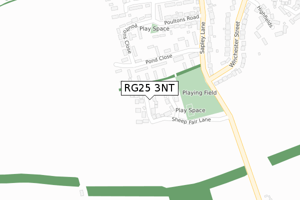
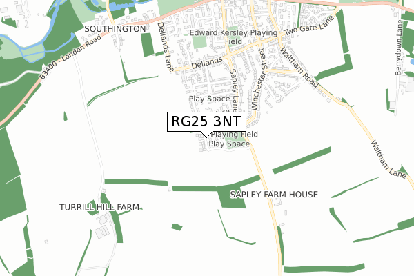
RG25 3NT is located in the Whitchurch, Overton & Laverstoke electoral ward, within the local authority district of Basingstoke and Deane and the English Parliamentary constituency of North West Hampshire. The Sub Integrated Care Board (ICB) Location is NHS Hampshire and Isle of Wight ICB - D9Y0V and the police force is Hampshire. This postcode has been in use since August 2019.


GetTheData
Source: OS Open Zoomstack (Ordnance Survey)
Licence: Open Government Licence (requires attribution)
Attribution: Contains OS data © Crown copyright and database right 2025
Source: Open Postcode Geo
Licence: Open Government Licence (requires attribution)
Attribution: Contains OS data © Crown copyright and database right 2025; Contains Royal Mail data © Royal Mail copyright and database right 2025; Source: Office for National Statistics licensed under the Open Government Licence v.3.0
| Easting | 451282 |
| Northing | 148832 |
| Latitude | 51.236371 |
| Longitude | -1.266816 |
GetTheData
Source: Open Postcode Geo
Licence: Open Government Licence
| Country | England |
| Postcode District | RG25 |
➜ See where RG25 is on a map ➜ Where is Overton? | |
GetTheData
Source: Land Registry Price Paid Data
Licence: Open Government Licence
| Ward | Whitchurch, Overton & Laverstoke |
| Constituency | North West Hampshire |
GetTheData
Source: ONS Postcode Database
Licence: Open Government Licence
32, APPLE DELL VIEW, OVERTON, BASINGSTOKE, RG25 3NT 2021 22 JAN £550,000 |
36, APPLE DELL VIEW, OVERTON, BASINGSTOKE, RG25 3NT 2021 22 JAN £459,950 |
34, APPLE DELL VIEW, OVERTON, BASINGSTOKE, RG25 3NT 2021 21 JAN £569,950 |
2020 23 OCT £429,950 |
46, APPLE DELL VIEW, OVERTON, BASINGSTOKE, RG25 3NT 2020 30 SEP £689,950 |
14, APPLE DELL VIEW, OVERTON, BASINGSTOKE, RG25 3NT 2020 28 SEP £449,950 |
22, APPLE DELL VIEW, OVERTON, BASINGSTOKE, RG25 3NT 2020 28 SEP £449,950 |
16, APPLE DELL VIEW, OVERTON, BASINGSTOKE, RG25 3NT 2020 27 AUG £449,950 |
1, APPLE DELL VIEW, OVERTON, BASINGSTOKE, RG25 3NT 2020 14 AUG £670,500 |
40, APPLE DELL VIEW, OVERTON, BASINGSTOKE, RG25 3NT 2020 31 MAR £449,950 |
GetTheData
Source: HM Land Registry Price Paid Data
Licence: Contains HM Land Registry data © Crown copyright and database right 2025. This data is licensed under the Open Government Licence v3.0.
| Pond Close (Sapley Lane) | Overton | 232m |
| Sapley Lane (Charledown Road) | Overton | 353m |
| Kerchers Field | Overton | 523m |
| Pound Road (Winchester Street) | Overton | 540m |
| Pound Road | Overton | 544m |
| Overton Station | 2.1km |
| Whitchurch (Hants) Station | 5km |
GetTheData
Source: NaPTAN
Licence: Open Government Licence
| Percentage of properties with Next Generation Access | 100.0% |
| Percentage of properties with Superfast Broadband | 100.0% |
| Percentage of properties with Ultrafast Broadband | 50.0% |
| Percentage of properties with Full Fibre Broadband | 50.0% |
Superfast Broadband is between 30Mbps and 300Mbps
Ultrafast Broadband is > 300Mbps
| Percentage of properties unable to receive 2Mbps | 0.0% |
| Percentage of properties unable to receive 5Mbps | 0.0% |
| Percentage of properties unable to receive 10Mbps | 0.0% |
| Percentage of properties unable to receive 30Mbps | 0.0% |
GetTheData
Source: Ofcom
Licence: Ofcom Terms of Use (requires attribution)
GetTheData
Source: ONS Postcode Database
Licence: Open Government Licence


➜ Get more ratings from the Food Standards Agency
GetTheData
Source: Food Standards Agency
Licence: FSA terms & conditions
| Last Collection | |||
|---|---|---|---|
| Location | Mon-Fri | Sat | Distance |
| The Green | 17:00 | 08:00 | 827m |
| Silk Mill Lane | 16:15 | 07:00 | 1,148m |
| Overton Station | 16:00 | 08:00 | 2,014m |
GetTheData
Source: Dracos
Licence: Creative Commons Attribution-ShareAlike
The below table lists the International Territorial Level (ITL) codes (formerly Nomenclature of Territorial Units for Statistics (NUTS) codes) and Local Administrative Units (LAU) codes for RG25 3NT:
| ITL 1 Code | Name |
|---|---|
| TLJ | South East (England) |
| ITL 2 Code | Name |
| TLJ3 | Hampshire and Isle of Wight |
| ITL 3 Code | Name |
| TLJ37 | North Hampshire |
| LAU 1 Code | Name |
| E07000084 | Basingstoke and Deane |
GetTheData
Source: ONS Postcode Directory
Licence: Open Government Licence
The below table lists the Census Output Area (OA), Lower Layer Super Output Area (LSOA), and Middle Layer Super Output Area (MSOA) for RG25 3NT:
| Code | Name | |
|---|---|---|
| OA | E00114572 | |
| LSOA | E01022535 | Basingstoke and Deane 022D |
| MSOA | E02004696 | Basingstoke and Deane 022 |
GetTheData
Source: ONS Postcode Directory
Licence: Open Government Licence
| RG25 3LZ | Pond Close | 88m |
| RG25 3LY | Pond Close | 163m |
| RG25 3LX | Poultons Close | 222m |
| RG25 3LU | Milldown Houses | 226m |
| RG25 3LT | Poultons Close | 232m |
| RG25 3LJ | Sapley Lane | 272m |
| RG25 3LR | Crawts Road | 287m |
| RG25 3NA | Poultons Road | 297m |
| RG25 3NB | Winchester Street | 323m |
| RG25 3LL | Charledown Road | 333m |
GetTheData
Source: Open Postcode Geo; Land Registry Price Paid Data
Licence: Open Government Licence