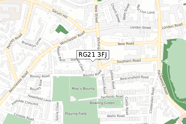
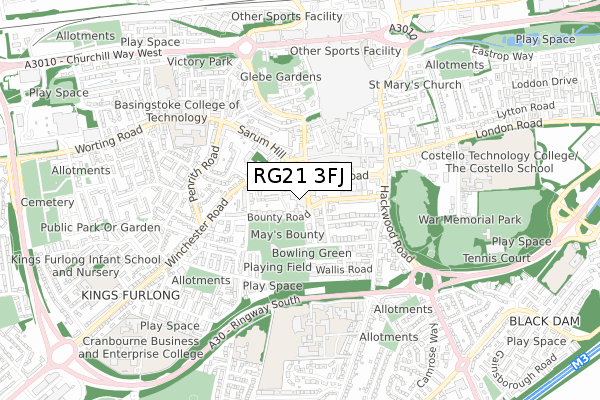
RG21 3FJ is located in the Brookvale & Kings Furlong electoral ward, within the local authority district of Basingstoke and Deane and the English Parliamentary constituency of Basingstoke. The Sub Integrated Care Board (ICB) Location is NHS Hampshire and Isle of Wight ICB - D9Y0V and the police force is Hampshire. This postcode has been in use since December 2019.


GetTheData
Source: OS Open Zoomstack (Ordnance Survey)
Licence: Open Government Licence (requires attribution)
Attribution: Contains OS data © Crown copyright and database right 2024
Source: Open Postcode Geo
Licence: Open Government Licence (requires attribution)
Attribution: Contains OS data © Crown copyright and database right 2024; Contains Royal Mail data © Royal Mail copyright and database right 2024; Source: Office for National Statistics licensed under the Open Government Licence v.3.0
| Easting | 463643 |
| Northing | 151683 |
| Latitude | 51.260764 |
| Longitude | -1.089273 |
GetTheData
Source: Open Postcode Geo
Licence: Open Government Licence
| Country | England |
| Postcode District | RG21 |
| ➜ RG21 open data dashboard ➜ See where RG21 is on a map ➜ Where is Basingstoke? | |
GetTheData
Source: Land Registry Price Paid Data
Licence: Open Government Licence
| Ward | Brookvale & Kings Furlong |
| Constituency | Basingstoke |
GetTheData
Source: ONS Postcode Database
Licence: Open Government Licence
| January 2024 | Drugs | On or near Parking Area | 192m |
| January 2024 | Public order | On or near Parking Area | 192m |
| January 2024 | Public order | On or near Parking Area | 327m |
| ➜ Get more crime data in our Crime section | |||
GetTheData
Source: data.police.uk
Licence: Open Government Licence
| Victoria Street (New Road) | Eastrop | 118m |
| Winton Square (Winchester Road) | Basingstoke | 157m |
| Winton Square (Winchester Road) | Basingstoke | 172m |
| Winton Square (Sarum Hill) | Basingstoke | 221m |
| Winton Square (Sarum Hill) | Basingstoke | 256m |
| Basingstoke Station | 0.9km |
GetTheData
Source: NaPTAN
Licence: Open Government Licence
GetTheData
Source: ONS Postcode Database
Licence: Open Government Licence


➜ Get more ratings from the Food Standards Agency
GetTheData
Source: Food Standards Agency
Licence: FSA terms & conditions
| Last Collection | |||
|---|---|---|---|
| Location | Mon-Fri | Sat | Distance |
| New Street | 17:30 | 12:00 | 247m |
| London Street Branch Office | 18:30 | 12:00 | 282m |
| London Street Branch Office | 18:30 | 12:00 | 288m |
GetTheData
Source: Dracos
Licence: Creative Commons Attribution-ShareAlike
| Facility | Distance |
|---|---|
| Basingstoke Sports And Social Club Bounty Road, Basingstoke Grass Pitches, Squash Courts | 143m |
| Carnival Hall Council Road, Basingstoke Sports Hall | 171m |
| Gladiator's Gym (Closed) Winchester Street, Basingstoke Studio, Health and Fitness Gym | 203m |
GetTheData
Source: Active Places
Licence: Open Government Licence
| School | Phase of Education | Distance |
|---|---|---|
| Fairfields Primary School Council Road, Basingstoke, RG21 3DH | Primary | 157m |
| Queen Mary's College Cliddesden Road, Basingstoke, RG21 3HF | 16 plus | 522m |
| Basingstoke College of Technology Worting Road, Basingstoke, RG21 8TN | 16 plus | 542m |
GetTheData
Source: Edubase
Licence: Open Government Licence
The below table lists the International Territorial Level (ITL) codes (formerly Nomenclature of Territorial Units for Statistics (NUTS) codes) and Local Administrative Units (LAU) codes for RG21 3FJ:
| ITL 1 Code | Name |
|---|---|
| TLJ | South East (England) |
| ITL 2 Code | Name |
| TLJ3 | Hampshire and Isle of Wight |
| ITL 3 Code | Name |
| TLJ37 | North Hampshire |
| LAU 1 Code | Name |
| E07000084 | Basingstoke and Deane |
GetTheData
Source: ONS Postcode Directory
Licence: Open Government Licence
The below table lists the Census Output Area (OA), Lower Layer Super Output Area (LSOA), and Middle Layer Super Output Area (MSOA) for RG21 3FJ:
| Code | Name | |
|---|---|---|
| OA | E00114402 | |
| LSOA | E01022503 | Basingstoke and Deane 012D |
| MSOA | E02004686 | Basingstoke and Deane 012 |
GetTheData
Source: ONS Postcode Directory
Licence: Open Government Licence
| RG21 3BT | Victoria Street | 29m |
| RG21 3BZ | Bounty Road | 55m |
| RG21 3EA | Southern Road | 105m |
| RG21 3DL | Jubilee Road | 124m |
| RG21 3FE | The Old Stable Yard | 147m |
| RG21 3BU | Bounty Road | 153m |
| RG21 8EN | Winton Square | 154m |
| RG21 3DY | Southern Road | 155m |
| RG21 7EF | Winchester Street | 160m |
| RG21 7EE | Winchester Street | 173m |
GetTheData
Source: Open Postcode Geo; Land Registry Price Paid Data
Licence: Open Government Licence