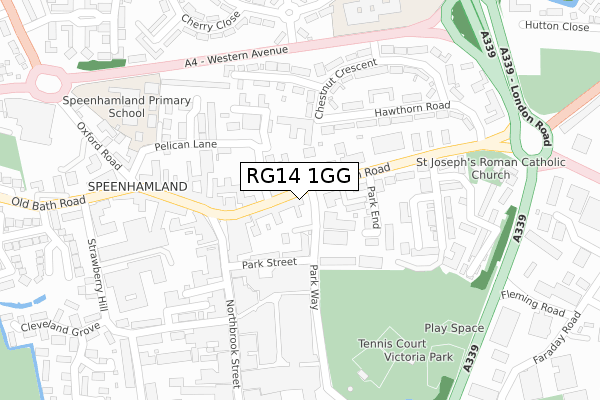
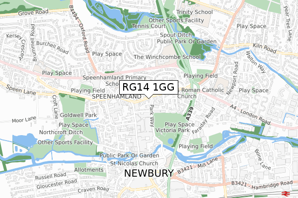
RG14 1GG is located in the Newbury Central electoral ward, within the unitary authority of West Berkshire and the English Parliamentary constituency of Newbury. The Sub Integrated Care Board (ICB) Location is NHS Buckinghamshire, Oxfordshire and Berkshire West ICB - 15A and the police force is Thames Valley. This postcode has been in use since December 2018.


GetTheData
Source: OS Open Zoomstack (Ordnance Survey)
Licence: Open Government Licence (requires attribution)
Attribution: Contains OS data © Crown copyright and database right 2024
Source: Open Postcode Geo
Licence: Open Government Licence (requires attribution)
Attribution: Contains OS data © Crown copyright and database right 2024; Contains Royal Mail data © Royal Mail copyright and database right 2024; Source: Office for National Statistics licensed under the Open Government Licence v.3.0
| Easting | 447190 |
| Northing | 167644 |
| Latitude | 51.405866 |
| Longitude | -1.322936 |
GetTheData
Source: Open Postcode Geo
Licence: Open Government Licence
| Country | England |
| Postcode District | RG14 |
| ➜ RG14 open data dashboard ➜ See where RG14 is on a map ➜ Where is Newbury? | |
GetTheData
Source: Land Registry Price Paid Data
Licence: Open Government Licence
| Ward | Newbury Central |
| Constituency | Newbury |
GetTheData
Source: ONS Postcode Database
Licence: Open Government Licence
| January 2024 | Anti-social behaviour | On or near Parking Area | 105m |
| December 2023 | Bicycle theft | On or near Parking Area | 105m |
| December 2023 | Violence and sexual offences | On or near Parking Area | 105m |
| ➜ Get more crime data in our Crime section | |||
GetTheData
Source: data.police.uk
Licence: Open Government Licence
| Park Way Top (Park Way) | Newbury | 33m |
| Park Way Top (Park Way) | Newbury | 72m |
| Park Way | Newbury | 237m |
| Park Way | Newbury | 244m |
| Hawthorn Road (London Road) | Newbury | 270m |
| Newbury Station | 0.9km |
| Newbury Racecourse Station | 1.3km |
GetTheData
Source: NaPTAN
Licence: Open Government Licence
| Percentage of properties with Next Generation Access | 100.0% |
| Percentage of properties with Superfast Broadband | 100.0% |
| Percentage of properties with Ultrafast Broadband | 100.0% |
| Percentage of properties with Full Fibre Broadband | 0.0% |
Superfast Broadband is between 30Mbps and 300Mbps
Ultrafast Broadband is > 300Mbps
| Percentage of properties unable to receive 2Mbps | 0.0% |
| Percentage of properties unable to receive 5Mbps | 0.0% |
| Percentage of properties unable to receive 10Mbps | 0.0% |
| Percentage of properties unable to receive 30Mbps | 0.0% |
GetTheData
Source: Ofcom
Licence: Ofcom Terms of Use (requires attribution)
GetTheData
Source: ONS Postcode Database
Licence: Open Government Licence


➜ Get more ratings from the Food Standards Agency
GetTheData
Source: Food Standards Agency
Licence: FSA terms & conditions
| Last Collection | |||
|---|---|---|---|
| Location | Mon-Fri | Sat | Distance |
| Hawthorn Road | 17:30 | 10:30 | 104m |
| Speenhamlandpost Office | 17:30 | 11:00 | 150m |
| Northbrook Street | 17:30 | 11:00 | 322m |
GetTheData
Source: Dracos
Licence: Creative Commons Attribution-ShareAlike
| Facility | Distance |
|---|---|
| Newbury Better Health & Fitness Centre Park Way, Newbury Health and Fitness Gym, Swimming Pool, Studio | 86m |
| Energie Fitness Club (Newbury) (Closed) Park Way, Newbury Swimming Pool, Health and Fitness Gym, Studio | 144m |
| Flex Muscle & Fitness Gym (Closed) Park Way, Newbury Health and Fitness Gym | 264m |
GetTheData
Source: Active Places
Licence: Open Government Licence
| School | Phase of Education | Distance |
|---|---|---|
| Victoria Park Nursery School & Family Hub Victoria Park, Parkway, Newbury, RG14 1EH | Nursery | 163m |
| Speenhamland School Pelican Lane, Newbury, RG14 1NU | Primary | 317m |
| The Winchcombe School Maple Crescent, Shaw, Newbury, RG14 1LN | Primary | 518m |
GetTheData
Source: Edubase
Licence: Open Government Licence
The below table lists the International Territorial Level (ITL) codes (formerly Nomenclature of Territorial Units for Statistics (NUTS) codes) and Local Administrative Units (LAU) codes for RG14 1GG:
| ITL 1 Code | Name |
|---|---|
| TLJ | South East (England) |
| ITL 2 Code | Name |
| TLJ1 | Berkshire, Buckinghamshire and Oxfordshire |
| ITL 3 Code | Name |
| TLJ11 | Berkshire |
| LAU 1 Code | Name |
| E06000037 | West Berkshire |
GetTheData
Source: ONS Postcode Directory
Licence: Open Government Licence
The below table lists the Census Output Area (OA), Lower Layer Super Output Area (LSOA), and Middle Layer Super Output Area (MSOA) for RG14 1GG:
| Code | Name | |
|---|---|---|
| OA | E00082569 | |
| LSOA | E01016346 | West Berkshire 019B |
| MSOA | E02003385 | West Berkshire 019 |
GetTheData
Source: ONS Postcode Directory
Licence: Open Government Licence
| RG14 1JL | London Road | 46m |
| RG14 1EE | Park Way | 47m |
| RG14 1JW | Clarendon Gardens | 100m |
| RG14 1EA | Park Street | 116m |
| RG14 1BA | The Broadway | 118m |
| RG14 1ED | Park Terrace | 120m |
| RG14 1AU | The Broadway | 122m |
| RG14 1JS | Park End | 122m |
| RG14 1JN | London Road | 134m |
| RG14 1EG | St Marys Place | 163m |
GetTheData
Source: Open Postcode Geo; Land Registry Price Paid Data
Licence: Open Government Licence