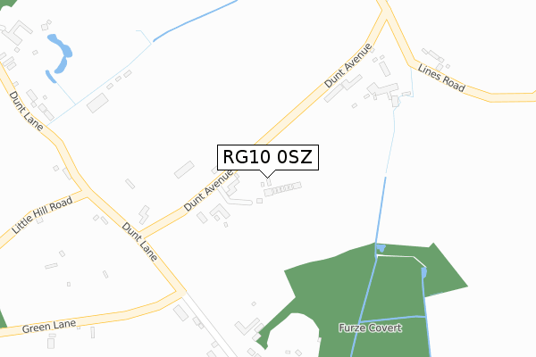
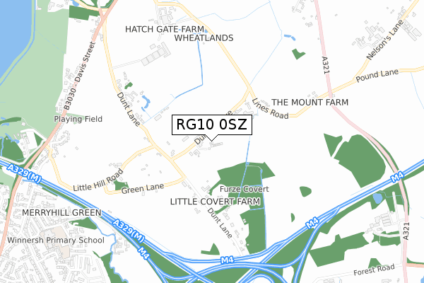
RG10 0SZ is located in the Hurst electoral ward, within the unitary authority of Wokingham and the English Parliamentary constituency of Maidenhead. The Sub Integrated Care Board (ICB) Location is NHS Buckinghamshire, Oxfordshire and Berkshire West ICB - 15A and the police force is Thames Valley. This postcode has been in use since September 2018.


GetTheData
Source: OS Open Zoomstack (Ordnance Survey)
Licence: Open Government Licence (requires attribution)
Attribution: Contains OS data © Crown copyright and database right 2024
Source: Open Postcode Geo
Licence: Open Government Licence (requires attribution)
Attribution: Contains OS data © Crown copyright and database right 2024; Contains Royal Mail data © Royal Mail copyright and database right 2024; Source: Office for National Statistics licensed under the Open Government Licence v.3.0
| Easting | 479595 |
| Northing | 171763 |
| Latitude | 51.439282 |
| Longitude | -0.856218 |
GetTheData
Source: Open Postcode Geo
Licence: Open Government Licence
| Country | England |
| Postcode District | RG10 |
| ➜ RG10 open data dashboard ➜ See where RG10 is on a map | |
GetTheData
Source: Land Registry Price Paid Data
Licence: Open Government Licence
| Ward | Hurst |
| Constituency | Maidenhead |
GetTheData
Source: ONS Postcode Database
Licence: Open Government Licence
| February 2022 | Violence and sexual offences | On or near Green Lane | 266m |
| August 2021 | Criminal damage and arson | On or near Dunt Avenue | 82m |
| August 2021 | Anti-social behaviour | On or near Green Lane | 266m |
| ➜ Get more crime data in our Crime section | |||
GetTheData
Source: data.police.uk
Licence: Open Government Licence
| Davis Street | Hurst | 873m |
| Davis Street | Hurst | 881m |
| Jolly Farmer (Davis Street) | Hurst | 935m |
| Dinton Pastures (Davis Street) | Davis Street | 958m |
| Dinton Pastures (Davis Street) | Davis Street | 959m |
| Winnersh Station | 1.7km |
| Winnersh Triangle Station | 2.5km |
| Wokingham Station | 3.3km |
GetTheData
Source: NaPTAN
Licence: Open Government Licence
GetTheData
Source: ONS Postcode Database
Licence: Open Government Licence


➜ Get more ratings from the Food Standards Agency
GetTheData
Source: Food Standards Agency
Licence: FSA terms & conditions
| Last Collection | |||
|---|---|---|---|
| Location | Mon-Fri | Sat | Distance |
| Davis Way | 16:00 | 10:30 | 974m |
| Hurst Church | 16:00 | 09:30 | 1,255m |
| Danywern Drive | 16:00 | 11:45 | 1,347m |
GetTheData
Source: Dracos
Licence: Creative Commons Attribution-ShareAlike
| Facility | Distance |
|---|---|
| Davis Street Playing Field (Closed) Davis Street, Hurst, Reading Grass Pitches | 810m |
| Winnersh Primary School Greenwood Grove, Winnersh, Wokingham Grass Pitches | 1.1km |
| Hurst Golf Course (Closed) Davis Street, Hurst, Reading Golf | 1.3km |
GetTheData
Source: Active Places
Licence: Open Government Licence
| School | Phase of Education | Distance |
|---|---|---|
| Winnersh Primary School Greenwood Grove, Winnersh, Wokingham, RG41 5LH | Primary | 1.1km |
| Wheatfield Primary School Woodward Close, Winnersh, RG41 5UU | Primary | 1.5km |
| St Nicholas Church of England Primary, Hurst School Road, Hurst, Wokingham, RG10 0DR | Primary | 1.6km |
GetTheData
Source: Edubase
Licence: Open Government Licence
The below table lists the International Territorial Level (ITL) codes (formerly Nomenclature of Territorial Units for Statistics (NUTS) codes) and Local Administrative Units (LAU) codes for RG10 0SZ:
| ITL 1 Code | Name |
|---|---|
| TLJ | South East (England) |
| ITL 2 Code | Name |
| TLJ1 | Berkshire, Buckinghamshire and Oxfordshire |
| ITL 3 Code | Name |
| TLJ11 | Berkshire |
| LAU 1 Code | Name |
| E06000041 | Wokingham |
GetTheData
Source: ONS Postcode Directory
Licence: Open Government Licence
The below table lists the Census Output Area (OA), Lower Layer Super Output Area (LSOA), and Middle Layer Super Output Area (MSOA) for RG10 0SZ:
| Code | Name | |
|---|---|---|
| OA | E00084069 | |
| LSOA | E01016656 | Wokingham 010C |
| MSOA | E02003448 | Wokingham 010 |
GetTheData
Source: ONS Postcode Directory
Licence: Open Government Licence
| RG10 0SY | Dunt Avenue | 0m |
| RG10 0TA | Dunt Lane | 352m |
| RG10 0TE | Dunt Lane | 370m |
| RG10 0TB | Dunt Lane | 377m |
| RG10 0RT | Lines Road | 382m |
| RG10 0TF | Green Lane | 438m |
| RG10 0TG | Little Hill Road | 562m |
| RG10 0SR | Lines Road | 707m |
| RG10 0TT | Douglas Grange | 879m |
| RG10 0TN | Victoria Cottages | 887m |
GetTheData
Source: Open Postcode Geo; Land Registry Price Paid Data
Licence: Open Government Licence