Property/Postcode Data Search:
PR8 1SD maps, stats, and open data
PR8 1SD is located in the Duke's electoral ward, within the metropolitan district of Sefton and the English Parliamentary constituency of Southport. The Sub Integrated Care Board (ICB) Location is NHS Cheshire and Merseyside ICB - 01V and the police force is Merseyside. This postcode has been in use since February 2019.
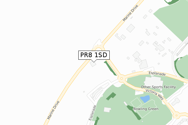
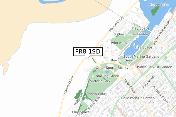
PR8 1SD maps


Source: OS Open Zoomstack (Ordnance Survey)
Licence: Open Government Licence (requires attribution)
Attribution: Contains OS data © Crown copyright and database right 2025
Source: Open Postcode Geo
Licence: Open Government Licence (requires attribution)
Attribution: Contains OS data © Crown copyright and database right 2025; Contains Royal Mail data © Royal Mail copyright and database right 2025; Source: Office for National Statistics licensed under the Open Government Licence v.3.0
Licence: Open Government Licence (requires attribution)
Attribution: Contains OS data © Crown copyright and database right 2025
Source: Open Postcode Geo
Licence: Open Government Licence (requires attribution)
Attribution: Contains OS data © Crown copyright and database right 2025; Contains Royal Mail data © Royal Mail copyright and database right 2025; Source: Office for National Statistics licensed under the Open Government Licence v.3.0
PR8 1SD geodata
| Easting | 332533 |
| Northing | 417282 |
| Latitude | 53.647688 |
| Longitude | -3.022111 |
Where is PR8 1SD?
| Country | England |
| Postcode District | PR8 |
Politics
| Ward | Duke's |
|---|---|
| Constituency | Southport |
Transport
Nearest bus stops to PR8 1SD
| Ocean Plaza (Marine Drive) | Southport | 58m |
| Marine Drive (Victoria Way) | Southport | 150m |
| Pleasureland (The Esplanade) | Southport | 252m |
| Dunes Splash World (The Esplanade) | Southport | 362m |
| Morrisons | Southport | 526m |
Nearest railway stations to PR8 1SD
| Southport Station | 1.3km |
| Birkdale Station | 1.6km |
| Hillside Station | 2.8km |
Deprivation
59.8% of English postcodes are less deprived than PR8 1SD:Food Standards Agency
Three nearest food hygiene ratings to PR8 1SD (metres)
Southport Sailing Club

Marine Drive
107m
Pleasureland

Marine Drive
169m
The Kitchen, Red & Blue Vans

Pleasureland
169m
➜ Get more ratings from the Food Standards Agency
Nearest post box to PR8 1SD
| Last Collection | |||
|---|---|---|---|
| Location | Mon-Fri | Sat | Distance |
| Lord St South | 17:45 | 11:30 | 720m |
| 1 Lulworth Road | 17:30 | 11:30 | 739m |
| Lord St Central | 17:45 | 11:30 | 883m |
Environment
| Risk of PR8 1SD flooding from rivers and sea | High |
PR8 1SD ITL and PR8 1SD LAU
The below table lists the International Territorial Level (ITL) codes (formerly Nomenclature of Territorial Units for Statistics (NUTS) codes) and Local Administrative Units (LAU) codes for PR8 1SD:
| ITL 1 Code | Name |
|---|---|
| TLD | North West (England) |
| ITL 2 Code | Name |
| TLD7 | Merseyside |
| ITL 3 Code | Name |
| TLD73 | Sefton |
| LAU 1 Code | Name |
| E08000014 | Sefton |
PR8 1SD census areas
The below table lists the Census Output Area (OA), Lower Layer Super Output Area (LSOA), and Middle Layer Super Output Area (MSOA) for PR8 1SD:
| Code | Name | |
|---|---|---|
| OA | E00035339 | |
| LSOA | E01006971 | Sefton 009C |
| MSOA | E02001437 | Sefton 009 |
Nearest postcodes to PR8 1SD
| PR8 1RU | Rotten Row | 569m |
| PR8 1RT | Beach Priory Gardens | 600m |
| PR8 1RS | Duke Street | 608m |
| PR8 2SW | Beechfield Gardens | 614m |
| PR8 2SA | Beach Priory Gardens | 676m |
| PR8 2BN | Westcliffe Road | 680m |
| PR8 1ND | Kingsway | 685m |
| PR8 2BP | Beach Road | 701m |
| PR8 2BH | Lord Street West | 707m |
| PR8 1RE | Coronation Walk | 752m |