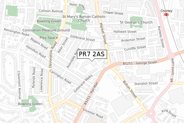
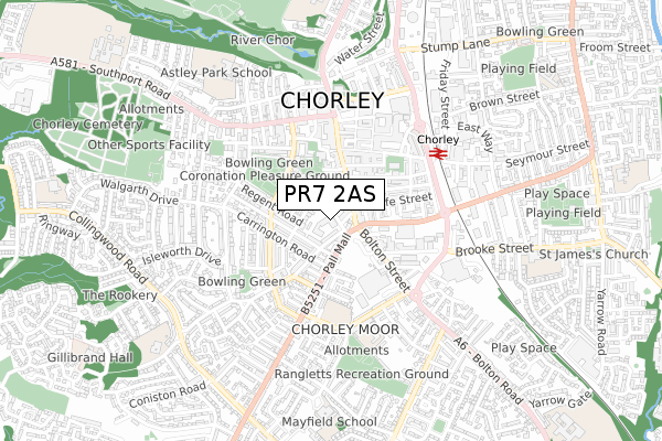
PR7 2AS is located in the Chorley North West electoral ward, within the local authority district of Chorley and the English Parliamentary constituency of Chorley. The Sub Integrated Care Board (ICB) Location is NHS Lancashire and South Cumbria ICB - 00X and the police force is Lancashire. This postcode has been in use since September 2019.


GetTheData
Source: OS Open Zoomstack (Ordnance Survey)
Licence: Open Government Licence (requires attribution)
Attribution: Contains OS data © Crown copyright and database right 2024
Source: Open Postcode Geo
Licence: Open Government Licence (requires attribution)
Attribution: Contains OS data © Crown copyright and database right 2024; Contains Royal Mail data © Royal Mail copyright and database right 2024; Source: Office for National Statistics licensed under the Open Government Licence v.3.0
| Easting | 358268 |
| Northing | 417267 |
| Latitude | 53.650245 |
| Longitude | -2.632825 |
GetTheData
Source: Open Postcode Geo
Licence: Open Government Licence
| Country | England |
| Postcode District | PR7 |
| ➜ PR7 open data dashboard ➜ See where PR7 is on a map ➜ Where is Chorley? | |
GetTheData
Source: Land Registry Price Paid Data
Licence: Open Government Licence
| Ward | Chorley North West |
| Constituency | Chorley |
GetTheData
Source: ONS Postcode Database
Licence: Open Government Licence
| January 2024 | Criminal damage and arson | On or near Pall Mall | 388m |
| December 2023 | Violence and sexual offences | On or near Claremont Avenue | 416m |
| November 2023 | Other theft | On or near Peter Street | 322m |
| ➜ Get more crime data in our Crime section | |||
GetTheData
Source: data.police.uk
Licence: Open Government Licence
| Hamilton Road (Pall Mall) | Chorley Town Centre | 91m |
| Market Street | Chorley Town Centre | 93m |
| Hamilton Road (Pall Mall) | Chorley Town Centre | 115m |
| George Street | Chorley Town Centre | 164m |
| George Street | Chorley Town Centre | 175m |
| Chorley Station | 0.5km |
| Euxton Balshaw Lane Station | 2.8km |
| Buckshaw Parkway Station | 3.2km |
GetTheData
Source: NaPTAN
Licence: Open Government Licence
GetTheData
Source: ONS Postcode Database
Licence: Open Government Licence


➜ Get more ratings from the Food Standards Agency
GetTheData
Source: Food Standards Agency
Licence: FSA terms & conditions
| Last Collection | |||
|---|---|---|---|
| Location | Mon-Fri | Sat | Distance |
| St Georges Street | 17:30 | 12:00 | 230m |
| Cloverfield, Clayton Le Woods | 17:15 | 10:45 | 244m |
| 93 Collingwood Road | 17:00 | 11:30 | 298m |
GetTheData
Source: Dracos
Licence: Creative Commons Attribution-ShareAlike
| Facility | Distance |
|---|---|
| Coronation Recreation Ground (Chorley) Devonshire Road, Chorley Outdoor Tennis Courts, Grass Pitches | 308m |
| Chorley Fitness Chapel Street, Chorley Health and Fitness Gym, Studio | 382m |
| Anytime Fitness (Chorley) New Market Street, New Market Street, Chorley Health and Fitness Gym | 435m |
GetTheData
Source: Active Places
Licence: Open Government Licence
| School | Phase of Education | Distance |
|---|---|---|
| Duke Street Primary School Duke Street, Chorley, PR7 3DU | Primary | 406m |
| Duke Street Nursery School Duke Street, Duke Street Duke Street, Chorley, PR7 3DU | Nursery | 495m |
| Chorley Astley Park School Harrington Road, Chorley, PR7 1JZ | Not applicable | 706m |
GetTheData
Source: Edubase
Licence: Open Government Licence
The below table lists the International Territorial Level (ITL) codes (formerly Nomenclature of Territorial Units for Statistics (NUTS) codes) and Local Administrative Units (LAU) codes for PR7 2AS:
| ITL 1 Code | Name |
|---|---|
| TLD | North West (England) |
| ITL 2 Code | Name |
| TLD4 | Lancashire |
| ITL 3 Code | Name |
| TLD47 | Chorley and West Lancashire |
| LAU 1 Code | Name |
| E07000118 | Chorley |
GetTheData
Source: ONS Postcode Directory
Licence: Open Government Licence
The below table lists the Census Output Area (OA), Lower Layer Super Output Area (LSOA), and Middle Layer Super Output Area (MSOA) for PR7 2AS:
| Code | Name | |
|---|---|---|
| OA | E00126561 | |
| LSOA | E01024936 | Chorley 010A |
| MSOA | E02005198 | Chorley 010 |
GetTheData
Source: ONS Postcode Directory
Licence: Open Government Licence
| PR7 2EX | Cheapside | 44m |
| PR7 2LA | Pall Mall | 73m |
| PR7 2EZ | Gillibrand Walks | 82m |
| PR7 2EF | Peel Street | 87m |
| PR7 2SL | Market Street | 96m |
| PR7 2ED | Avondale Road | 108m |
| PR7 2EJ | Gillibrand Street | 127m |
| PR7 2DD | Westminster Road | 129m |
| PR7 2SQ | Market Street | 148m |
| PR7 2DL | Hamilton Road | 153m |
GetTheData
Source: Open Postcode Geo; Land Registry Price Paid Data
Licence: Open Government Licence