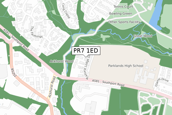
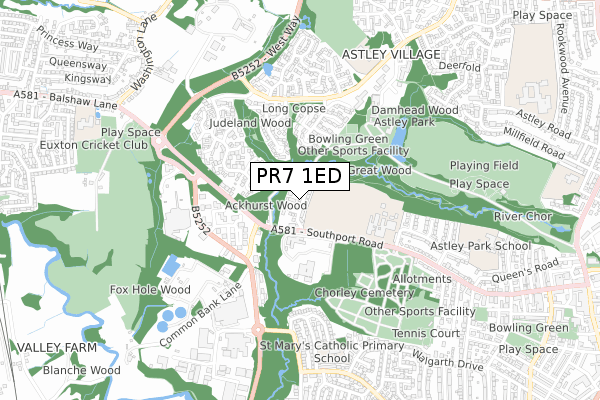
PR7 1ED is located in the Chorley North West electoral ward, within the local authority district of Chorley and the English Parliamentary constituency of Chorley. The Sub Integrated Care Board (ICB) Location is NHS Lancashire and South Cumbria ICB - 00X and the police force is Lancashire. This postcode has been in use since January 2018.


GetTheData
Source: OS Open Zoomstack (Ordnance Survey)
Licence: Open Government Licence (requires attribution)
Attribution: Contains OS data © Crown copyright and database right 2024
Source: Open Postcode Geo
Licence: Open Government Licence (requires attribution)
Attribution: Contains OS data © Crown copyright and database right 2024; Contains Royal Mail data © Royal Mail copyright and database right 2024; Source: Office for National Statistics licensed under the Open Government Licence v.3.0
| Easting | 357080 |
| Northing | 418018 |
| Latitude | 53.656899 |
| Longitude | -2.650900 |
GetTheData
Source: Open Postcode Geo
Licence: Open Government Licence
| Country | England |
| Postcode District | PR7 |
| ➜ PR7 open data dashboard ➜ See where PR7 is on a map ➜ Where is Chorley? | |
GetTheData
Source: Land Registry Price Paid Data
Licence: Open Government Licence
| Ward | Chorley North West |
| Constituency | Chorley |
GetTheData
Source: ONS Postcode Database
Licence: Open Government Licence
2022 16 SEP £364,000 |
2022 1 JUN £340,000 |
2022 23 MAR £438,000 |
2021 21 JUL £275,000 |
2021 9 APR £330,000 |
2021 5 MAR £315,000 |
17, ACKHURST LODGE DRIVE, CHORLEY, PR7 1ED 2019 20 DEC £340,000 |
30, ACKHURST LODGE DRIVE, CHORLEY, PR7 1ED 2019 25 OCT £269,995 |
11, ACKHURST LODGE DRIVE, CHORLEY, PR7 1ED 2019 27 SEP £329,995 |
2019 20 SEP £321,995 |
GetTheData
Source: HM Land Registry Price Paid Data
Licence: Contains HM Land Registry data © Crown copyright and database right 2024. This data is licensed under the Open Government Licence v3.0.
| June 2022 | Criminal damage and arson | On or near Long Copse | 337m |
| June 2022 | Other crime | On or near Southport Road | 398m |
| June 2022 | Other crime | On or near Ackhurst Road | 444m |
| ➜ Get more crime data in our Crime section | |||
GetTheData
Source: data.police.uk
Licence: Open Government Licence
| Lancashire College (Southport Road) | Southport Road | 154m |
| Lancashire College (Southport Road) | Southport Road | 208m |
| Southport Road | Southport Road | 277m |
| Ackhurst Public House (Southport Road) | Southport Road | 347m |
| Foxhole Road | Gillibrand | 371m |
| Euxton Balshaw Lane Station | 1.5km |
| Chorley Station | 1.7km |
| Buckshaw Parkway Station | 1.9km |
GetTheData
Source: NaPTAN
Licence: Open Government Licence
| Percentage of properties with Next Generation Access | 100.0% |
| Percentage of properties with Superfast Broadband | 100.0% |
| Percentage of properties with Ultrafast Broadband | 100.0% |
| Percentage of properties with Full Fibre Broadband | 100.0% |
Superfast Broadband is between 30Mbps and 300Mbps
Ultrafast Broadband is > 300Mbps
| Percentage of properties unable to receive 2Mbps | 0.0% |
| Percentage of properties unable to receive 5Mbps | 0.0% |
| Percentage of properties unable to receive 10Mbps | 0.0% |
| Percentage of properties unable to receive 30Mbps | 0.0% |
GetTheData
Source: Ofcom
Licence: Ofcom Terms of Use (requires attribution)
GetTheData
Source: ONS Postcode Database
Licence: Open Government Licence


➜ Get more ratings from the Food Standards Agency
GetTheData
Source: Food Standards Agency
Licence: FSA terms & conditions
| Last Collection | |||
|---|---|---|---|
| Location | Mon-Fri | Sat | Distance |
| Common Bank Industrial Estate | 17:45 | 351m | |
| Common Bank Industrial Estate | 17:45 | 11:30 | 371m |
| Astley Village Post Office | 17:00 | 11:30 | 633m |
GetTheData
Source: Dracos
Licence: Creative Commons Attribution-ShareAlike
| Facility | Distance |
|---|---|
| Parklands Academy Southport Road, Chorley Sports Hall, Grass Pitches, Artificial Grass Pitch | 316m |
| St Marys Catholic Primary School & Nursery Hornchurch Drive, Chorley Grass Pitches | 649m |
| Buckshaw Primary School Chancery Road, Chancery Road, Chorley Grass Pitches | 670m |
GetTheData
Source: Active Places
Licence: Open Government Licence
| School | Phase of Education | Distance |
|---|---|---|
| Lancashire College of Adult Education Southport Road, Chorley, PR7 1NB | Not applicable | 166m |
| Parklands High School Southport Road, Chorley, PR7 1LL | Secondary | 358m |
| Oliver House School Hallgate, Astley Village, Chorley, PR7 1XA | Not applicable | 534m |
GetTheData
Source: Edubase
Licence: Open Government Licence
The below table lists the International Territorial Level (ITL) codes (formerly Nomenclature of Territorial Units for Statistics (NUTS) codes) and Local Administrative Units (LAU) codes for PR7 1ED:
| ITL 1 Code | Name |
|---|---|
| TLD | North West (England) |
| ITL 2 Code | Name |
| TLD4 | Lancashire |
| ITL 3 Code | Name |
| TLD47 | Chorley and West Lancashire |
| LAU 1 Code | Name |
| E07000118 | Chorley |
GetTheData
Source: ONS Postcode Directory
Licence: Open Government Licence
The below table lists the Census Output Area (OA), Lower Layer Super Output Area (LSOA), and Middle Layer Super Output Area (MSOA) for PR7 1ED:
| Code | Name | |
|---|---|---|
| OA | E00126578 | |
| LSOA | E01024934 | Chorley 008C |
| MSOA | E02005196 | Chorley 008 |
GetTheData
Source: ONS Postcode Directory
Licence: Open Government Licence
| PR7 1SH | The Farthings | 274m |
| PR7 1NT | Southport Road | 311m |
| PR7 1UR | Merefield | 319m |
| PR7 1TH | Long Copse | 323m |
| PR7 1UP | Merefield | 353m |
| PR7 1NL | Chorley West Business Park | 367m |
| PR7 1TP | The Farthings | 451m |
| PR7 1NA | Hampton Close | 490m |
| PR7 1NR | Common Bank Lane | 516m |
| PR7 1UY | Threlfall | 521m |
GetTheData
Source: Open Postcode Geo; Land Registry Price Paid Data
Licence: Open Government Licence