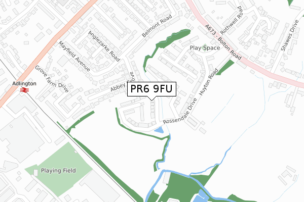
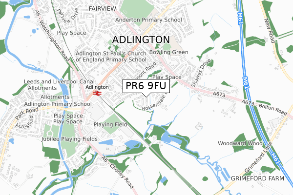
PR6 9FU is located in the Adlington & Anderton electoral ward, within the local authority district of Chorley and the English Parliamentary constituency of Chorley. The Sub Integrated Care Board (ICB) Location is NHS Lancashire and South Cumbria ICB - 00X and the police force is Lancashire. This postcode has been in use since April 2018.


GetTheData
Source: OS Open Zoomstack (Ordnance Survey)
Licence: Open Government Licence (requires attribution)
Attribution: Contains OS data © Crown copyright and database right 2024
Source: Open Postcode Geo
Licence: Open Government Licence (requires attribution)
Attribution: Contains OS data © Crown copyright and database right 2024; Contains Royal Mail data © Royal Mail copyright and database right 2024; Source: Office for National Statistics licensed under the Open Government Licence v.3.0
| Easting | 360628 |
| Northing | 413088 |
| Latitude | 53.612868 |
| Longitude | -2.596594 |
GetTheData
Source: Open Postcode Geo
Licence: Open Government Licence
| Country | England |
| Postcode District | PR6 |
| ➜ PR6 open data dashboard ➜ See where PR6 is on a map ➜ Where is Adlington? | |
GetTheData
Source: Land Registry Price Paid Data
Licence: Open Government Licence
| Ward | Adlington & Anderton |
| Constituency | Chorley |
GetTheData
Source: ONS Postcode Database
Licence: Open Government Licence
6, BRIERFIELD CLOSE, ADLINGTON, CHORLEY, PR6 9FU 2018 19 APR £319,950 |
1, BRIERFIELD CLOSE, ADLINGTON, CHORLEY, PR6 9FU 2018 3 APR £324,950 |
5, BRIERFIELD CLOSE, ADLINGTON, CHORLEY, PR6 9FU 2018 29 MAR £309,950 |
4, BRIERFIELD CLOSE, ADLINGTON, CHORLEY, PR6 9FU 2018 23 MAR £339,950 |
3, BRIERFIELD CLOSE, ADLINGTON, CHORLEY, PR6 9FU 2018 16 MAR £339,950 |
2, BRIERFIELD CLOSE, ADLINGTON, CHORLEY, PR6 9FU 2018 9 MAR £309,950 |
GetTheData
Source: HM Land Registry Price Paid Data
Licence: Contains HM Land Registry data © Crown copyright and database right 2024. This data is licensed under the Open Government Licence v3.0.
| June 2022 | Violence and sexual offences | On or near Anglezarke Road | 257m |
| June 2022 | Shoplifting | On or near Bolton Road | 345m |
| June 2022 | Violence and sexual offences | On or near Lancaster Close | 368m |
| ➜ Get more crime data in our Crime section | |||
GetTheData
Source: data.police.uk
Licence: Open Government Licence
| Rothwell Road (Bolton Road) | Adlington | 311m |
| Rothwell Road (Bolton Road) | Adlington | 314m |
| Library (Railway Road) | Adlington | 367m |
| Library (Railway Road) | Adlington | 376m |
| Railway Station (Railway Road) | Adlington | 416m |
| Adlington (Lancs) Station | 0.4km |
| Blackrod Station | 3km |
| Chorley Station | 4.8km |
GetTheData
Source: NaPTAN
Licence: Open Government Licence
| Percentage of properties with Next Generation Access | 0.0% |
| Percentage of properties with Superfast Broadband | 0.0% |
| Percentage of properties with Ultrafast Broadband | 0.0% |
| Percentage of properties with Full Fibre Broadband | 0.0% |
Superfast Broadband is between 30Mbps and 300Mbps
Ultrafast Broadband is > 300Mbps
| Median download speed | 18.8Mbps |
| Average download speed | 18.1Mbps |
| Maximum download speed | 20.35Mbps |
| Median upload speed | 1.2Mbps |
| Average upload speed | 1.2Mbps |
| Maximum upload speed | 1.22Mbps |
| Percentage of properties unable to receive 2Mbps | 0.0% |
| Percentage of properties unable to receive 5Mbps | 0.0% |
| Percentage of properties unable to receive 10Mbps | 0.0% |
| Percentage of properties unable to receive 30Mbps | 100.0% |
GetTheData
Source: Ofcom
Licence: Ofcom Terms of Use (requires attribution)
GetTheData
Source: ONS Postcode Database
Licence: Open Government Licence


➜ Get more ratings from the Food Standards Agency
GetTheData
Source: Food Standards Agency
Licence: FSA terms & conditions
| Last Collection | |||
|---|---|---|---|
| Location | Mon-Fri | Sat | Distance |
| Tsb, Railway Road, Adlington | 17:15 | 10:30 | 344m |
| Higher Adlington Post Office | 17:15 | 09:15 | 582m |
| Grey Horse | 17:15 | 09:00 | 1,134m |
GetTheData
Source: Dracos
Licence: Creative Commons Attribution-ShareAlike
| Facility | Distance |
|---|---|
| St Joseph's Catholic Primary School (Anderton) Rothwell Road, Anderton, Chorley Grass Pitches | 452m |
| Adlington Cricket Club Off Huyton Road, Adlington, Chorley Grass Pitches | 455m |
| Adlington St Paul's C Of E Primary School Railway Road, Adlington, Chorley Grass Pitches | 455m |
GetTheData
Source: Active Places
Licence: Open Government Licence
| School | Phase of Education | Distance |
|---|---|---|
| Adlington St Paul's Church of England Primary School Railway Road, Adlington, Chorley, PR6 9QZ | Primary | 455m |
| St Joseph's Catholic Primary School, Anderton Rothwell Road, Anderton, Chorley, PR6 9LZ | Primary | 470m |
| Anderton Primary School Babylon Lane, Adlington, PR6 9NN | Primary | 535m |
GetTheData
Source: Edubase
Licence: Open Government Licence
The below table lists the International Territorial Level (ITL) codes (formerly Nomenclature of Territorial Units for Statistics (NUTS) codes) and Local Administrative Units (LAU) codes for PR6 9FU:
| ITL 1 Code | Name |
|---|---|
| TLD | North West (England) |
| ITL 2 Code | Name |
| TLD4 | Lancashire |
| ITL 3 Code | Name |
| TLD47 | Chorley and West Lancashire |
| LAU 1 Code | Name |
| E07000118 | Chorley |
GetTheData
Source: ONS Postcode Directory
Licence: Open Government Licence
The below table lists the Census Output Area (OA), Lower Layer Super Output Area (LSOA), and Middle Layer Super Output Area (MSOA) for PR6 9FU:
| Code | Name | |
|---|---|---|
| OA | E00126458 | |
| LSOA | E01024915 | Chorley 014A |
| MSOA | E02005202 | Chorley 014 |
GetTheData
Source: ONS Postcode Directory
Licence: Open Government Licence
| PR6 9QB | Abbey Grove | 138m |
| PR6 9HU | Huyton Terrace | 156m |
| PR6 9PT | Belmont Road | 206m |
| PR6 9QA | Gidlow Avenue | 259m |
| PR6 9PZ | Anglezarke Road | 262m |
| PR6 9QE | Mayfield Avenue | 279m |
| PR6 9QS | Grove Farm Drive | 288m |
| PR6 9HT | Bolton Road | 295m |
| PR6 9PY | Granville Street | 299m |
| PR6 9NG | Melling Close | 302m |
GetTheData
Source: Open Postcode Geo; Land Registry Price Paid Data
Licence: Open Government Licence