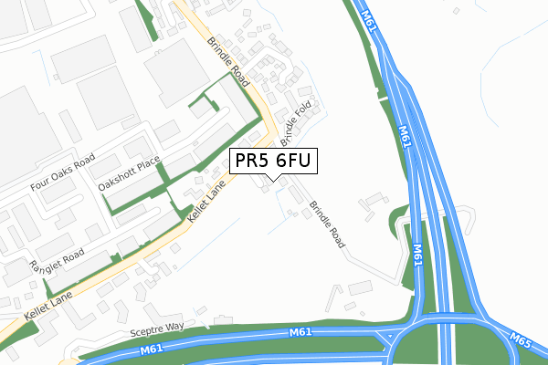
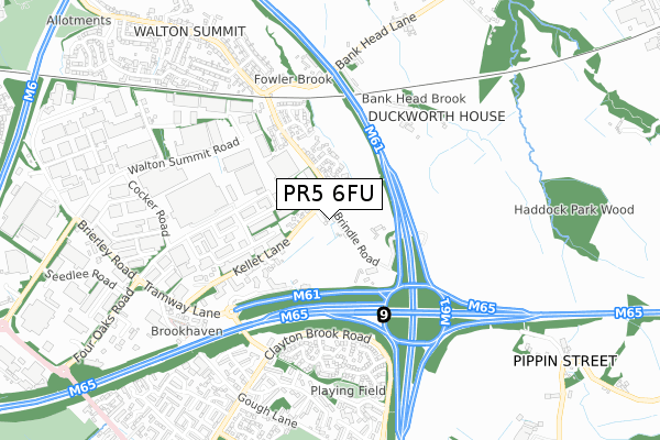
PR5 6FU is located in the Bamber Bridge East electoral ward, within the local authority district of South Ribble and the English Parliamentary constituency of Ribble Valley. The Sub Integrated Care Board (ICB) Location is NHS Lancashire and South Cumbria ICB - 00X and the police force is Lancashire. This postcode has been in use since June 2019.


GetTheData
Source: OS Open Zoomstack (Ordnance Survey)
Licence: Open Government Licence (requires attribution)
Attribution: Contains OS data © Crown copyright and database right 2025
Source: Open Postcode Geo
Licence: Open Government Licence (requires attribution)
Attribution: Contains OS data © Crown copyright and database right 2025; Contains Royal Mail data © Royal Mail copyright and database right 2025; Source: Office for National Statistics licensed under the Open Government Licence v.3.0
| Easting | 358208 |
| Northing | 425194 |
| Latitude | 53.721484 |
| Longitude | -2.634803 |
GetTheData
Source: Open Postcode Geo
Licence: Open Government Licence
| Country | England |
| Postcode District | PR5 |
➜ See where PR5 is on a map ➜ Where is Bamber Bridge? | |
GetTheData
Source: Land Registry Price Paid Data
Licence: Open Government Licence
| Ward | Bamber Bridge East |
| Constituency | Ribble Valley |
GetTheData
Source: ONS Postcode Database
Licence: Open Government Licence
2020 22 MAY £484,250 |
GetTheData
Source: HM Land Registry Price Paid Data
Licence: Contains HM Land Registry data © Crown copyright and database right 2025. This data is licensed under the Open Government Licence v3.0.
| Hospital Inn Level Crossing (Brindle Road) | Bamber Bridge | 409m |
| Carr Meadow (Clayton Brook Road) | Clayton Brook | 425m |
| Carr Meadow (Clayton Brook Road) | Clayton Brook | 436m |
| Hospital Inn Level Crossing (Brindle Road) | Bamber Bridge | 478m |
| Hospital Inn (Brindle Road) | Bamber Bridge | 548m |
| Bamber Bridge Station | 1.8km |
| Lostock Hall Station | 3.5km |
| Leyland Station | 4.3km |
GetTheData
Source: NaPTAN
Licence: Open Government Licence
GetTheData
Source: ONS Postcode Database
Licence: Open Government Licence


➜ Get more ratings from the Food Standards Agency
GetTheData
Source: Food Standards Agency
Licence: FSA terms & conditions
| Last Collection | |||
|---|---|---|---|
| Location | Mon-Fri | Sat | Distance |
| Hospital Inn | 16:30 | 09:30 | 709m |
| Blue Bell Way, Bamber Bridge | 16:30 | 09:30 | 1,110m |
| Walton Summit (2) | 17:30 | 09:00 | 1,198m |
GetTheData
Source: Dracos
Licence: Creative Commons Attribution-ShareAlike
The below table lists the International Territorial Level (ITL) codes (formerly Nomenclature of Territorial Units for Statistics (NUTS) codes) and Local Administrative Units (LAU) codes for PR5 6FU:
| ITL 1 Code | Name |
|---|---|
| TLD | North West (England) |
| ITL 2 Code | Name |
| TLD4 | Lancashire |
| ITL 3 Code | Name |
| TLD45 | Mid Lancashire |
| LAU 1 Code | Name |
| E07000126 | South Ribble |
GetTheData
Source: ONS Postcode Directory
Licence: Open Government Licence
The below table lists the Census Output Area (OA), Lower Layer Super Output Area (LSOA), and Middle Layer Super Output Area (MSOA) for PR5 6FU:
| Code | Name | |
|---|---|---|
| OA | E00128902 | |
| LSOA | E01025400 | South Ribble 008B |
| MSOA | E02005294 | South Ribble 008 |
GetTheData
Source: ONS Postcode Directory
Licence: Open Government Licence
| PR5 6AN | Kellet Lane | 138m |
| PR5 6RU | Brindle Fold | 145m |
| PR5 8AT | Oakshott Place | 176m |
| PR5 6AP | Brindle Road | 191m |
| PR5 6DX | Craigflower Court | 224m |
| PR5 6AD | Ivy House Close | 271m |
| PR5 6YF | Hudson Court | 371m |
| PR5 8AR | Ranglet Road | 387m |
| PR5 6AX | Oak Leaf Drive | 403m |
| PR5 8AU | Carr Place | 405m |
GetTheData
Source: Open Postcode Geo; Land Registry Price Paid Data
Licence: Open Government Licence