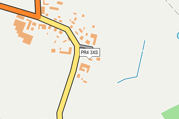
PR4 3XS is located in the Rural North Fylde electoral ward, within the local authority district of Fylde and the English Parliamentary constituency of Fylde. The Sub Integrated Care Board (ICB) Location is NHS Lancashire and South Cumbria ICB - 02M and the police force is Lancashire. This postcode has been in use since April 2017.


GetTheData
Source: OS OpenMap – Local (Ordnance Survey)
Source: OS VectorMap District (Ordnance Survey)
Licence: Open Government Licence (requires attribution)
| Easting | 340765 |
| Northing | 437828 |
| Latitude | 53.833331 |
| Longitude | -2.901539 |
GetTheData
Source: Open Postcode Geo
Licence: Open Government Licence
| Country | England |
| Postcode District | PR4 |
| ➜ PR4 open data dashboard ➜ See where PR4 is on a map ➜ Where is Thistleton? | |
GetTheData
Source: Land Registry Price Paid Data
Licence: Open Government Licence
| Ward | Rural North Fylde |
| Constituency | Fylde |
GetTheData
Source: ONS Postcode Database
Licence: Open Government Licence
| June 2022 | Anti-social behaviour | On or near Thistleton Road | 270m |
| May 2022 | Violence and sexual offences | On or near Thistleton Road | 270m |
| April 2022 | Other crime | On or near B5269 | 373m |
| ➜ Get more crime data in our Crime section | |||
GetTheData
Source: data.police.uk
Licence: Open Government Licence
| Village Centre (Thistleton Road) | Thistleton | 121m |
| Village Centre (Thistleton Road) | Thistleton | 125m |
| Town Head Farm (Thistleton Road) | Thistleton | 250m |
| Ship Hotel (High Street) | Elswick | 1,253m |
| Ship Inn (High Street) | Elswick | 1,257m |
GetTheData
Source: NaPTAN
Licence: Open Government Licence
| Percentage of properties with Next Generation Access | 100.0% |
| Percentage of properties with Superfast Broadband | 0.0% |
| Percentage of properties with Ultrafast Broadband | 0.0% |
| Percentage of properties with Full Fibre Broadband | 0.0% |
Superfast Broadband is between 30Mbps and 300Mbps
Ultrafast Broadband is > 300Mbps
| Percentage of properties unable to receive 2Mbps | 0.0% |
| Percentage of properties unable to receive 5Mbps | 0.0% |
| Percentage of properties unable to receive 10Mbps | 0.0% |
| Percentage of properties unable to receive 30Mbps | 100.0% |
GetTheData
Source: Ofcom
Licence: Ofcom Terms of Use (requires attribution)
GetTheData
Source: ONS Postcode Database
Licence: Open Government Licence


➜ Get more ratings from the Food Standards Agency
GetTheData
Source: Food Standards Agency
Licence: FSA terms & conditions
| Last Collection | |||
|---|---|---|---|
| Location | Mon-Fri | Sat | Distance |
| Great Singleton | 17:30 | 12:00 | 2,789m |
| Weeton Village | 16:00 | 10:00 | 3,851m |
| Wesham Cross | 17:00 | 09:45 | 4,622m |
GetTheData
Source: Dracos
Licence: Creative Commons Attribution-ShareAlike
| Facility | Distance |
|---|---|
| Roseacre Road Playing Fields Roseacre Road, Elswick, Preston Grass Pitches | 1.5km |
| Great Eccleston Copp C Of E Primary School Copp Lane, Great Eccleston, Preston Grass Pitches | 2.1km |
| Singleton Church Of England Va Primary School Church Road, Singleton, Poulton-le-fylde Grass Pitches | 2.5km |
GetTheData
Source: Active Places
Licence: Open Government Licence
| School | Phase of Education | Distance |
|---|---|---|
| Great Eccleston Copp CofE Primary School Copp Lane, Great Eccleston, Preston, PR3 0ZN | Primary | 2.1km |
| Singleton Church of England Voluntary Aided Primary School Church Road, Singleton, Poulton-le-Fylde, FY6 8LN | Primary | 2.5km |
| Weeton Primary School Minden Road, Weeton, Preston, PR4 3HX | Primary | 3km |
GetTheData
Source: Edubase
Licence: Open Government Licence
The below table lists the International Territorial Level (ITL) codes (formerly Nomenclature of Territorial Units for Statistics (NUTS) codes) and Local Administrative Units (LAU) codes for PR4 3XS:
| ITL 1 Code | Name |
|---|---|
| TLD | North West (England) |
| ITL 2 Code | Name |
| TLD4 | Lancashire |
| ITL 3 Code | Name |
| TLD45 | Mid Lancashire |
| LAU 1 Code | Name |
| E07000119 | Fylde |
GetTheData
Source: ONS Postcode Directory
Licence: Open Government Licence
The below table lists the Census Output Area (OA), Lower Layer Super Output Area (LSOA), and Middle Layer Super Output Area (MSOA) for PR4 3XS:
| Code | Name | |
|---|---|---|
| OA | E00127020 | |
| LSOA | E01025026 | Fylde 001B |
| MSOA | E02005203 | Fylde 001 |
GetTheData
Source: ONS Postcode Directory
Licence: Open Government Licence
| PR4 3XA | Thistleton Road | 128m |
| PR4 3YA | Fleetwood Road | 780m |
| PR4 3ZA | Fleetwood Road | 983m |
| PR4 3UA | Grange Road | 1051m |
| PR4 3UJ | West View | 1127m |
| PR4 3US | The Meadows | 1178m |
| PR4 3ZR | Cedar Walk | 1192m |
| PR4 3ZN | Ronwood Close | 1227m |
| PR4 3XL | Wilson Drive | 1279m |
| PR4 3UQ | Roseacre Drive | 1324m |
GetTheData
Source: Open Postcode Geo; Land Registry Price Paid Data
Licence: Open Government Licence