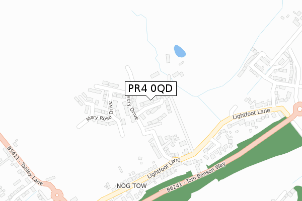
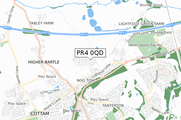
PR4 0QD is located in the Preston Rural North electoral ward, within the local authority district of Preston and the English Parliamentary constituency of Wyre and Preston North. The Sub Integrated Care Board (ICB) Location is NHS Lancashire and South Cumbria ICB - 01E and the police force is Lancashire. This postcode has been in use since April 2018.


GetTheData
Source: OS Open Zoomstack (Ordnance Survey)
Licence: Open Government Licence (requires attribution)
Attribution: Contains OS data © Crown copyright and database right 2024
Source: Open Postcode Geo
Licence: Open Government Licence (requires attribution)
Attribution: Contains OS data © Crown copyright and database right 2024; Contains Royal Mail data © Royal Mail copyright and database right 2024; Source: Office for National Statistics licensed under the Open Government Licence v.3.0
| Easting | 350930 |
| Northing | 433385 |
| Latitude | 53.794464 |
| Longitude | -2.746391 |
GetTheData
Source: Open Postcode Geo
Licence: Open Government Licence
| Country | England |
| Postcode District | PR4 |
| ➜ PR4 open data dashboard ➜ See where PR4 is on a map ➜ Where is Fulwood? | |
GetTheData
Source: Land Registry Price Paid Data
Licence: Open Government Licence
| Ward | Preston Rural North |
| Constituency | Wyre And Preston North |
GetTheData
Source: ONS Postcode Database
Licence: Open Government Licence
25, VANGUARD CLOSE, HIGHER BARTLE, PRESTON, PR4 0QD 2020 30 SEP £299,995 |
19, VANGUARD CLOSE, HIGHER BARTLE, PRESTON, PR4 0QD 2020 7 AUG £314,995 |
10, VANGUARD CLOSE, HIGHER BARTLE, PRESTON, PR4 0QD 2019 27 SEP £364,995 |
21, VANGUARD CLOSE, HIGHER BARTLE, PRESTON, PR4 0QD 2019 27 SEP £281,995 |
23, VANGUARD CLOSE, HIGHER BARTLE, PRESTON, PR4 0QD 2019 5 SEP £345,995 |
7, VANGUARD CLOSE, HIGHER BARTLE, PRESTON, PR4 0QD 2019 28 JUN £279,995 |
15, VANGUARD CLOSE, HIGHER BARTLE, PRESTON, PR4 0QD 2019 21 JUN £319,995 |
13, VANGUARD CLOSE, HIGHER BARTLE, PRESTON, PR4 0QD 2019 3 JUN £359,995 |
1, VANGUARD CLOSE, HIGHER BARTLE, PRESTON, PR4 0QD 2019 15 APR £318,995 |
8, VANGUARD CLOSE, HIGHER BARTLE, PRESTON, PR4 0QD 2019 18 MAR £309,995 |
GetTheData
Source: HM Land Registry Price Paid Data
Licence: Contains HM Land Registry data © Crown copyright and database right 2024. This data is licensed under the Open Government Licence v3.0.
| June 2022 | Other theft | On or near Lightfoot Lane | 222m |
| June 2022 | Violence and sexual offences | On or near New Rough Hey | 489m |
| June 2022 | Public order | On or near New Rough Hey | 489m |
| ➜ Get more crime data in our Crime section | |||
GetTheData
Source: data.police.uk
Licence: Open Government Licence
| Lightfoot Lane | Fulwood | 198m |
| Abbott Croft (Lightfoot Lane) | Fulwood | 200m |
| Tag Lane Shelter (Tag Lane) | Nog Tow | 457m |
| Tag Lane | Nog Tow | 475m |
| The Guild Merchant (Tanterton Hall Road) | Tanterton | 558m |
| Salwick Station | 4.9km |
| Preston Station | 4.9km |
GetTheData
Source: NaPTAN
Licence: Open Government Licence
| Percentage of properties with Next Generation Access | 100.0% |
| Percentage of properties with Superfast Broadband | 100.0% |
| Percentage of properties with Ultrafast Broadband | 100.0% |
| Percentage of properties with Full Fibre Broadband | 80.0% |
Superfast Broadband is between 30Mbps and 300Mbps
Ultrafast Broadband is > 300Mbps
| Percentage of properties unable to receive 2Mbps | 0.0% |
| Percentage of properties unable to receive 5Mbps | 0.0% |
| Percentage of properties unable to receive 10Mbps | 0.0% |
| Percentage of properties unable to receive 30Mbps | 0.0% |
GetTheData
Source: Ofcom
Licence: Ofcom Terms of Use (requires attribution)
GetTheData
Source: ONS Postcode Database
Licence: Open Government Licence


➜ Get more ratings from the Food Standards Agency
GetTheData
Source: Food Standards Agency
Licence: FSA terms & conditions
| Last Collection | |||
|---|---|---|---|
| Location | Mon-Fri | Sat | Distance |
| Nog Tow | 16:00 | 10:30 | 448m |
| 89 Landsdown Hill, Fulwood | 17:45 | 11:30 | 1,446m |
| Turnpike | 17:30 | 11:30 | 1,755m |
GetTheData
Source: Dracos
Licence: Creative Commons Attribution-ShareAlike
| Facility | Distance |
|---|---|
| Fulwood Amateurs Afc Lightfoot Lane, Fulwood, Preston Grass Pitches | 609m |
| Tanterton Playing Fields Bowlingfield, Ingol, Preston Grass Pitches | 759m |
| Fulwood Driving Range And Golf Academy (Closed) Lightfoot Lane, Fulwood, Preston Golf, Grass Pitches | 808m |
GetTheData
Source: Active Places
Licence: Open Government Licence
| School | Phase of Education | Distance |
|---|---|---|
| Pool House Community Primary School Kidsgrove, Tanterton, Ingol, Preston, PR2 7BX | Primary | 864m |
| Harris Primary School Wychnor, Fulwood, Preston, PR2 7EE | Primary | 970m |
| Woodplumpton St Anne's CofE Primary School Woodplumpton Road, Woodplumpton, Preston, PR4 0NE | Primary | 1.5km |
GetTheData
Source: Edubase
Licence: Open Government Licence
The below table lists the International Territorial Level (ITL) codes (formerly Nomenclature of Territorial Units for Statistics (NUTS) codes) and Local Administrative Units (LAU) codes for PR4 0QD:
| ITL 1 Code | Name |
|---|---|
| TLD | North West (England) |
| ITL 2 Code | Name |
| TLD4 | Lancashire |
| ITL 3 Code | Name |
| TLD45 | Mid Lancashire |
| LAU 1 Code | Name |
| E07000123 | Preston |
GetTheData
Source: ONS Postcode Directory
Licence: Open Government Licence
The below table lists the Census Output Area (OA), Lower Layer Super Output Area (LSOA), and Middle Layer Super Output Area (MSOA) for PR4 0QD:
| Code | Name | |
|---|---|---|
| OA | E00128321 | |
| LSOA | E01025280 | Preston 002C |
| MSOA | E02005254 | Preston 002 |
GetTheData
Source: ONS Postcode Directory
Licence: Open Government Licence
| PR4 0AJ | Lightfoot Lane | 69m |
| PR4 0LZ | Mayflower Drive | 125m |
| PR4 0LA | Lightfoot Lane | 249m |
| PR4 0AN | Abbott Croft | 252m |
| PR4 0AD | Daisy Fields | 307m |
| PR4 0AH | Lightfoot Lane | 361m |
| PR4 0AA | Brook Meadow | 424m |
| PR2 7BA | New Rough Hey | 445m |
| PR2 7BB | New Rough Hey | 480m |
| PR4 0NA | Tag Lane | 494m |
GetTheData
Source: Open Postcode Geo; Land Registry Price Paid Data
Licence: Open Government Licence