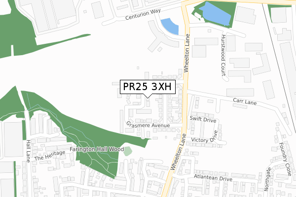
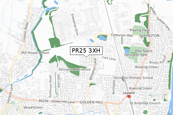
PR25 3XH is located in the Farington East electoral ward, within the local authority district of South Ribble and the English Parliamentary constituency of Ribble Valley. The Sub Integrated Care Board (ICB) Location is NHS Lancashire and South Cumbria ICB - 00X and the police force is Lancashire. This postcode has been in use since December 2019.


GetTheData
Source: OS Open Zoomstack (Ordnance Survey)
Licence: Open Government Licence (requires attribution)
Attribution: Contains OS data © Crown copyright and database right 2024
Source: Open Postcode Geo
Licence: Open Government Licence (requires attribution)
Attribution: Contains OS data © Crown copyright and database right 2024; Contains Royal Mail data © Royal Mail copyright and database right 2024; Source: Office for National Statistics licensed under the Open Government Licence v.3.0
| Easting | 354095 |
| Northing | 423297 |
| Latitude | 53.704089 |
| Longitude | -2.696846 |
GetTheData
Source: Open Postcode Geo
Licence: Open Government Licence
| Country | England |
| Postcode District | PR25 |
| ➜ PR25 open data dashboard ➜ See where PR25 is on a map ➜ Where is Leyland? | |
GetTheData
Source: Land Registry Price Paid Data
Licence: Open Government Licence
| Ward | Farington East |
| Constituency | Ribble Valley |
GetTheData
Source: ONS Postcode Database
Licence: Open Government Licence
5, EASEDALE CLOSE, FARINGTON, LEYLAND, PR25 3XH 2020 10 JUL £192,995 |
2, EASEDALE CLOSE, FARINGTON, LEYLAND, PR25 3XH 2020 10 JUL £192,995 |
4, EASEDALE CLOSE, FARINGTON, LEYLAND, PR25 3XH 2020 27 MAR £181,995 |
1, EASEDALE CLOSE, FARINGTON, LEYLAND, PR25 3XH 2020 20 MAR £207,995 |
3, EASEDALE CLOSE, FARINGTON, LEYLAND, PR25 3XH 2020 6 MAR £248,995 |
17, EASEDALE CLOSE, FARINGTON, LEYLAND, PR25 3XH 2020 14 FEB £205,995 |
20, EASEDALE CLOSE, LEYLAND, PR25 3XH 2019 19 DEC £235,950 |
19, EASEDALE CLOSE, LEYLAND, PR25 3XH 2019 19 DEC £192,995 |
16, EASEDALE CLOSE, FARINGTON, LEYLAND, PR25 3XH 2019 12 DEC £192,995 |
26, EASEDALE CLOSE, LEYLAND, PR25 3XH 2019 4 DEC £248,995 |
GetTheData
Source: HM Land Registry Price Paid Data
Licence: Contains HM Land Registry data © Crown copyright and database right 2024. This data is licensed under the Open Government Licence v3.0.
| June 2022 | Violence and sexual offences | On or near Sports/Recreation Area | 299m |
| June 2022 | Vehicle crime | On or near Carr Lane | 342m |
| June 2022 | Vehicle crime | On or near Carr Lane | 342m |
| ➜ Get more crime data in our Crime section | |||
GetTheData
Source: data.police.uk
Licence: Open Government Licence
| Kentmere Avenue (Wheelton Lane) | Farington | 172m |
| Kentmere Avenue (Wheelton Lane) | Farington | 179m |
| Jubilee House (Centurion Way) | Farington | 311m |
| Jubilee House (Centurion Way) | Farington | 326m |
| Parish Gardens (Wheelton Lane) | Golden Hill | 353m |
| Leyland Station | 0.9km |
| Lostock Hall Station | 2.3km |
| Bamber Bridge Station | 3.5km |
GetTheData
Source: NaPTAN
Licence: Open Government Licence
GetTheData
Source: ONS Postcode Database
Licence: Open Government Licence


➜ Get more ratings from the Food Standards Agency
GetTheData
Source: Food Standards Agency
Licence: FSA terms & conditions
| Last Collection | |||
|---|---|---|---|
| Location | Mon-Fri | Sat | Distance |
| Morrisons | 17:00 | 11:30 | 515m |
| Golden Hill | 17:30 | 12:30 | 708m |
| North Gate | 17:30 | 11:30 | 768m |
GetTheData
Source: Dracos
Licence: Creative Commons Attribution-ShareAlike
| Facility | Distance |
|---|---|
| The Gym Group (Leyland) Olympian Way, Leyland Health and Fitness Gym | 621m |
| Btr Fields Stanifield Lane, Farington, Leyland Grass Pitches | 895m |
| St Marys Roman Catholic Primary School Haig Avenue, Leyland Grass Pitches | 965m |
GetTheData
Source: Active Places
Licence: Open Government Licence
| School | Phase of Education | Distance |
|---|---|---|
| Farington Primary School Rose Street, Farington, Leyland, PR25 4GH | Primary | 784m |
| Leyland St Mary's Roman Catholic Primary School Haig Avenue, Leyland, PR25 2QA | Primary | 965m |
| Northbrook Primary Academy Bannister Drive, Leyland, PR25 2GB | Primary | 1km |
GetTheData
Source: Edubase
Licence: Open Government Licence
The below table lists the International Territorial Level (ITL) codes (formerly Nomenclature of Territorial Units for Statistics (NUTS) codes) and Local Administrative Units (LAU) codes for PR25 3XH:
| ITL 1 Code | Name |
|---|---|
| TLD | North West (England) |
| ITL 2 Code | Name |
| TLD4 | Lancashire |
| ITL 3 Code | Name |
| TLD45 | Mid Lancashire |
| LAU 1 Code | Name |
| E07000126 | South Ribble |
GetTheData
Source: ONS Postcode Directory
Licence: Open Government Licence
The below table lists the Census Output Area (OA), Lower Layer Super Output Area (LSOA), and Middle Layer Super Output Area (MSOA) for PR25 3XH:
| Code | Name | |
|---|---|---|
| OA | E00129007 | |
| LSOA | E01025420 | South Ribble 012D |
| MSOA | E02005298 | South Ribble 012 |
GetTheData
Source: ONS Postcode Directory
Licence: Open Government Licence
| PR25 3UJ | Windermere Avenue | 78m |
| PR25 3UE | Grasmere Avenue | 80m |
| PR25 3UH | Kentmere Avenue | 115m |
| PR25 3UD | Wheelton Lane | 146m |
| PR25 3UF | Parish Gardens | 297m |
| PR25 3UT | Parish Gardens | 304m |
| PR25 3ZG | Summerfield | 326m |
| PR25 3ZJ | The Heritage | 329m |
| PR25 3ZF | Bluebell Wood | 340m |
| PR25 3UQ | Centurion Court | 365m |
GetTheData
Source: Open Postcode Geo; Land Registry Price Paid Data
Licence: Open Government Licence