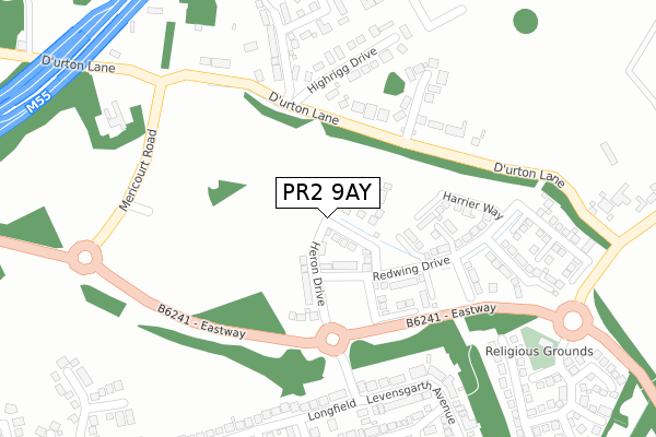
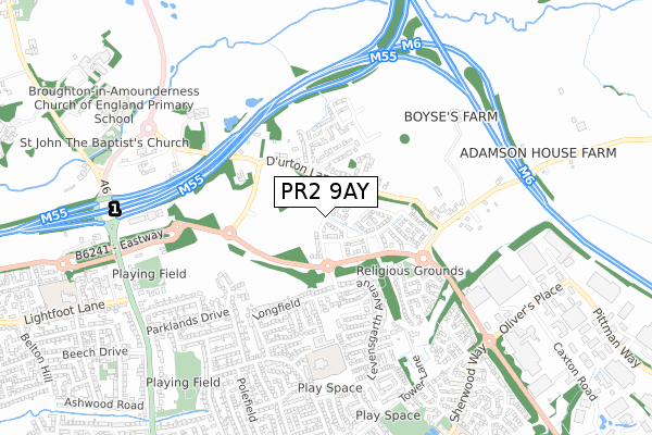
PR2 9AY is located in the Preston Rural East electoral ward, within the local authority district of Preston and the English Parliamentary constituency of Wyre and Preston North. The Sub Integrated Care Board (ICB) Location is NHS Lancashire and South Cumbria ICB - 01E and the police force is Lancashire. This postcode has been in use since January 2020.


GetTheData
Source: OS Open Zoomstack (Ordnance Survey)
Licence: Open Government Licence (requires attribution)
Attribution: Contains OS data © Crown copyright and database right 2024
Source: Open Postcode Geo
Licence: Open Government Licence (requires attribution)
Attribution: Contains OS data © Crown copyright and database right 2024; Contains Royal Mail data © Royal Mail copyright and database right 2024; Source: Office for National Statistics licensed under the Open Government Licence v.3.0
| Easting | 353748 |
| Northing | 434097 |
| Latitude | 53.801121 |
| Longitude | -2.703724 |
GetTheData
Source: Open Postcode Geo
Licence: Open Government Licence
| Country | England |
| Postcode District | PR2 |
| ➜ PR2 open data dashboard ➜ See where PR2 is on a map ➜ Where is Broughton? | |
GetTheData
Source: Land Registry Price Paid Data
Licence: Open Government Licence
| Ward | Preston Rural East |
| Constituency | Wyre And Preston North |
GetTheData
Source: ONS Postcode Database
Licence: Open Government Licence
1, WITTON ROAD, FULWOOD, PRESTON, PR2 9AY 2023 8 MAR £530,000 |
2022 25 NOV £385,500 |
1, WITTON ROAD, FULWOOD, PRESTON, PR2 9AY 2022 11 FEB £522,500 |
1, WITTON ROAD, FULWOOD, PRESTON, PR2 9AY 2020 9 OCT £484,995 |
5, WITTON ROAD, FULWOOD, PRESTON, PR2 9AY 2020 25 SEP £449,995 |
11, WITTON ROAD, FULWOOD, PRESTON, PR2 9AY 2020 11 SEP £324,995 |
15, WITTON ROAD, FULWOOD, PRESTON, PR2 9AY 2020 28 AUG £304,995 |
7, WITTON ROAD, FULWOOD, PRESTON, PR2 9AY 2020 28 AUG £369,995 |
13, WITTON ROAD, FULWOOD, PRESTON, PR2 9AY 2020 7 AUG £285,996 |
3, WITTON ROAD, FULWOOD, PRESTON, PR2 9AY 2020 24 APR £382,995 |
GetTheData
Source: HM Land Registry Price Paid Data
Licence: Contains HM Land Registry data © Crown copyright and database right 2024. This data is licensed under the Open Government Licence v3.0.
| December 2023 | Anti-social behaviour | On or near Longfield | 428m |
| November 2023 | Burglary | On or near Longfield | 428m |
| May 2023 | Public order | On or near Haywood Close | 423m |
| ➜ Get more crime data in our Crime section | |||
GetTheData
Source: data.police.uk
Licence: Open Government Licence
| Ashness Close (Levensgarth Avenue) | Sherwood | 452m |
| Ashness Close (Levensgarth Avenue) | Sherwood | 478m |
| Moorfield Avenue (Broadwood Drive) | Sharoe Green | 679m |
| Broadwood Drive | Sharoe Green | 693m |
| Hellifield (Broadwood Drive) | Sharoe Green | 715m |
| Preston Station | 4.9km |
GetTheData
Source: NaPTAN
Licence: Open Government Licence
GetTheData
Source: ONS Postcode Database
Licence: Open Government Licence


➜ Get more ratings from the Food Standards Agency
GetTheData
Source: Food Standards Agency
Licence: FSA terms & conditions
| Last Collection | |||
|---|---|---|---|
| Location | Mon-Fri | Sat | Distance |
| Durton Lane, Warwick House | 17:00 | 10:00 | 156m |
| Levensgarth Avenue | 17:30 | 11:30 | 316m |
| 8 South Drive, Fulwood | 17:45 | 11:30 | 836m |
GetTheData
Source: Dracos
Licence: Creative Commons Attribution-ShareAlike
| Facility | Distance |
|---|---|
| Swim Central Preston Olivers Place, Fulwood, Preston Swimming Pool | 686m |
| Fulwood & Broughton Cricket Club Garstang Road, Broughton, Preston Grass Pitches | 712m |
| South Grove Park South Drive, Fulwood, Preston Grass Pitches | 829m |
GetTheData
Source: Active Places
Licence: Open Government Licence
| School | Phase of Education | Distance |
|---|---|---|
| Fulwood, St Peter's Church of England Primary School and Nursery Meadowfield, Fulwood, Preston, PR2 9RE | Primary | 608m |
| Sherwood Primary School Sherwood Way, Fulwood, Preston, PR2 9GA | Primary | 1km |
| St Clare's Catholic Primary School, Preston Sharoe Green Lane North, Fulwood, Preston, PR2 9HH | Primary | 1.1km |
GetTheData
Source: Edubase
Licence: Open Government Licence
The below table lists the International Territorial Level (ITL) codes (formerly Nomenclature of Territorial Units for Statistics (NUTS) codes) and Local Administrative Units (LAU) codes for PR2 9AY:
| ITL 1 Code | Name |
|---|---|
| TLD | North West (England) |
| ITL 2 Code | Name |
| TLD4 | Lancashire |
| ITL 3 Code | Name |
| TLD45 | Mid Lancashire |
| LAU 1 Code | Name |
| E07000123 | Preston |
GetTheData
Source: ONS Postcode Directory
Licence: Open Government Licence
The below table lists the Census Output Area (OA), Lower Layer Super Output Area (LSOA), and Middle Layer Super Output Area (MSOA) for PR2 9AY:
| Code | Name | |
|---|---|---|
| OA | E00128290 | |
| LSOA | E01025277 | Preston 002B |
| MSOA | E02005254 | Preston 002 |
GetTheData
Source: ONS Postcode Directory
Licence: Open Government Licence
| PR3 5LE | Durton Lane | 175m |
| PR3 5LG | St Johns Court | 191m |
| PR3 5LJ | Highrigg Drive | 216m |
| PR2 9FP | Levensgarth Avenue | 342m |
| PR2 9FU | Longfield | 364m |
| PR2 9FE | Langport Close | 372m |
| PR2 9FN | Langfield Close | 409m |
| PR2 9PJ | Haywood Close | 437m |
| PR2 9PF | Briar Bank Row | 440m |
| PR2 9FL | Longley Close | 441m |
GetTheData
Source: Open Postcode Geo; Land Registry Price Paid Data
Licence: Open Government Licence