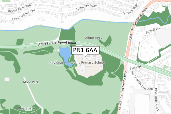
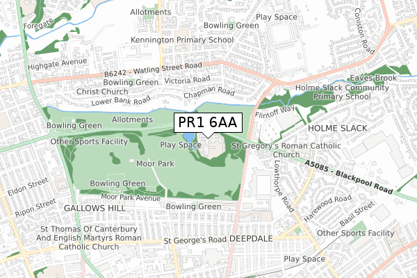
PR1 6AA is located in the Plungington electoral ward, within the local authority district of Preston and the English Parliamentary constituency of Preston. The Sub Integrated Care Board (ICB) Location is NHS Lancashire and South Cumbria ICB - 01E and the police force is Lancashire. This postcode has been in use since January 2018.


GetTheData
Source: OS Open Zoomstack (Ordnance Survey)
Licence: Open Government Licence (requires attribution)
Attribution: Contains OS data © Crown copyright and database right 2024
Source: Open Postcode Geo
Licence: Open Government Licence (requires attribution)
Attribution: Contains OS data © Crown copyright and database right 2024; Contains Royal Mail data © Royal Mail copyright and database right 2024; Source: Office for National Statistics licensed under the Open Government Licence v.3.0
| Easting | 354394 |
| Northing | 431146 |
| Latitude | 53.774657 |
| Longitude | -2.693478 |
GetTheData
Source: Open Postcode Geo
Licence: Open Government Licence
| Country | England |
| Postcode District | PR1 |
| ➜ PR1 open data dashboard ➜ See where PR1 is on a map ➜ Where is Preston? | |
GetTheData
Source: Land Registry Price Paid Data
Licence: Open Government Licence
| Ward | Plungington |
| Constituency | Preston |
GetTheData
Source: ONS Postcode Database
Licence: Open Government Licence
| January 2024 | Shoplifting | On or near Supermarket | 486m |
| January 2024 | Violence and sexual offences | On or near Supermarket | 486m |
| January 2024 | Criminal damage and arson | On or near Supermarket | 486m |
| ➜ Get more crime data in our Crime section | |||
GetTheData
Source: data.police.uk
Licence: Open Government Licence
| Sainsburys (Sir Tom Finney Way) | Deepdale | 241m |
| Football Ground (Deepdale Road) | Deepdale | 243m |
| Football Ground (Deepdale Road) | Deepdale | 258m |
| Sainsburys (Sir Tom Finney Way) | Deepdale | 272m |
| Moor Park Hs (Deepdale Road) | Deepdale | 440m |
| Preston Station | 2.2km |
GetTheData
Source: NaPTAN
Licence: Open Government Licence
GetTheData
Source: ONS Postcode Database
Licence: Open Government Licence


➜ Get more ratings from the Food Standards Agency
GetTheData
Source: Food Standards Agency
Licence: FSA terms & conditions
| Last Collection | |||
|---|---|---|---|
| Location | Mon-Fri | Sat | Distance |
| 49 Newton Road, Ashton | 17:00 | 11:30 | 936m |
| Lower North Road | 17:45 | 11:30 | 1,055m |
| 86 Moor Lane | 17:30 | 11:30 | 1,135m |
GetTheData
Source: Dracos
Licence: Creative Commons Attribution-ShareAlike
| Facility | Distance |
|---|---|
| Moor Park Moor Park Avenue, Preston Grass Pitches, Outdoor Tennis Courts | 291m |
| The Gym Group (Preston) (Closed) Bill Shankly Crescent, Preston Health and Fitness Gym, Studio | 392m |
| Moor Park High School And Sixth Form Moor Park Avenue, Preston Sports Hall | 412m |
GetTheData
Source: Active Places
Licence: Open Government Licence
| School | Phase of Education | Distance |
|---|---|---|
| Larches High School Moor Park, Blackpool Road, Preston, PR1 6AA | Not applicable | 0m |
| Acorns Primary School Moor Park, Blackpool Road, Preston, PR1 6AU | Not applicable | 58m |
| Moor Park High School and Sixth Form Moor Park Avenue, Preston, PR1 6DT | Secondary | 411m |
GetTheData
Source: Edubase
Licence: Open Government Licence
The below table lists the International Territorial Level (ITL) codes (formerly Nomenclature of Territorial Units for Statistics (NUTS) codes) and Local Administrative Units (LAU) codes for PR1 6AA:
| ITL 1 Code | Name |
|---|---|
| TLD | North West (England) |
| ITL 2 Code | Name |
| TLD4 | Lancashire |
| ITL 3 Code | Name |
| TLD45 | Mid Lancashire |
| LAU 1 Code | Name |
| E07000123 | Preston |
GetTheData
Source: ONS Postcode Directory
Licence: Open Government Licence
The below table lists the Census Output Area (OA), Lower Layer Super Output Area (LSOA), and Middle Layer Super Output Area (MSOA) for PR1 6AA:
| Code | Name | |
|---|---|---|
| OA | E00128275 | |
| LSOA | E01025275 | Preston 011C |
| MSOA | E02005263 | Preston 011 |
GetTheData
Source: ONS Postcode Directory
Licence: Open Government Licence
| PR2 8NX | Chapman Road | 264m |
| PR2 8NY | Chapman Road | 294m |
| PR1 6UX | Parkside | 316m |
| PR2 8WR | Chapman Road | 321m |
| PR2 8PB | Park Walk | 340m |
| PR2 8NQ | Victoria Road | 345m |
| PR1 6UU | Sherbourne Crescent | 351m |
| PR2 8AL | Garrison Road | 361m |
| PR2 8PN | Park Road | 362m |
| PR2 8NP | Victoria Road | 379m |
GetTheData
Source: Open Postcode Geo; Land Registry Price Paid Data
Licence: Open Government Licence