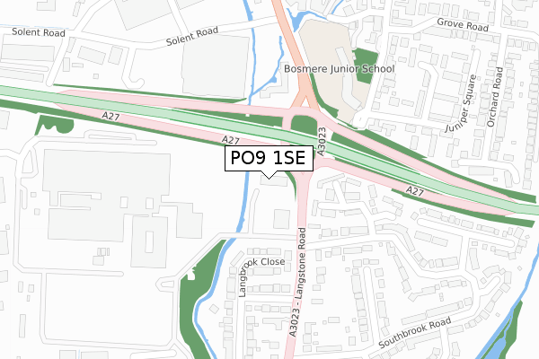
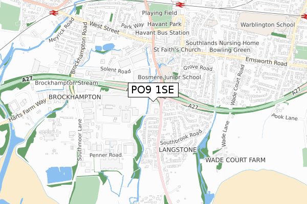
PO9 1SE is located in the St Faith's electoral ward, within the local authority district of Havant and the English Parliamentary constituency of Havant. The Sub Integrated Care Board (ICB) Location is NHS Hampshire and Isle of Wight ICB - D9Y0V and the police force is Hampshire. This postcode has been in use since January 2018.


GetTheData
Source: OS Open Zoomstack (Ordnance Survey)
Licence: Open Government Licence (requires attribution)
Attribution: Contains OS data © Crown copyright and database right 2024
Source: Open Postcode Geo
Licence: Open Government Licence (requires attribution)
Attribution: Contains OS data © Crown copyright and database right 2024; Contains Royal Mail data © Royal Mail copyright and database right 2024; Source: Office for National Statistics licensed under the Open Government Licence v.3.0
| Easting | 471564 |
| Northing | 105803 |
| Latitude | 50.847322 |
| Longitude | -0.984833 |
GetTheData
Source: Open Postcode Geo
Licence: Open Government Licence
| Country | England |
| Postcode District | PO9 |
| ➜ PO9 open data dashboard ➜ See where PO9 is on a map ➜ Where is Havant? | |
GetTheData
Source: Land Registry Price Paid Data
Licence: Open Government Licence
| Ward | St Faith's |
| Constituency | Havant |
GetTheData
Source: ONS Postcode Database
Licence: Open Government Licence
| January 2024 | Violence and sexual offences | On or near Homewell | 424m |
| January 2024 | Violence and sexual offences | On or near Homewell | 424m |
| January 2024 | Shoplifting | On or near Homewell | 424m |
| ➜ Get more crime data in our Crime section | |||
GetTheData
Source: data.police.uk
Licence: Open Government Licence
| Woodbury Avenue (Langstone Road) | Langstone | 85m |
| Solent Road (Park Road South) | Havant | 236m |
| Langbrook Close (Langstone Road) | Langstone | 239m |
| Tesco Superstore (Solent Road) | Havant | 292m |
| Tesco Superstore (Solent Road) | Havant | 305m |
| Havant Station | 0.8km |
| Bedhampton Station | 1.1km |
| Warblington Station | 1.4km |
GetTheData
Source: NaPTAN
Licence: Open Government Licence
GetTheData
Source: ONS Postcode Database
Licence: Open Government Licence


➜ Get more ratings from the Food Standards Agency
GetTheData
Source: Food Standards Agency
Licence: FSA terms & conditions
| Last Collection | |||
|---|---|---|---|
| Location | Mon-Fri | Sat | Distance |
| Tesco Stores | 18:50 | 12:00 | 272m |
| Southbrook Road | 17:30 | 11:15 | 337m |
| West Street | 18:30 | 11:15 | 483m |
GetTheData
Source: Dracos
Licence: Creative Commons Attribution-ShareAlike
| Facility | Distance |
|---|---|
| Bosmere Junior School South Street, Havant Grass Pitches | 210m |
| Activ Health Fitness Centre Langstone Road, Havant Health and Fitness Gym | 351m |
| Havant Park Park Way, Havant Grass Pitches, Outdoor Tennis Courts | 801m |
GetTheData
Source: Active Places
Licence: Open Government Licence
| School | Phase of Education | Distance |
|---|---|---|
| Bosmere Junior School South Street, Havant, PO9 1DA | Primary | 210m |
| Fairfield Infant School Fairfield Road, Havant, PO9 1AY | Primary | 782m |
| Releasing Potential School 7 Kingscroft Court, Ridgway, Havant, PO9 1LS | Not applicable | 798m |
GetTheData
Source: Edubase
Licence: Open Government Licence
The below table lists the International Territorial Level (ITL) codes (formerly Nomenclature of Territorial Units for Statistics (NUTS) codes) and Local Administrative Units (LAU) codes for PO9 1SE:
| ITL 1 Code | Name |
|---|---|
| TLJ | South East (England) |
| ITL 2 Code | Name |
| TLJ3 | Hampshire and Isle of Wight |
| ITL 3 Code | Name |
| TLJ35 | South Hampshire |
| LAU 1 Code | Name |
| E07000090 | Havant |
GetTheData
Source: ONS Postcode Directory
Licence: Open Government Licence
The below table lists the Census Output Area (OA), Lower Layer Super Output Area (LSOA), and Middle Layer Super Output Area (MSOA) for PO9 1SE:
| Code | Name | |
|---|---|---|
| OA | E00116635 | |
| LSOA | E01022954 | Havant 014B |
| MSOA | E02004775 | Havant 014 |
GetTheData
Source: ONS Postcode Directory
Licence: Open Government Licence
| PO9 1ST | Regents Court | 113m |
| PO9 1SP | Regents Court | 133m |
| PO9 1RS | Langbrook Close | 166m |
| PO9 1RH | Woodbury Avenue | 168m |
| PO9 1RJ | Rectory Road | 196m |
| PO9 1RA | Langstone Road | 243m |
| PO9 1HX | Juniper Square | 273m |
| PO9 1RW | Southbrook Close | 278m |
| PO9 1JA | Juniper Square | 279m |
| PO9 1BY | South Street | 301m |
GetTheData
Source: Open Postcode Geo; Land Registry Price Paid Data
Licence: Open Government Licence