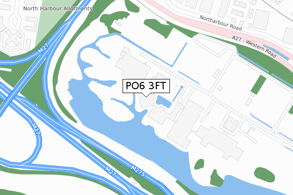
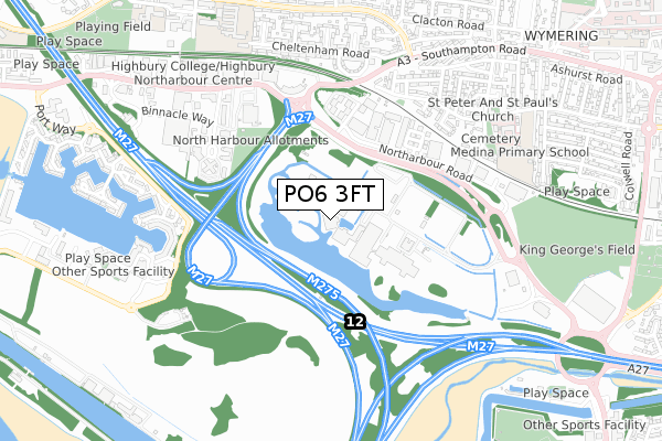
PO6 3FT is located in the Cosham electoral ward, within the unitary authority of Portsmouth and the English Parliamentary constituency of Portsmouth North. The Sub Integrated Care Board (ICB) Location is NHS Hampshire and Isle of Wight ICB - 10R and the police force is Hampshire. This postcode has been in use since June 2018.


GetTheData
Source: OS Open Zoomstack (Ordnance Survey)
Licence: Open Government Licence (requires attribution)
Attribution: Contains OS data © Crown copyright and database right 2025
Source: Open Postcode Geo
Licence: Open Government Licence (requires attribution)
Attribution: Contains OS data © Crown copyright and database right 2025; Contains Royal Mail data © Royal Mail copyright and database right 2025; Source: Office for National Statistics licensed under the Open Government Licence v.3.0
| Easting | 464426 |
| Northing | 105132 |
| Latitude | 50.842126 |
| Longitude | -1.086328 |
GetTheData
Source: Open Postcode Geo
Licence: Open Government Licence
| Country | England |
| Postcode District | PO6 |
➜ See where PO6 is on a map ➜ Where is Portsmouth? | |
GetTheData
Source: Land Registry Price Paid Data
Licence: Open Government Licence
| Ward | Cosham |
| Constituency | Portsmouth North |
GetTheData
Source: ONS Postcode Database
Licence: Open Government Licence
| Events Parking North Harbour | Cosham | 325m |
| Northarbour Spur (Southampton Road) | Cosham | 507m |
| Parr Road (Medina Road) | Cosham | 536m |
| Parr Road (Medina Road) | Cosham | 555m |
| Winterhill Road (Medina Road) | Cosham | 594m |
| Cosham Station | 1.3km |
| Hilsea Station | 2.5km |
| Portchester Station | 2.8km |
GetTheData
Source: NaPTAN
Licence: Open Government Licence
GetTheData
Source: ONS Postcode Database
Licence: Open Government Licence


➜ Get more ratings from the Food Standards Agency
GetTheData
Source: Food Standards Agency
Licence: FSA terms & conditions
| Last Collection | |||
|---|---|---|---|
| Location | Mon-Fri | Sat | Distance |
| Western Road | 18:30 | 12:15 | 342m |
| Coverack Way | 16:45 | 11:45 | 612m |
| Cheltenham Road | 16:15 | 11:45 | 645m |
GetTheData
Source: Dracos
Licence: Creative Commons Attribution-ShareAlike
| Risk of PO6 3FT flooding from rivers and sea | Low |
| ➜ PO6 3FT flood map | |
GetTheData
Source: Open Flood Risk by Postcode
Licence: Open Government Licence
The below table lists the International Territorial Level (ITL) codes (formerly Nomenclature of Territorial Units for Statistics (NUTS) codes) and Local Administrative Units (LAU) codes for PO6 3FT:
| ITL 1 Code | Name |
|---|---|
| TLJ | South East (England) |
| ITL 2 Code | Name |
| TLJ3 | Hampshire and Isle of Wight |
| ITL 3 Code | Name |
| TLJ31 | Portsmouth |
| LAU 1 Code | Name |
| E06000044 | Portsmouth |
GetTheData
Source: ONS Postcode Directory
Licence: Open Government Licence
The below table lists the Census Output Area (OA), Lower Layer Super Output Area (LSOA), and Middle Layer Super Output Area (MSOA) for PO6 3FT:
| Code | Name | |
|---|---|---|
| OA | E00086140 | |
| LSOA | E01017054 | Portsmouth 004A |
| MSOA | E02003527 | Portsmouth 004 |
GetTheData
Source: ONS Postcode Directory
Licence: Open Government Licence
| PO6 3TJ | Northarbour Road | 437m |
| PO6 4PS | Compass Road | 444m |
| PO6 3TH | Acorn Business Centre | 459m |
| PO6 3NS | Blackwater Close | 532m |
| PO6 3NR | Whippingham Close | 543m |
| PO6 3QB | Dursley Crescent | 571m |
| PO6 3NT | Parr Road | 571m |
| PO6 3NU | Bryson Road | 572m |
| PO6 3NJ | Medina Road | 594m |
| PO6 4TF | Port Way | 617m |
GetTheData
Source: Open Postcode Geo; Land Registry Price Paid Data
Licence: Open Government Licence