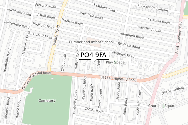
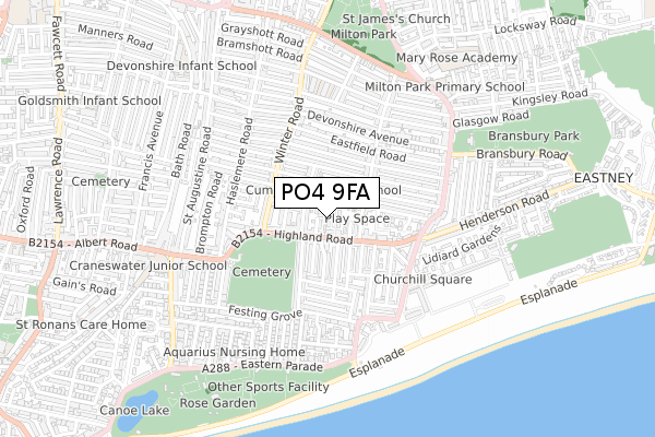
PO4 9FA is located in the Milton electoral ward, within the unitary authority of Portsmouth and the English Parliamentary constituency of Portsmouth South. The Sub Integrated Care Board (ICB) Location is NHS Hampshire and Isle of Wight ICB - 10R and the police force is Hampshire. This postcode has been in use since December 2019.


GetTheData
Source: OS Open Zoomstack (Ordnance Survey)
Licence: Open Government Licence (requires attribution)
Attribution: Contains OS data © Crown copyright and database right 2024
Source: Open Postcode Geo
Licence: Open Government Licence (requires attribution)
Attribution: Contains OS data © Crown copyright and database right 2024; Contains Royal Mail data © Royal Mail copyright and database right 2024; Source: Office for National Statistics licensed under the Open Government Licence v.3.0
| Easting | 466231 |
| Northing | 99057 |
| Latitude | 50.787299 |
| Longitude | -1.061790 |
GetTheData
Source: Open Postcode Geo
Licence: Open Government Licence
| Country | England |
| Postcode District | PO4 |
| ➜ PO4 open data dashboard ➜ See where PO4 is on a map ➜ Where is Portsmouth? | |
GetTheData
Source: Land Registry Price Paid Data
Licence: Open Government Licence
| Ward | Milton |
| Constituency | Portsmouth South |
GetTheData
Source: ONS Postcode Database
Licence: Open Government Licence
| December 2023 | Violence and sexual offences | On or near Pretoria Road | 456m |
| November 2023 | Violence and sexual offences | On or near Pretoria Road | 456m |
| November 2023 | Violence and sexual offences | On or near Pretoria Road | 456m |
| ➜ Get more crime data in our Crime section | |||
GetTheData
Source: data.police.uk
Licence: Open Government Licence
| Kimberley Road (Highland Road) | Eastney | 76m |
| Kimberley Road (Highland Road) | Eastney | 102m |
| Eastney Health Centre (Highland Road) | Eastney | 165m |
| Eastney Health Centre (Highland Road) | Eastney | 227m |
| Highland Road (Winter Road) | Eastney | 242m |
| Fratton Station | 1.3km |
| Portsmouth & Southsea Station | 2.4km |
| Southsea Hoverport | 2.7km |
GetTheData
Source: NaPTAN
Licence: Open Government Licence
| Percentage of properties with Next Generation Access | 100.0% |
| Percentage of properties with Superfast Broadband | 100.0% |
| Percentage of properties with Ultrafast Broadband | 0.0% |
| Percentage of properties with Full Fibre Broadband | 0.0% |
Superfast Broadband is between 30Mbps and 300Mbps
Ultrafast Broadband is > 300Mbps
| Percentage of properties unable to receive 2Mbps | 0.0% |
| Percentage of properties unable to receive 5Mbps | 0.0% |
| Percentage of properties unable to receive 10Mbps | 0.0% |
| Percentage of properties unable to receive 30Mbps | 0.0% |
GetTheData
Source: Ofcom
Licence: Ofcom Terms of Use (requires attribution)
GetTheData
Source: ONS Postcode Database
Licence: Open Government Licence


➜ Get more ratings from the Food Standards Agency
GetTheData
Source: Food Standards Agency
Licence: FSA terms & conditions
| Last Collection | |||
|---|---|---|---|
| Location | Mon-Fri | Sat | Distance |
| Hellyer Road | 16:30 | 12:00 | 119m |
| Eastney Health Centre | 16:45 | 12:00 | 160m |
| Landguard Road | 17:00 | 11:30 | 228m |
GetTheData
Source: Dracos
Licence: Creative Commons Attribution-ShareAlike
| Facility | Distance |
|---|---|
| The Tenth Hole Eastern Parade, Southsea Golf | 588m |
| Bransbury Park Bransbury Road, Southsea Grass Pitches, Outdoor Tennis Courts, Artificial Grass Pitch | 627m |
| St Helens Field Eastern Parade, Southsea Grass Pitches | 632m |
GetTheData
Source: Active Places
Licence: Open Government Licence
| School | Phase of Education | Distance |
|---|---|---|
| Cumberland Infant School Methuen Road, Southsea, PO4 9HJ | Primary | 148m |
| Wimborne Primary School Wimborne Road, Southsea, Portsmouth, PO4 8DE | Primary | 508m |
| Milton Park Primary School Eastney Road, Southsea, Portsmouth, PO4 8ET | Primary | 664m |
GetTheData
Source: Edubase
Licence: Open Government Licence
The below table lists the International Territorial Level (ITL) codes (formerly Nomenclature of Territorial Units for Statistics (NUTS) codes) and Local Administrative Units (LAU) codes for PO4 9FA:
| ITL 1 Code | Name |
|---|---|
| TLJ | South East (England) |
| ITL 2 Code | Name |
| TLJ3 | Hampshire and Isle of Wight |
| ITL 3 Code | Name |
| TLJ31 | Portsmouth |
| LAU 1 Code | Name |
| E06000044 | Portsmouth |
GetTheData
Source: ONS Postcode Directory
Licence: Open Government Licence
The below table lists the Census Output Area (OA), Lower Layer Super Output Area (LSOA), and Middle Layer Super Output Area (MSOA) for PO4 9FA:
| Code | Name | |
|---|---|---|
| OA | E00086344 | |
| LSOA | E01017097 | Portsmouth 021C |
| MSOA | E02003544 | Portsmouth 021 |
GetTheData
Source: ONS Postcode Directory
Licence: Open Government Licence
| PO4 9EZ | Highland Road | 37m |
| PO4 9RY | Pedam Close | 39m |
| PO4 9RZ | Blenheim Court | 59m |
| PO4 9HA | Highland Road | 60m |
| PO4 9HQ | Methuen Road | 77m |
| PO4 9DH | Hellyer Road | 86m |
| PO4 9NF | Highland Road | 103m |
| PO4 9HJ | Methuen Road | 106m |
| PO4 9NQ | Highland Road | 124m |
| PO4 9HN | Reginald Road | 137m |
GetTheData
Source: Open Postcode Geo; Land Registry Price Paid Data
Licence: Open Government Licence