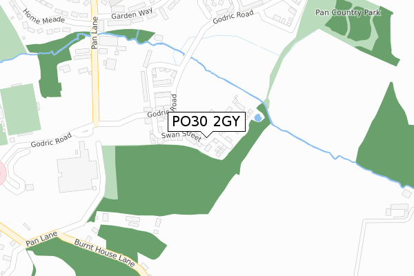
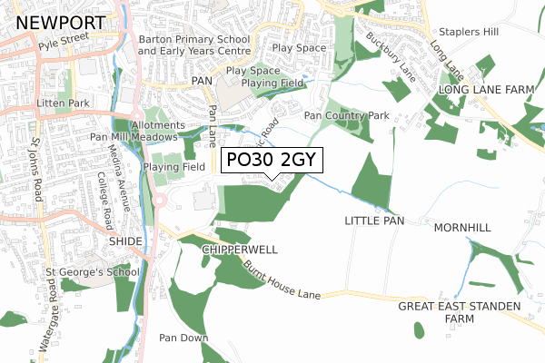
PO30 2GY is located in the Pan & Barton electoral ward, within the unitary authority of Isle of Wight and the English Parliamentary constituency of Isle of Wight. The Sub Integrated Care Board (ICB) Location is NHS Hampshire and Isle of Wight ICB - D9Y0V and the police force is Hampshire. This postcode has been in use since February 2020.


GetTheData
Source: OS Open Zoomstack (Ordnance Survey)
Licence: Open Government Licence (requires attribution)
Attribution: Contains OS data © Crown copyright and database right 2024
Source: Open Postcode Geo
Licence: Open Government Licence (requires attribution)
Attribution: Contains OS data © Crown copyright and database right 2024; Contains Royal Mail data © Royal Mail copyright and database right 2024; Source: Office for National Statistics licensed under the Open Government Licence v.3.0
| Easting | 450995 |
| Northing | 88441 |
| Latitude | 50.693378 |
| Longitude | -1.279380 |
GetTheData
Source: Open Postcode Geo
Licence: Open Government Licence
| Country | England |
| Postcode District | PO30 |
| ➜ PO30 open data dashboard ➜ See where PO30 is on a map ➜ Where is Newport? | |
GetTheData
Source: Land Registry Price Paid Data
Licence: Open Government Licence
| Ward | Pan & Barton |
| Constituency | Isle Of Wight |
GetTheData
Source: ONS Postcode Database
Licence: Open Government Licence
8, SQUIRREL CLOSE, NEWPORT, PO30 2GY 2020 28 FEB £310,000 |
10, SQUIRREL CLOSE, NEWPORT, PO30 2GY 2020 28 FEB £315,000 |
GetTheData
Source: HM Land Registry Price Paid Data
Licence: Contains HM Land Registry data © Crown copyright and database right 2024. This data is licensed under the Open Government Licence v3.0.
| June 2022 | Violence and sexual offences | On or near Sports/Recreation Area | 489m |
| June 2022 | Drugs | On or near Sports/Recreation Area | 489m |
| June 2022 | Violence and sexual offences | On or near Sports/Recreation Area | 489m |
| ➜ Get more crime data in our Crime section | |||
GetTheData
Source: data.police.uk
Licence: Open Government Licence
| St Georges Park (St.georges Way) | Newport | 595m |
| Downside Middle (Furrlongs) | Pan | 600m |
| Manor Crescent (Furrlongs) | Pan | 605m |
| St Georges Park (St.georges Way) | Newport | 607m |
| Pan Lane (Furrlongs) | Pan | 610m |
GetTheData
Source: NaPTAN
Licence: Open Government Licence
GetTheData
Source: ONS Postcode Database
Licence: Open Government Licence


➜ Get more ratings from the Food Standards Agency
GetTheData
Source: Food Standards Agency
Licence: FSA terms & conditions
| Last Collection | |||
|---|---|---|---|
| Location | Mon-Fri | Sat | Distance |
| Pan Post Office | 17:30 | 12:00 | 612m |
| Robinhood Street | 17:30 | 12:30 | 687m |
| Shide Post Office | 17:15 | 12:00 | 703m |
GetTheData
Source: Dracos
Licence: Creative Commons Attribution-ShareAlike
| Facility | Distance |
|---|---|
| Downside Recreation Ground Furrlongs, Newport Grass Pitches | 510m |
| St Georges Park (Closed) St. Georges Way, Newport Grass Pitches | 511m |
| Barton Primary School Furrlongs, Newport Grass Pitches | 560m |
GetTheData
Source: Active Places
Licence: Open Government Licence
| School | Phase of Education | Distance |
|---|---|---|
| Barton Primary School Furrlongs, Newport, PO30 2AX | Primary | 791m |
| Medina House School School Lane, Newport Isle of Wight, PO30 2HS | Not applicable | 934m |
| St George's School Watergate Rd, Newport, PO30 1XW | Not applicable | 939m |
GetTheData
Source: Edubase
Licence: Open Government Licence
The below table lists the International Territorial Level (ITL) codes (formerly Nomenclature of Territorial Units for Statistics (NUTS) codes) and Local Administrative Units (LAU) codes for PO30 2GY:
| ITL 1 Code | Name |
|---|---|
| TLJ | South East (England) |
| ITL 2 Code | Name |
| TLJ3 | Hampshire and Isle of Wight |
| ITL 3 Code | Name |
| TLJ34 | Isle of Wight |
| LAU 1 Code | Name |
| E06000046 | Isle of Wight |
GetTheData
Source: ONS Postcode Directory
Licence: Open Government Licence
The below table lists the Census Output Area (OA), Lower Layer Super Output Area (LSOA), and Middle Layer Super Output Area (MSOA) for PO30 2GY:
| Code | Name | |
|---|---|---|
| OA | E00087529 | |
| LSOA | E01017331 | Isle of Wight 008C |
| MSOA | E02003588 | Isle of Wight 008 |
GetTheData
Source: ONS Postcode Directory
Licence: Open Government Licence
| PO30 2FR | Godric Road | 355m |
| PO30 2PH | Pan Lane | 383m |
| PO30 2BN | Garden Way | 397m |
| PO30 2BW | Garden Way | 408m |
| PO30 2BP | Pan Lane | 419m |
| PO30 2FP | Godric Road | 499m |
| PO30 2AS | Pan Lane | 522m |
| PO30 2FH | Canning Court | 548m |
| PO30 2AT | Downs View Road | 559m |
| PO30 2PJ | Burnt House Lane | 566m |
GetTheData
Source: Open Postcode Geo; Land Registry Price Paid Data
Licence: Open Government Licence