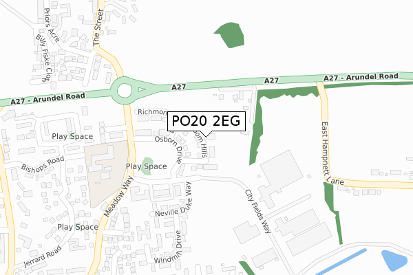
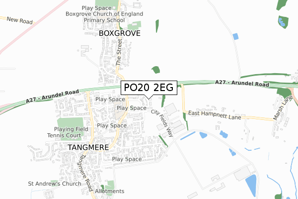
PO20 2EG is located in the North Mundham & Tangmere electoral ward, within the local authority district of Chichester and the English Parliamentary constituency of Chichester. The Sub Integrated Care Board (ICB) Location is NHS Sussex ICB - 70F and the police force is Sussex. This postcode has been in use since December 2017.


GetTheData
Source: OS Open Zoomstack (Ordnance Survey)
Licence: Open Government Licence (requires attribution)
Attribution: Contains OS data © Crown copyright and database right 2024
Source: Open Postcode Geo
Licence: Open Government Licence (requires attribution)
Attribution: Contains OS data © Crown copyright and database right 2024; Contains Royal Mail data © Royal Mail copyright and database right 2024; Source: Office for National Statistics licensed under the Open Government Licence v.3.0
| Easting | 490948 |
| Northing | 106875 |
| Latitude | 50.854241 |
| Longitude | -0.709291 |
GetTheData
Source: Open Postcode Geo
Licence: Open Government Licence
| Country | England |
| Postcode District | PO20 |
| ➜ PO20 open data dashboard ➜ See where PO20 is on a map ➜ Where is Tangmere? | |
GetTheData
Source: Land Registry Price Paid Data
Licence: Open Government Licence
| Ward | North Mundham & Tangmere |
| Constituency | Chichester |
GetTheData
Source: ONS Postcode Database
Licence: Open Government Licence
| June 2022 | Anti-social behaviour | On or near Hawker Close | 216m |
| June 2022 | Violence and sexual offences | On or near Hawker Close | 216m |
| June 2022 | Possession of weapons | On or near Windmill Drive | 295m |
| ➜ Get more crime data in our Crime section | |||
GetTheData
Source: data.police.uk
Licence: Open Government Licence
| Hawker Close (Meadow Way) | Tangmere | 190m |
| Oakwood Close (Meadow Way) | Tangmere | 375m |
| Priory Close (The Street) | Boxgrove | 376m |
| Boxgrove Turning (A27) | Tangmere | 433m |
| Priory Close (The Street) | Boxgrove | 442m |
| Barnham Station | 5.5km |
GetTheData
Source: NaPTAN
Licence: Open Government Licence
➜ Broadband speed and availability dashboard for PO20 2EG
| Percentage of properties with Next Generation Access | 100.0% |
| Percentage of properties with Superfast Broadband | 100.0% |
| Percentage of properties with Ultrafast Broadband | 0.0% |
| Percentage of properties with Full Fibre Broadband | 0.0% |
Superfast Broadband is between 30Mbps and 300Mbps
Ultrafast Broadband is > 300Mbps
| Median download speed | 55.0Mbps |
| Average download speed | 56.9Mbps |
| Maximum download speed | 80.00Mbps |
| Median upload speed | 10.0Mbps |
| Average upload speed | 13.7Mbps |
| Maximum upload speed | 19.98Mbps |
| Percentage of properties unable to receive 2Mbps | 0.0% |
| Percentage of properties unable to receive 5Mbps | 0.0% |
| Percentage of properties unable to receive 10Mbps | 0.0% |
| Percentage of properties unable to receive 30Mbps | 0.0% |
➜ Broadband speed and availability dashboard for PO20 2EG
GetTheData
Source: Ofcom
Licence: Ofcom Terms of Use (requires attribution)
GetTheData
Source: ONS Postcode Database
Licence: Open Government Licence


➜ Get more ratings from the Food Standards Agency
GetTheData
Source: Food Standards Agency
Licence: FSA terms & conditions
| Last Collection | |||
|---|---|---|---|
| Location | Mon-Fri | Sat | Distance |
| Boxgrove Post Office | 17:00 | 11:00 | 548m |
| Easthampnett Lane | 16:50 | 07:30 | 621m |
| Chestnut Walk Tangmere | 16:00 | 08:00 | 801m |
GetTheData
Source: Dracos
Licence: Creative Commons Attribution-ShareAlike
| Facility | Distance |
|---|---|
| Tangmere Primary Academy Bishop Road, Tangmere, Chichester Swimming Pool | 273m |
| Tangmere Village Centre Recreation Ground (Tangmere Cricket Club) Malcolm Road, Tangmere Grass Pitches, Outdoor Tennis Courts | 683m |
| Boxgrove Village Hall And Community Centre The Street, Boxgrove, Chichester Sports Hall, Grass Pitches | 816m |
GetTheData
Source: Active Places
Licence: Open Government Licence
| School | Phase of Education | Distance |
|---|---|---|
| Tangmere Primary Academy Bishops Road, Tangmere, Chichester, PO20 2JB | Primary | 253m |
| Boxgrove CofE Primary School The Street, Boxgrove, Chichester, PO18 0EE | Primary | 741m |
| Westbourne House School Coach Road, Shopwyke, Chichester, PO20 2BH | Not applicable | 2.6km |
GetTheData
Source: Edubase
Licence: Open Government Licence
The below table lists the International Territorial Level (ITL) codes (formerly Nomenclature of Territorial Units for Statistics (NUTS) codes) and Local Administrative Units (LAU) codes for PO20 2EG:
| ITL 1 Code | Name |
|---|---|
| TLJ | South East (England) |
| ITL 2 Code | Name |
| TLJ2 | Surrey, East and West Sussex |
| ITL 3 Code | Name |
| TLJ27 | West Sussex (South West) |
| LAU 1 Code | Name |
| E07000225 | Chichester |
GetTheData
Source: ONS Postcode Directory
Licence: Open Government Licence
The below table lists the Census Output Area (OA), Lower Layer Super Output Area (LSOA), and Middle Layer Super Output Area (MSOA) for PO20 2EG:
| Code | Name | |
|---|---|---|
| OA | E00160842 | |
| LSOA | E01031539 | Chichester 012F |
| MSOA | E02006572 | Chichester 012 |
GetTheData
Source: ONS Postcode Directory
Licence: Open Government Licence
| PO18 0JZ | Arundel Road | 106m |
| PO20 2AU | Neville Duke Way | 187m |
| PO20 2AN | The Boulevard | 228m |
| PO20 2JE | Hawker Close | 231m |
| PO20 2AS | Neville Duke Way | 237m |
| PO20 2AQ | The Boulevard | 251m |
| PO20 2AL | Wellington Place | 278m |
| PO20 2AP | Windmill Drive | 303m |
| PO20 2WR | Meadowside Walk | 306m |
| PO20 2WD | Oakwood Close | 319m |
GetTheData
Source: Open Postcode Geo; Land Registry Price Paid Data
Licence: Open Government Licence