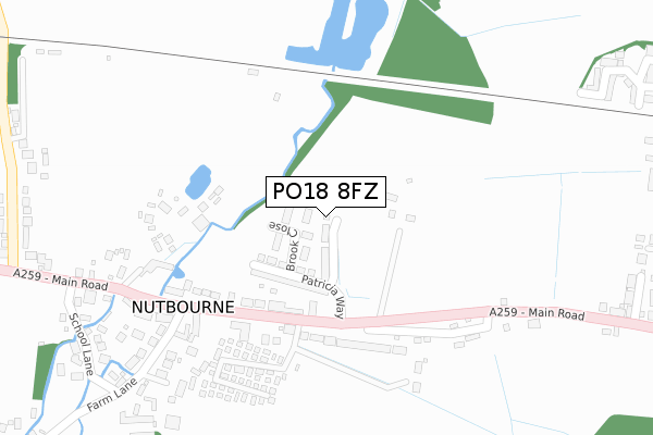
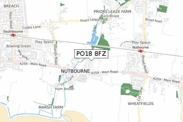
PO18 8FZ is located in the Southbourne electoral ward, within the local authority district of Chichester and the English Parliamentary constituency of Chichester. The Sub Integrated Care Board (ICB) Location is NHS Sussex ICB - 70F and the police force is Sussex. This postcode has been in use since April 2020.


GetTheData
Source: OS Open Zoomstack (Ordnance Survey)
Licence: Open Government Licence (requires attribution)
Attribution: Contains OS data © Crown copyright and database right 2024
Source: Open Postcode Geo
Licence: Open Government Licence (requires attribution)
Attribution: Contains OS data © Crown copyright and database right 2024; Contains Royal Mail data © Royal Mail copyright and database right 2024; Source: Office for National Statistics licensed under the Open Government Licence v.3.0
| Easting | 478044 |
| Northing | 105582 |
| Latitude | 50.844498 |
| Longitude | -0.892852 |
GetTheData
Source: Open Postcode Geo
Licence: Open Government Licence
| Country | England |
| Postcode District | PO18 |
| ➜ PO18 open data dashboard ➜ See where PO18 is on a map ➜ Where is Nutbourne? | |
GetTheData
Source: Land Registry Price Paid Data
Licence: Open Government Licence
| Ward | Southbourne |
| Constituency | Chichester |
GetTheData
Source: ONS Postcode Database
Licence: Open Government Licence
2022 6 MAY £535,000 |
1, JEPPSON WALK, NUTBOURNE, CHICHESTER, PO18 8FZ 2022 14 JAN £515,000 |
3, JEPPSON WALK, NUTBOURNE, CHICHESTER, PO18 8FZ 2021 16 SEP £530,000 |
2021 18 MAR £508,000 |
5, JEPPSON WALK, NUTBOURNE, CHICHESTER, PO18 8FZ 2020 4 DEC £411,375 |
7, JEPPSON WALK, NUTBOURNE, CHICHESTER, PO18 8FZ 2020 3 DEC £429,500 |
6, JEPPSON WALK, NUTBOURNE, CHICHESTER, PO18 8FZ 2020 29 JUN £520,000 |
8, JEPPSON WALK, NUTBOURNE, CHICHESTER, PO18 8FZ 2020 14 APR £429,500 |
GetTheData
Source: HM Land Registry Price Paid Data
Licence: Contains HM Land Registry data © Crown copyright and database right 2024. This data is licensed under the Open Government Licence v3.0.
| June 2022 | Violence and sexual offences | On or near Petrol Station | 184m |
| June 2022 | Burglary | On or near Petrol Station | 184m |
| May 2022 | Burglary | On or near Farm Lane | 440m |
| ➜ Get more crime data in our Crime section | |||
GetTheData
Source: data.police.uk
Licence: Open Government Licence
| Hamcroft | Nutbourne | 123m |
| Hamcroft (Main Road) | Nutbourne | 128m |
| Farm Lane (Main Road) | Nutbourne | 210m |
| Farm Lane (Main Road) | Nutbourne | 279m |
| Pottery Lane (Main Road) | Nutbourne | 437m |
| Nutbourne Station | 0.7km |
| Southbourne Station | 1.2km |
| Bosham Station | 3.2km |
GetTheData
Source: NaPTAN
Licence: Open Government Licence
GetTheData
Source: ONS Postcode Database
Licence: Open Government Licence


➜ Get more ratings from the Food Standards Agency
GetTheData
Source: Food Standards Agency
Licence: FSA terms & conditions
| Last Collection | |||
|---|---|---|---|
| Location | Mon-Fri | Sat | Distance |
| Nutbourne Post Office | 16:00 | 11:00 | 125m |
| Inlands Lane | 16:00 | 08:00 | 457m |
| Barleycorn Pub | 16:00 | 07:15 | 776m |
GetTheData
Source: Dracos
Licence: Creative Commons Attribution-ShareAlike
| Facility | Distance |
|---|---|
| Southbourne Junior School New Road, Southbourne, Emsworth Grass Pitches | 926m |
| Chidham Parochial Primary School Chidham Lane, Chidham, Chichester Sports Hall, Grass Pitches | 1.4km |
| Bourne Community College Park Road, Emsworth Grass Pitches, Sports Hall, Artificial Grass Pitch, Outdoor Tennis Courts | 1.6km |
GetTheData
Source: Active Places
Licence: Open Government Licence
| School | Phase of Education | Distance |
|---|---|---|
| Southbourne Infant School New Road, Southbourne, Emsworth, PO10 8JX | Primary | 926m |
| Southbourne Junior School New Road, Southbourne, Emsworth, PO10 8JX | Primary | 926m |
| Chidham Parochial Primary School Chidham Lane, Chidham, Chichester, PO18 8TH | Primary | 1.4km |
GetTheData
Source: Edubase
Licence: Open Government Licence
The below table lists the International Territorial Level (ITL) codes (formerly Nomenclature of Territorial Units for Statistics (NUTS) codes) and Local Administrative Units (LAU) codes for PO18 8FZ:
| ITL 1 Code | Name |
|---|---|
| TLJ | South East (England) |
| ITL 2 Code | Name |
| TLJ2 | Surrey, East and West Sussex |
| ITL 3 Code | Name |
| TLJ27 | West Sussex (South West) |
| LAU 1 Code | Name |
| E07000225 | Chichester |
GetTheData
Source: ONS Postcode Directory
Licence: Open Government Licence
The below table lists the Census Output Area (OA), Lower Layer Super Output Area (LSOA), and Middle Layer Super Output Area (MSOA) for PO18 8FZ:
| Code | Name | |
|---|---|---|
| OA | E00160826 | |
| LSOA | E01031535 | Chichester 009E |
| MSOA | E02006569 | Chichester 009 |
GetTheData
Source: ONS Postcode Directory
Licence: Open Government Licence
| PO18 8SG | Phoebe Mews | 92m |
| PO18 8TX | Nutbourne Park | 154m |
| PO18 8RT | Main Road | 192m |
| PO18 8SD | Farm Lane | 227m |
| PO18 8RU | Nutbourne Park | 227m |
| PO18 8RL | Main Road | 271m |
| PO18 8SB | Farm Lane | 282m |
| PO18 8RN | Main Road | 284m |
| PO18 8SE | Bell Court | 296m |
| PO18 8SF | Anchor Court | 315m |
GetTheData
Source: Open Postcode Geo; Land Registry Price Paid Data
Licence: Open Government Licence