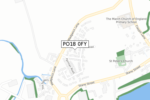
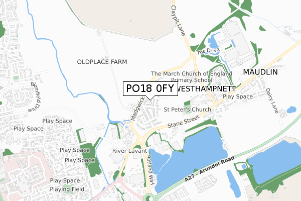
PO18 0FY is located in the Goodwood electoral ward, within the local authority district of Chichester and the English Parliamentary constituency of Chichester. The Sub Integrated Care Board (ICB) Location is NHS Sussex ICB - 70F and the police force is Sussex. This postcode has been in use since October 2019.


GetTheData
Source: OS Open Zoomstack (Ordnance Survey)
Licence: Open Government Licence (requires attribution)
Attribution: Contains OS data © Crown copyright and database right 2024
Source: Open Postcode Geo
Licence: Open Government Licence (requires attribution)
Attribution: Contains OS data © Crown copyright and database right 2024; Contains Royal Mail data © Royal Mail copyright and database right 2024; Source: Office for National Statistics licensed under the Open Government Licence v.3.0
| Easting | 487772 |
| Northing | 106269 |
| Latitude | 50.849283 |
| Longitude | -0.754546 |
GetTheData
Source: Open Postcode Geo
Licence: Open Government Licence
| Country | England |
| Postcode District | PO18 |
| ➜ PO18 open data dashboard ➜ See where PO18 is on a map ➜ Where is Westhampnett? | |
GetTheData
Source: Land Registry Price Paid Data
Licence: Open Government Licence
| Ward | Goodwood |
| Constituency | Chichester |
GetTheData
Source: ONS Postcode Database
Licence: Open Government Licence
| June 2022 | Vehicle crime | On or near Madgwick Lane | 100m |
| June 2022 | Violence and sexual offences | On or near Old Place Lane | 195m |
| June 2022 | Anti-social behaviour | On or near The Sadlers | 326m |
| ➜ Get more crime data in our Crime section | |||
GetTheData
Source: data.police.uk
Licence: Open Government Licence
| Jarvis Hotel (Westhampnett Road) | Chichester | 376m |
| Jarvis Hotel (Westhampnett Road) | Chichester | 440m |
| School (Claypit Lane) | Westhampnett | 440m |
| Homebase (Barnfield Drive) | Chichester | 474m |
| Homebase (Barnfield Drive) | Chichester | 488m |
| Chichester Station | 2.7km |
| Fishbourne Station | 4.4km |
GetTheData
Source: NaPTAN
Licence: Open Government Licence
GetTheData
Source: ONS Postcode Database
Licence: Open Government Licence


➜ Get more ratings from the Food Standards Agency
GetTheData
Source: Food Standards Agency
Licence: FSA terms & conditions
| Last Collection | |||
|---|---|---|---|
| Location | Mon-Fri | Sat | Distance |
| Westhampnett Village | 16:30 | 08:00 | 539m |
| Swanfield Drive | 16:00 | 12:15 | 997m |
| St Richards Hospital | 17:30 | 12:20 | 1,144m |
GetTheData
Source: Dracos
Licence: Creative Commons Attribution-ShareAlike
| Facility | Distance |
|---|---|
| Chichester Park Hotel Leisure Club Madgwick Lane, Westhampnett, Chichester Health and Fitness Gym, Swimming Pool | 376m |
| The March C Of E Primary School Claypit Lane, Westhampnett, Chichester Sports Hall, Grass Pitches | 420m |
| The Gym Group (Chichester) Portfield Way, Portfield Way, Chichester Health and Fitness Gym | 752m |
GetTheData
Source: Active Places
Licence: Open Government Licence
| School | Phase of Education | Distance |
|---|---|---|
| The March CofE Primary School Claypit Lane, Westhampnett, Chichester, PO18 0NU | Primary | 421m |
| Portfield Primary Academy St James Road, Chichester, West Sussex, PO19 7HA | Primary | 1.3km |
| Westbourne House School Coach Road, Shopwyke, Chichester, PO20 2BH | Not applicable | 1.4km |
GetTheData
Source: Edubase
Licence: Open Government Licence
The below table lists the International Territorial Level (ITL) codes (formerly Nomenclature of Territorial Units for Statistics (NUTS) codes) and Local Administrative Units (LAU) codes for PO18 0FY:
| ITL 1 Code | Name |
|---|---|
| TLJ | South East (England) |
| ITL 2 Code | Name |
| TLJ2 | Surrey, East and West Sussex |
| ITL 3 Code | Name |
| TLJ27 | West Sussex (South West) |
| LAU 1 Code | Name |
| E07000225 | Chichester |
GetTheData
Source: ONS Postcode Directory
Licence: Open Government Licence
The below table lists the Census Output Area (OA), Lower Layer Super Output Area (LSOA), and Middle Layer Super Output Area (MSOA) for PO18 0FY:
| Code | Name | |
|---|---|---|
| OA | E00166607 | |
| LSOA | E01031509 | Chichester 006D |
| MSOA | E02006566 | Chichester 006 |
GetTheData
Source: ONS Postcode Directory
Licence: Open Government Licence
| PO18 0NL | Old Place Lane | 155m |
| PO18 0NR | Madgwick Lane | 214m |
| PO18 0PR | The Sadlers | 306m |
| PO19 7RT | Rutland Way | 353m |
| PO18 0NU | Claypit Lane | 465m |
| PO18 0NT | Stane Street | 475m |
| PO18 0NX | Coach Road | 540m |
| PO18 0SN | Potters Green | 580m |
| PO18 0SG | Kiln Walk | 589m |
| PO18 0PA | Stane Street | 595m |
GetTheData
Source: Open Postcode Geo; Land Registry Price Paid Data
Licence: Open Government Licence