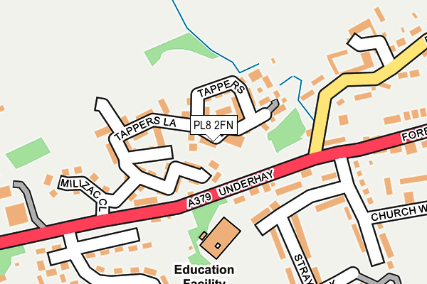
PL8 2FN is located in the Newton & Yealmpton electoral ward, within the local authority district of South Hams and the English Parliamentary constituency of South West Devon. The Sub Integrated Care Board (ICB) Location is NHS Devon ICB - 15N and the police force is Devon & Cornwall. This postcode has been in use since June 2017.


GetTheData
Source: OS OpenMap – Local (Ordnance Survey)
Source: OS VectorMap District (Ordnance Survey)
Licence: Open Government Licence (requires attribution)
| Easting | 257394 |
| Northing | 51720 |
| Latitude | 50.348067 |
| Longitude | -4.005744 |
GetTheData
Source: Open Postcode Geo
Licence: Open Government Licence
| Country | England |
| Postcode District | PL8 |
| ➜ PL8 open data dashboard ➜ See where PL8 is on a map | |
GetTheData
Source: Land Registry Price Paid Data
Licence: Open Government Licence
| Ward | Newton & Yealmpton |
| Constituency | South West Devon |
GetTheData
Source: ONS Postcode Database
Licence: Open Government Licence
| May 2022 | Violence and sexual offences | On or near Milizac Close | 183m |
| April 2022 | Anti-social behaviour | On or near Church Way | 286m |
| March 2022 | Other theft | On or near Chapel Lane | 437m |
| ➜ Get more crime data in our Crime section | |||
GetTheData
Source: data.police.uk
Licence: Open Government Licence
| Stray Park (Underhay) | Yealmpton | 127m |
| Stray Park (Underhay) | Yealmpton | 130m |
| Yealm Park (Underhay) | Yealmpton | 259m |
| Yealm Park (Underhay) | Yealmpton | 285m |
| Volunteer Inn (Fore Street) | Yealmpton | 456m |
GetTheData
Source: NaPTAN
Licence: Open Government Licence
GetTheData
Source: ONS Postcode Database
Licence: Open Government Licence


➜ Get more ratings from the Food Standards Agency
GetTheData
Source: Food Standards Agency
Licence: FSA terms & conditions
| Last Collection | |||
|---|---|---|---|
| Location | Mon-Fri | Sat | Distance |
| Yealmpton Post Office | 16:45 | 10:40 | 583m |
| Brixton Post Office | 17:00 | 10:45 | 2,062m |
| Elburton Post Office | 17:00 | 12:00 | 4,425m |
GetTheData
Source: Dracos
Licence: Creative Commons Attribution-ShareAlike
| Facility | Distance |
|---|---|
| Yealmpton Recreation Ground Yealmpton, Plymouth Grass Pitches | 388m |
| Brixton St Marys Church Of England Primary School Elliotts Hill, Brixton, Plymouth Sports Hall, Swimming Pool, Grass Pitches | 2.2km |
| Cofflete Park Brixton, Plymouth Grass Pitches | 2.7km |
GetTheData
Source: Active Places
Licence: Open Government Licence
| School | Phase of Education | Distance |
|---|---|---|
| Yealmpton Primary School Stray Park, Yealmpton, Plymouth, PL8 2HF | Primary | 128m |
| St Mary's Church of England Primary School Elliott's Hill, Brixton, Plymouth, PL8 2AG | Primary | 2.2km |
| Newton Ferrers Church of England Primary School Newton Ferrers, Dillons the Green, Newton Ferrers Plymouth, PL8 1AS | Primary | 4km |
GetTheData
Source: Edubase
Licence: Open Government Licence
The below table lists the International Territorial Level (ITL) codes (formerly Nomenclature of Territorial Units for Statistics (NUTS) codes) and Local Administrative Units (LAU) codes for PL8 2FN:
| ITL 1 Code | Name |
|---|---|
| TLK | South West (England) |
| ITL 2 Code | Name |
| TLK4 | Devon |
| ITL 3 Code | Name |
| TLK43 | Devon CC |
| LAU 1 Code | Name |
| E07000044 | South Hams |
GetTheData
Source: ONS Postcode Directory
Licence: Open Government Licence
The below table lists the Census Output Area (OA), Lower Layer Super Output Area (LSOA), and Middle Layer Super Output Area (MSOA) for PL8 2FN:
| Code | Name | |
|---|---|---|
| OA | E00102273 | |
| LSOA | E01020190 | South Hams 008D |
| MSOA | E02004196 | South Hams 008 |
GetTheData
Source: ONS Postcode Directory
Licence: Open Government Licence
| PL8 2FH | Bumble Walk | 0m |
| PL8 2PJ | Gardeners Lane | 69m |
| PL8 2JS | 70m | |
| PL8 2PL | Tappers Lane | 75m |
| PL8 2PN | Peasberry Place | 76m |
| PL8 2JU | Speculation | 88m |
| PL8 2JT | Underhay | 90m |
| PL8 2FF | Brook Mead | 97m |
| PL8 2PG | Kitley Walk | 126m |
| PL8 2JR | Underhay | 182m |
GetTheData
Source: Open Postcode Geo; Land Registry Price Paid Data
Licence: Open Government Licence