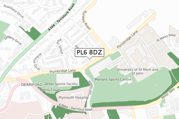
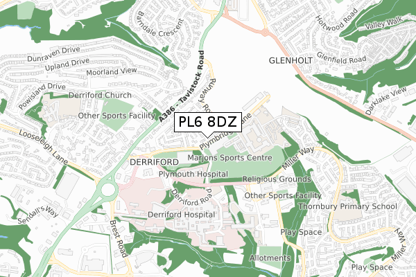
PL6 8DZ is located in the Moor View electoral ward, within the unitary authority of Plymouth and the English Parliamentary constituency of Plymouth, Moor View. The Sub Integrated Care Board (ICB) Location is NHS Devon ICB - 15N and the police force is Devon & Cornwall. This postcode has been in use since May 2017.


GetTheData
Source: OS Open Zoomstack (Ordnance Survey)
Licence: Open Government Licence (requires attribution)
Attribution: Contains OS data © Crown copyright and database right 2024
Source: Open Postcode Geo
Licence: Open Government Licence (requires attribution)
Attribution: Contains OS data © Crown copyright and database right 2024; Contains Royal Mail data © Royal Mail copyright and database right 2024; Source: Office for National Statistics licensed under the Open Government Licence v.3.0
| Easting | 249941 |
| Northing | 59980 |
| Latitude | 50.420448 |
| Longitude | -4.113724 |
GetTheData
Source: Open Postcode Geo
Licence: Open Government Licence
| Country | England |
| Postcode District | PL6 |
| ➜ PL6 open data dashboard ➜ See where PL6 is on a map ➜ Where is Plymouth? | |
GetTheData
Source: Land Registry Price Paid Data
Licence: Open Government Licence
| Ward | Moor View |
| Constituency | Plymouth, Moor View |
GetTheData
Source: ONS Postcode Database
Licence: Open Government Licence
5, CANBERRA ROAD, PLYMOUTH, PL6 8DZ 2017 15 DEC £345,000 |
9, CANBERRA ROAD, PLYMOUTH, PL6 8DZ 2017 24 NOV £325,000 |
15, CANBERRA ROAD, PLYMOUTH, PL6 8DZ 2017 24 NOV £365,000 |
11, CANBERRA ROAD, PLYMOUTH, PL6 8DZ 2017 10 NOV £325,000 |
6, CANBERRA ROAD, PLYMOUTH, PL6 8DZ 2017 30 OCT £331,000 |
7, CANBERRA ROAD, PLYMOUTH, PL6 8DZ 2017 27 OCT £325,000 |
4, CANBERRA ROAD, PLYMOUTH, PL6 8DZ 2017 26 MAY £349,995 |
GetTheData
Source: HM Land Registry Price Paid Data
Licence: Contains HM Land Registry data © Crown copyright and database right 2024. This data is licensed under the Open Government Licence v3.0.
| June 2022 | Other theft | On or near Derriford Road | 300m |
| June 2022 | Drugs | On or near Derriford Road | 300m |
| June 2022 | Other crime | On or near Derriford Road | 300m |
| ➜ Get more crime data in our Crime section | |||
GetTheData
Source: data.police.uk
Licence: Open Government Licence
| Marjons | Derriford | 108m |
| Marjons | Derriford | 113m |
| Runway Road | Derriford | 115m |
| Runway Road | Derriford | 169m |
| Marjon (Plymbridge Lane) | Derriford | 184m |
| Plymouth Station | 5.2km |
| Keyham Station | 5.8km |
| Bere Ferrers Station | 5.9km |
GetTheData
Source: NaPTAN
Licence: Open Government Licence
➜ Broadband speed and availability dashboard for PL6 8DZ
| Percentage of properties with Next Generation Access | 100.0% |
| Percentage of properties with Superfast Broadband | 100.0% |
| Percentage of properties with Ultrafast Broadband | 0.0% |
| Percentage of properties with Full Fibre Broadband | 0.0% |
Superfast Broadband is between 30Mbps and 300Mbps
Ultrafast Broadband is > 300Mbps
| Median download speed | 61.9Mbps |
| Average download speed | 53.3Mbps |
| Maximum download speed | 71.07Mbps |
| Median upload speed | 10.0Mbps |
| Average upload speed | 9.6Mbps |
| Maximum upload speed | 14.09Mbps |
| Percentage of properties unable to receive 2Mbps | 0.0% |
| Percentage of properties unable to receive 5Mbps | 0.0% |
| Percentage of properties unable to receive 10Mbps | 0.0% |
| Percentage of properties unable to receive 30Mbps | 0.0% |
➜ Broadband speed and availability dashboard for PL6 8DZ
GetTheData
Source: Ofcom
Licence: Ofcom Terms of Use (requires attribution)
GetTheData
Source: ONS Postcode Database
Licence: Open Government Licence


➜ Get more ratings from the Food Standards Agency
GetTheData
Source: Food Standards Agency
Licence: FSA terms & conditions
| Last Collection | |||
|---|---|---|---|
| Location | Mon-Fri | Sat | Distance |
| Penrith Gardens | 17:15 | 12:30 | 571m |
| Clittaford Road | 17:15 | 12:00 | 802m |
| Glenholt Post Office | 17:15 | 12:00 | 837m |
GetTheData
Source: Dracos
Licence: Creative Commons Attribution-ShareAlike
| Facility | Distance |
|---|---|
| Nuffield Health (The Devonshire) Plymbridge Lane, Derriford, Plymouth Swimming Pool, Health and Fitness Gym, Indoor Tennis Centre, Sports Hall, Studio, Squash Courts, Outdoor Tennis Courts | 175m |
| Marjon Sport Centre Derriford Road, Derriford, Plymouth Sports Hall, Swimming Pool, Health and Fitness Gym, Artificial Grass Pitch, Grass Pitches, Squash Courts, Studio, Outdoor Tennis Courts | 214m |
| Plymouth College (Delgany Sports Ground) Delgany View, Derriford, Plymouth Grass Pitches | 577m |
GetTheData
Source: Active Places
Licence: Open Government Licence
| School | Phase of Education | Distance |
|---|---|---|
| College of St Mark & St John Derriford Road, Plymouth, PL6 8BH | Not applicable | 253m |
| Thornbury Primary School Miller Way, Estover, Plymouth, PL6 8UL | Primary | 904m |
| Notre Dame RC School Looseleigh Lane, Derriford, Plymouth, PL6 5HN | Secondary | 975m |
GetTheData
Source: Edubase
Licence: Open Government Licence
The below table lists the International Territorial Level (ITL) codes (formerly Nomenclature of Territorial Units for Statistics (NUTS) codes) and Local Administrative Units (LAU) codes for PL6 8DZ:
| ITL 1 Code | Name |
|---|---|
| TLK | South West (England) |
| ITL 2 Code | Name |
| TLK4 | Devon |
| ITL 3 Code | Name |
| TLK41 | Plymouth |
| LAU 1 Code | Name |
| E06000026 | Plymouth |
GetTheData
Source: ONS Postcode Directory
Licence: Open Government Licence
The below table lists the Census Output Area (OA), Lower Layer Super Output Area (LSOA), and Middle Layer Super Output Area (MSOA) for PL6 8DZ:
| Code | Name | |
|---|---|---|
| OA | E00172072 | |
| LSOA | E01015092 | Plymouth 005C |
| MSOA | E02003126 | Plymouth 005 |
GetTheData
Source: ONS Postcode Directory
Licence: Open Government Licence
| PL6 8DW | Hangar Lane | 90m |
| PL6 8DT | Runway Road | 115m |
| PL6 8DD | Plymbridge Lane | 125m |
| PL6 8DS | Piper Street | 132m |
| PL6 8DU | Radar Road | 132m |
| PL6 8DL | Piper Street | 159m |
| PL6 8DN | Piper Street | 173m |
| PL6 8DJ | Piper Street | 177m |
| PL6 8ED | Jetstream Way | 199m |
| PL6 8DF | Brymon Way | 204m |
GetTheData
Source: Open Postcode Geo; Land Registry Price Paid Data
Licence: Open Government Licence