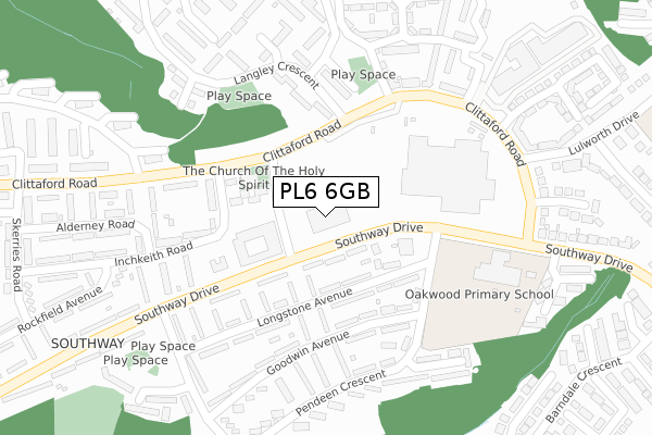
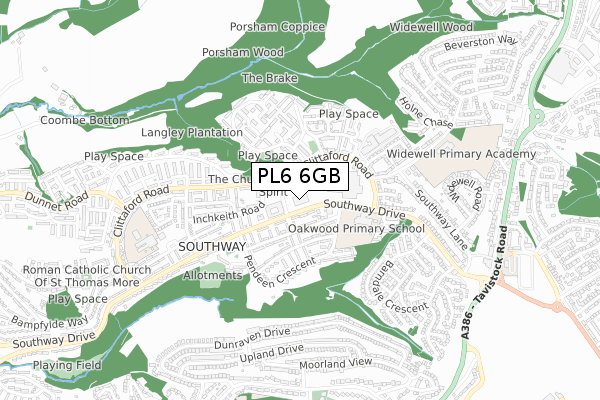
PL6 6GB is located in the Southway electoral ward, within the unitary authority of Plymouth and the English Parliamentary constituency of Plymouth, Moor View. The Sub Integrated Care Board (ICB) Location is NHS Devon ICB - 15N and the police force is Devon & Cornwall. This postcode has been in use since October 2017.


GetTheData
Source: OS Open Zoomstack (Ordnance Survey)
Licence: Open Government Licence (requires attribution)
Attribution: Contains OS data © Crown copyright and database right 2024
Source: Open Postcode Geo
Licence: Open Government Licence (requires attribution)
Attribution: Contains OS data © Crown copyright and database right 2024; Contains Royal Mail data © Royal Mail copyright and database right 2024; Source: Office for National Statistics licensed under the Open Government Licence v.3.0
| Easting | 249212 |
| Northing | 61065 |
| Latitude | 50.430013 |
| Longitude | -4.124415 |
GetTheData
Source: Open Postcode Geo
Licence: Open Government Licence
| Country | England |
| Postcode District | PL6 |
| ➜ PL6 open data dashboard ➜ See where PL6 is on a map ➜ Where is Plymouth? | |
GetTheData
Source: Land Registry Price Paid Data
Licence: Open Government Licence
| Ward | Southway |
| Constituency | Plymouth, Moor View |
GetTheData
Source: ONS Postcode Database
Licence: Open Government Licence
| June 2022 | Violence and sexual offences | On or near Longstone Avenue | 139m |
| June 2022 | Anti-social behaviour | On or near Goodwin Avenue | 203m |
| June 2022 | Violence and sexual offences | On or near Clittaford Road | 254m |
| ➜ Get more crime data in our Crime section | |||
GetTheData
Source: data.police.uk
Licence: Open Government Licence
| Flamborough Road | Southway | 66m |
| Flamborough Road | Southway | 75m |
| Flamborough Road (Clittaford Road) | Southway | 116m |
| Langley Crescent | Southway | 136m |
| Southway Shops (Southway Drive) | Southway | 156m |
| Bere Ferrers Station | 4.7km |
| St Budeaux Victoria Road Station | 5.5km |
| St Budeaux Ferry Road Station | 5.5km |
GetTheData
Source: NaPTAN
Licence: Open Government Licence
GetTheData
Source: ONS Postcode Database
Licence: Open Government Licence


➜ Get more ratings from the Food Standards Agency
GetTheData
Source: Food Standards Agency
Licence: FSA terms & conditions
| Last Collection | |||
|---|---|---|---|
| Location | Mon-Fri | Sat | Distance |
| Beverston Way | 17:30 | 12:30 | 1,039m |
| Clittaford Road | 17:15 | 12:00 | 1,086m |
| Tesco (Roborough) | 17:30 | 12:30 | 1,286m |
GetTheData
Source: Dracos
Licence: Creative Commons Attribution-ShareAlike
| Facility | Distance |
|---|---|
| Langley Junior (Closed) Pendeen Crescent, Plymouth Grass Pitches | 233m |
| Widewell Primary Academy Lulworth Drive, Plymouth Grass Pitches, Sports Hall, Artificial Grass Pitch | 637m |
| Belliver Way - Factory Pitches Belliver Way, Roborough, Plymouth Grass Pitches | 918m |
GetTheData
Source: Active Places
Licence: Open Government Licence
| School | Phase of Education | Distance |
|---|---|---|
| Oakwood Primary Academy Pendeen Crescent, Southway, Plymouth, PL6 6QS | Primary | 233m |
| Beechwood Primary Academy 31 Rockfield Avenue, Southway, Plymouth, PL6 6DX | Primary | 614m |
| Widewell Primary Academy Lulworth Drive, Roborough, Plymouth, PL6 7ER | Primary | 675m |
GetTheData
Source: Edubase
Licence: Open Government Licence
The below table lists the International Territorial Level (ITL) codes (formerly Nomenclature of Territorial Units for Statistics (NUTS) codes) and Local Administrative Units (LAU) codes for PL6 6GB:
| ITL 1 Code | Name |
|---|---|
| TLK | South West (England) |
| ITL 2 Code | Name |
| TLK4 | Devon |
| ITL 3 Code | Name |
| TLK41 | Plymouth |
| LAU 1 Code | Name |
| E06000026 | Plymouth |
GetTheData
Source: ONS Postcode Directory
Licence: Open Government Licence
The below table lists the Census Output Area (OA), Lower Layer Super Output Area (LSOA), and Middle Layer Super Output Area (MSOA) for PL6 6GB:
| Code | Name | |
|---|---|---|
| OA | E00076597 | |
| LSOA | E01015159 | Plymouth 002B |
| MSOA | E02003123 | Plymouth 002 |
GetTheData
Source: ONS Postcode Directory
Licence: Open Government Licence
| PL6 6QW | Southway Drive | 67m |
| PL6 6RA | Longstone Avenue | 107m |
| PL6 6RN | Flamborough Way | 109m |
| PL6 6QL | Southway Drive | 145m |
| PL6 6QY | Longstone Avenue | 157m |
| PL6 6RW | Flamborough Way | 173m |
| PL6 6EJ | Inchkeith Road | 179m |
| PL6 6QZ | Longstone Avenue | 180m |
| PL6 6RL | Goodwin Avenue | 192m |
| PL6 6HG | Hartland Close | 203m |
GetTheData
Source: Open Postcode Geo; Land Registry Price Paid Data
Licence: Open Government Licence