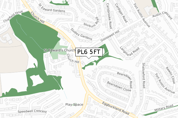
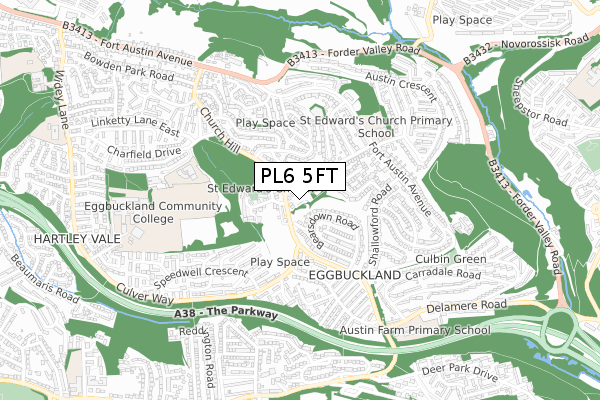
PL6 5FT is located in the Eggbuckland electoral ward, within the unitary authority of Plymouth and the English Parliamentary constituency of Plymouth, Moor View. The Sub Integrated Care Board (ICB) Location is NHS Devon ICB - 15N and the police force is Devon & Cornwall. This postcode has been in use since August 2019.


GetTheData
Source: OS Open Zoomstack (Ordnance Survey)
Licence: Open Government Licence (requires attribution)
Attribution: Contains OS data © Crown copyright and database right 2024
Source: Open Postcode Geo
Licence: Open Government Licence (requires attribution)
Attribution: Contains OS data © Crown copyright and database right 2024; Contains Royal Mail data © Royal Mail copyright and database right 2024; Source: Office for National Statistics licensed under the Open Government Licence v.3.0
| Easting | 249938 |
| Northing | 57743 |
| Latitude | 50.400343 |
| Longitude | -4.112872 |
GetTheData
Source: Open Postcode Geo
Licence: Open Government Licence
| Country | England |
| Postcode District | PL6 |
| ➜ PL6 open data dashboard ➜ See where PL6 is on a map ➜ Where is Plymouth? | |
GetTheData
Source: Land Registry Price Paid Data
Licence: Open Government Licence
| Ward | Eggbuckland |
| Constituency | Plymouth, Moor View |
GetTheData
Source: ONS Postcode Database
Licence: Open Government Licence
| September 2022 | Violence and sexual offences | On or near Crackston Close | 418m |
| June 2022 | Violence and sexual offences | On or near Doidges Farm Close | 171m |
| June 2022 | Anti-social behaviour | On or near Frogmore Court | 297m |
| ➜ Get more crime data in our Crime section | |||
GetTheData
Source: data.police.uk
Licence: Open Government Licence
| Elm Grove | Eggbuckland | 66m |
| Rose Cottages (Eggbuckland Road) | Eggbuckland | 84m |
| St Edwards Church (Church Hill) | Eggbuckland | 155m |
| St Edwards Church (Church Hill) | Eggbuckland | 164m |
| Frogmore Avenue (Eggbuckland Road) | Eggbuckland | 174m |
| Plymouth Station | 3.3km |
| Devonport Station | 4.8km |
| Keyham Station | 4.9km |
GetTheData
Source: NaPTAN
Licence: Open Government Licence
GetTheData
Source: ONS Postcode Database
Licence: Open Government Licence


➜ Get more ratings from the Food Standards Agency
GetTheData
Source: Food Standards Agency
Licence: FSA terms & conditions
| Last Collection | |||
|---|---|---|---|
| Location | Mon-Fri | Sat | Distance |
| Erlstoke Close | 17:30 | 12:30 | 615m |
| Windsor Road | 16:45 | 12:15 | 742m |
| Donnington Drive | 16:45 | 12:15 | 775m |
GetTheData
Source: Dracos
Licence: Creative Commons Attribution-ShareAlike
| Facility | Distance |
|---|---|
| Eggbuckland Community College Westcott Close, Plymouth Sports Hall, Health and Fitness Gym, Grass Pitches, Artificial Grass Pitch, Studio, Outdoor Tennis Courts | 717m |
| Courtlands School Widey Lane, Plymouth Grass Pitches | 1.1km |
| Higher Efford Playing Fields Efford Pathway, Plymouth Grass Pitches | 1.1km |
GetTheData
Source: Active Places
Licence: Open Government Licence
| School | Phase of Education | Distance |
|---|---|---|
| St Edward's CofE Primary School Fort Austin Avenue, Eggbuckland, Plymouth, PL6 5ST | Primary | 430m |
| Eggbuckland Vale Primary School Eggbuckland Vale Primary School, Charfield Drive, Charfield Drive, Eggbuckland, Plymouth, PL6 5PS | Primary | 478m |
| Austin Farm Academy Delamere Road, Eggbuckland, Austin Farm Academy, Plymouth, PL6 5XQ | Primary | 703m |
GetTheData
Source: Edubase
Licence: Open Government Licence
The below table lists the International Territorial Level (ITL) codes (formerly Nomenclature of Territorial Units for Statistics (NUTS) codes) and Local Administrative Units (LAU) codes for PL6 5FT:
| ITL 1 Code | Name |
|---|---|
| TLK | South West (England) |
| ITL 2 Code | Name |
| TLK4 | Devon |
| ITL 3 Code | Name |
| TLK41 | Plymouth |
| LAU 1 Code | Name |
| E06000026 | Plymouth |
GetTheData
Source: ONS Postcode Directory
Licence: Open Government Licence
The below table lists the Census Output Area (OA), Lower Layer Super Output Area (LSOA), and Middle Layer Super Output Area (MSOA) for PL6 5FT:
| Code | Name | |
|---|---|---|
| OA | E00076111 | |
| LSOA | E01015067 | Plymouth 012E |
| MSOA | E02003133 | Plymouth 012 |
GetTheData
Source: ONS Postcode Directory
Licence: Open Government Licence
| PL6 5RP | Hollow Hayes | 39m |
| PL6 5RS | Elm Grove | 43m |
| PL6 5TJ | Goosewell Hill | 72m |
| PL6 5RW | Rose Cottages | 92m |
| PL6 5TS | Bearsdown Road | 104m |
| PL6 5RL | Hayes Place | 113m |
| PL6 5RQ | Jubilee Cottages | 128m |
| PL6 5TU | Coltsfield Close | 129m |
| PL6 5RJ | Farm Lane | 143m |
| PL6 5PE | Dudley Gardens | 151m |
GetTheData
Source: Open Postcode Geo; Land Registry Price Paid Data
Licence: Open Government Licence