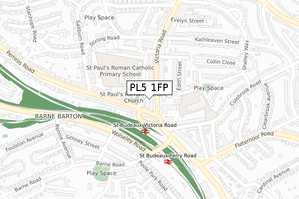
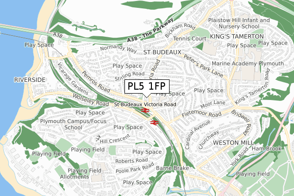
PL5 1FP is located in the St Budeaux electoral ward, within the unitary authority of Plymouth and the English Parliamentary constituency of Plymouth, Moor View. The Sub Integrated Care Board (ICB) Location is NHS Devon ICB - 15N and the police force is Devon & Cornwall. This postcode has been in use since April 2020.


GetTheData
Source: OS Open Zoomstack (Ordnance Survey)
Licence: Open Government Licence (requires attribution)
Attribution: Contains OS data © Crown copyright and database right 2024
Source: Open Postcode Geo
Licence: Open Government Licence (requires attribution)
Attribution: Contains OS data © Crown copyright and database right 2024; Contains Royal Mail data © Royal Mail copyright and database right 2024; Source: Office for National Statistics licensed under the Open Government Licence v.3.0
| Easting | 244625 |
| Northing | 58216 |
| Latitude | 50.403212 |
| Longitude | -4.187770 |
GetTheData
Source: Open Postcode Geo
Licence: Open Government Licence
| Country | England |
| Postcode District | PL5 |
| ➜ PL5 open data dashboard ➜ See where PL5 is on a map ➜ Where is Plymouth? | |
GetTheData
Source: Land Registry Price Paid Data
Licence: Open Government Licence
| Ward | St Budeaux |
| Constituency | Plymouth, Moor View |
GetTheData
Source: ONS Postcode Database
Licence: Open Government Licence
| August 2022 | Criminal damage and arson | On or near Ark Royal Close | 450m |
| June 2022 | Other theft | On or near Supermarket | 106m |
| June 2022 | Public order | On or near Supermarket | 106m |
| ➜ Get more crime data in our Crime section | |||
GetTheData
Source: data.police.uk
Licence: Open Government Licence
| Victoria Road Bottom (Victoria Road) | St Budeaux | 28m |
| Victoria Road Library | St Budeaux | 42m |
| St Paul's Church (Pemros Road) | St Budeaux | 72m |
| St Paul's Church (Pemros Road) | St Budeaux | 101m |
| Ferry Road Station (Barne Road) | Barne Barton | 183m |
| St Budeaux Victoria Road Station | 0.1km |
| St Budeaux Ferry Road Station | 0.2km |
| Saltash Station | 1.6km |
GetTheData
Source: NaPTAN
Licence: Open Government Licence
GetTheData
Source: ONS Postcode Database
Licence: Open Government Licence


➜ Get more ratings from the Food Standards Agency
GetTheData
Source: Food Standards Agency
Licence: FSA terms & conditions
| Last Collection | |||
|---|---|---|---|
| Location | Mon-Fri | Sat | Distance |
| Foulston Avenue | 17:00 | 12:00 | 53m |
| Victoria Road | 17:30 | 12:30 | 256m |
| Cardinal Avenue | 17:30 | 12:00 | 480m |
GetTheData
Source: Dracos
Licence: Creative Commons Attribution-ShareAlike
| Facility | Distance |
|---|---|
| St Pauls Catholic Primary School (Plymouth) Pemros Road, Plymouth Grass Pitches | 97m |
| St Budeaux Tennis Club Verna Road, Plymouth Outdoor Tennis Courts | 615m |
| Riverside Primary School (Plymouth) Poole Park Road, Plymouth Grass Pitches | 736m |
GetTheData
Source: Active Places
Licence: Open Government Licence
| School | Phase of Education | Distance |
|---|---|---|
| St Paul's Roman Catholic Primary School Pemros Road, St Budeaux, Plymouth, PL5 1NE | Primary | 72m |
| Victoria Road Primary Trelawney Avenue, St Budeaux, Plymouth, PL5 1RH | Primary | 168m |
| Riverside Community Primary School 210 Poole Park Road, St Budeaux, Plymouth, PL5 1DD | Primary | 677m |
GetTheData
Source: Edubase
Licence: Open Government Licence
The below table lists the International Territorial Level (ITL) codes (formerly Nomenclature of Territorial Units for Statistics (NUTS) codes) and Local Administrative Units (LAU) codes for PL5 1FP:
| ITL 1 Code | Name |
|---|---|
| TLK | South West (England) |
| ITL 2 Code | Name |
| TLK4 | Devon |
| ITL 3 Code | Name |
| TLK41 | Plymouth |
| LAU 1 Code | Name |
| E06000026 | Plymouth |
GetTheData
Source: ONS Postcode Directory
Licence: Open Government Licence
The below table lists the Census Output Area (OA), Lower Layer Super Output Area (LSOA), and Middle Layer Super Output Area (MSOA) for PL5 1FP:
| Code | Name | |
|---|---|---|
| OA | E00076517 | |
| LSOA | E01015144 | Plymouth 009D |
| MSOA | E02003130 | Plymouth 009 |
GetTheData
Source: ONS Postcode Directory
Licence: Open Government Licence
| PL5 1RW | Victoria Road | 12m |
| PL5 1ND | Pemros Road | 28m |
| PL5 1LZ | Pemros Road | 54m |
| PL5 1RN | Victoria Road | 68m |
| PL5 1NB | Laurel Cottages | 69m |
| PL5 1NA | Trelawney Place | 70m |
| PL5 1QH | Percy Street | 81m |
| PL5 1RG | Victoria Road | 94m |
| PL5 1RR | Victoria Road | 97m |
| PL5 1LY | Pemros Road | 122m |
GetTheData
Source: Open Postcode Geo; Land Registry Price Paid Data
Licence: Open Government Licence