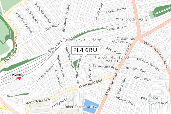
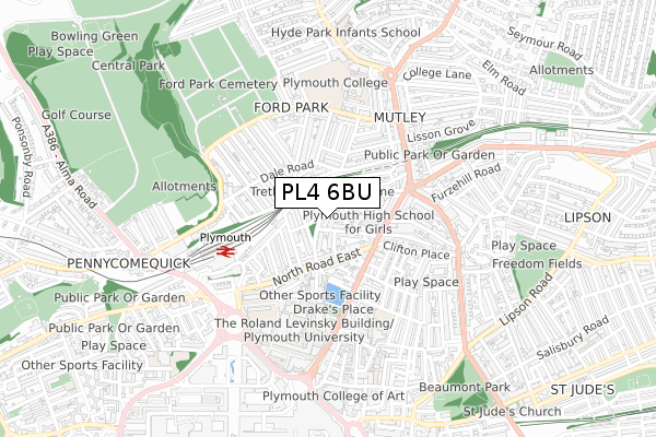
PL4 6BU is located in the Drake electoral ward, within the unitary authority of Plymouth and the English Parliamentary constituency of Plymouth, Sutton and Devonport. The Sub Integrated Care Board (ICB) Location is NHS Devon ICB - 15N and the police force is Devon & Cornwall. This postcode has been in use since February 2020.


GetTheData
Source: OS Open Zoomstack (Ordnance Survey)
Licence: Open Government Licence (requires attribution)
Attribution: Contains OS data © Crown copyright and database right 2024
Source: Open Postcode Geo
Licence: Open Government Licence (requires attribution)
Attribution: Contains OS data © Crown copyright and database right 2024; Contains Royal Mail data © Royal Mail copyright and database right 2024; Source: Office for National Statistics licensed under the Open Government Licence v.3.0
| Easting | 248102 |
| Northing | 55440 |
| Latitude | 50.379174 |
| Longitude | -4.137756 |
GetTheData
Source: Open Postcode Geo
Licence: Open Government Licence
| Country | England |
| Postcode District | PL4 |
| ➜ PL4 open data dashboard ➜ See where PL4 is on a map ➜ Where is Plymouth? | |
GetTheData
Source: Land Registry Price Paid Data
Licence: Open Government Licence
| Ward | Drake |
| Constituency | Plymouth, Sutton And Devonport |
GetTheData
Source: ONS Postcode Database
Licence: Open Government Licence
| October 2022 | Anti-social behaviour | On or near North Hill | 225m |
| September 2022 | Other theft | On or near North Hill | 225m |
| August 2022 | Anti-social behaviour | On or near North Hill | 225m |
| ➜ Get more crime data in our Crime section | |||
GetTheData
Source: data.police.uk
Licence: Open Government Licence
| North Road East Car Park (North Road East) | Pennycomequick | 157m |
| Evelyn Place (North Road East) | Pennycomequick | 165m |
| Sutherland Road (North Road East) | Plymouth | 175m |
| Apsley Road (Dale Road) | Mutley | 191m |
| High School For Girls (North Hill) | Plymouth | 203m |
| Plymouth Station | 0.4km |
| Devonport Station | 2.3km |
| Dockyard (Plymouth) Station | 2.7km |
GetTheData
Source: NaPTAN
Licence: Open Government Licence
GetTheData
Source: ONS Postcode Database
Licence: Open Government Licence


➜ Get more ratings from the Food Standards Agency
GetTheData
Source: Food Standards Agency
Licence: FSA terms & conditions
| Last Collection | |||
|---|---|---|---|
| Location | Mon-Fri | Sat | Distance |
| Old Beechwood Avenue P.o. | 18:30 | 12:00 | 212m |
| Deptford Chambers | 18:30 | 227m | |
| North Hill | 18:30 | 12:00 | 283m |
GetTheData
Source: Dracos
Licence: Creative Commons Attribution-ShareAlike
| Facility | Distance |
|---|---|
| Plymouth High School For Girls St. Lawrence Road, Plymouth Sports Hall, Outdoor Tennis Courts | 157m |
| Fletewood School North Road East, Plymouth Sports Hall | 257m |
| Su Gym Drake Circus, Plymouth Health and Fitness Gym, Sports Hall, Studio, Squash Courts | 452m |
GetTheData
Source: Active Places
Licence: Open Government Licence
| School | Phase of Education | Distance |
|---|---|---|
| Plymouth High School for Girls St Lawrence Road, Plymouth, PL4 6HT | Secondary | 116m |
| Fletewood School at Derry Villas 88 North Road East, Plymouth, PL4 6AN | Not applicable | 257m |
| University of Plymouth Drake Circus, Plymouth, PL4 8AA | Not applicable | 446m |
GetTheData
Source: Edubase
Licence: Open Government Licence
The below table lists the International Territorial Level (ITL) codes (formerly Nomenclature of Territorial Units for Statistics (NUTS) codes) and Local Administrative Units (LAU) codes for PL4 6BU:
| ITL 1 Code | Name |
|---|---|
| TLK | South West (England) |
| ITL 2 Code | Name |
| TLK4 | Devon |
| ITL 3 Code | Name |
| TLK41 | Plymouth |
| LAU 1 Code | Name |
| E06000026 | Plymouth |
GetTheData
Source: ONS Postcode Directory
Licence: Open Government Licence
The below table lists the Census Output Area (OA), Lower Layer Super Output Area (LSOA), and Middle Layer Super Output Area (MSOA) for PL4 6BU:
| Code | Name | |
|---|---|---|
| OA | E00076033 | |
| LSOA | E01015050 | Plymouth 023D |
| MSOA | E02003144 | Plymouth 023 |
GetTheData
Source: ONS Postcode Directory
Licence: Open Government Licence
| PL4 6HQ | Houndiscombe Road | 14m |
| PL4 6ED | St Lawrence Mews | 43m |
| PL4 6HG | Houndiscombe Road | 53m |
| PL4 6HF | Houndiscombe Road | 56m |
| PL4 6HR | St Lawrence Road | 61m |
| PL4 6JA | Allendale Road | 68m |
| PL4 6EU | Houndiscombe Road | 71m |
| PL4 6HN | St Lawrence Road | 89m |
| PL4 6HL | Evelyn Place | 91m |
| PL4 6HH | Houndiscombe Road | 101m |
GetTheData
Source: Open Postcode Geo; Land Registry Price Paid Data
Licence: Open Government Licence