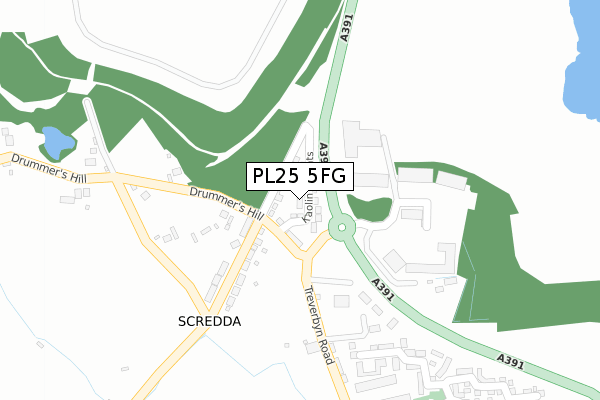
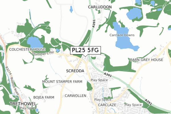
PL25 5FG is located in the Penwithick & Boscoppa electoral ward, within the unitary authority of Cornwall and the English Parliamentary constituency of St Austell and Newquay. The Sub Integrated Care Board (ICB) Location is NHS Cornwall and the Isles of Scilly ICB - 11N and the police force is Devon & Cornwall. This postcode has been in use since January 2018.


GetTheData
Source: OS Open Zoomstack (Ordnance Survey)
Licence: Open Government Licence (requires attribution)
Attribution: Contains OS data © Crown copyright and database right 2024
Source: Open Postcode Geo
Licence: Open Government Licence (requires attribution)
Attribution: Contains OS data © Crown copyright and database right 2024; Contains Royal Mail data © Royal Mail copyright and database right 2024; Source: Office for National Statistics licensed under the Open Government Licence v.3.0
| Easting | 202091 |
| Northing | 54677 |
| Latitude | 50.358635 |
| Longitude | -4.783773 |
GetTheData
Source: Open Postcode Geo
Licence: Open Government Licence
| Country | England |
| Postcode District | PL25 |
| ➜ PL25 open data dashboard ➜ See where PL25 is on a map ➜ Where is Scredda? | |
GetTheData
Source: Land Registry Price Paid Data
Licence: Open Government Licence
| Ward | Penwithick & Boscoppa |
| Constituency | St Austell And Newquay |
GetTheData
Source: ONS Postcode Database
Licence: Open Government Licence
| June 2022 | Violence and sexual offences | On or near Treverbyn Road | 71m |
| June 2022 | Other crime | On or near Treverbyn Road | 71m |
| June 2022 | Anti-social behaviour | On or near Treverbyn Road | 71m |
| ➜ Get more crime data in our Crime section | |||
GetTheData
Source: data.police.uk
Licence: Open Government Licence
| St Austell Enterprise Park | Carluddon | 82m |
| St Austell Enterprise Park | Carluddon | 92m |
| Industrial Estate (Treverbyn Road) | Carclaze | 327m |
| Industrial Estate (Treverbyn Road) | Carclaze | 329m |
| Burlawn Drive | Carclaze | 752m |
| St Austell Station | 2.2km |
| Luxulyan Station | 4.3km |
| Bugle Station | 4.7km |
GetTheData
Source: NaPTAN
Licence: Open Government Licence
| Percentage of properties with Next Generation Access | 0.0% |
| Percentage of properties with Superfast Broadband | 0.0% |
| Percentage of properties with Ultrafast Broadband | 0.0% |
| Percentage of properties with Full Fibre Broadband | 0.0% |
Superfast Broadband is between 30Mbps and 300Mbps
Ultrafast Broadband is > 300Mbps
| Median download speed | 4.1Mbps |
| Average download speed | 4.5Mbps |
| Maximum download speed | 9.13Mbps |
| Median upload speed | 0.8Mbps |
| Average upload speed | 0.7Mbps |
| Maximum upload speed | 0.96Mbps |
| Percentage of properties unable to receive 2Mbps | 0.0% |
| Percentage of properties unable to receive 5Mbps | 100.0% |
| Percentage of properties unable to receive 10Mbps | 100.0% |
| Percentage of properties unable to receive 30Mbps | 100.0% |
GetTheData
Source: Ofcom
Licence: Ofcom Terms of Use (requires attribution)
GetTheData
Source: ONS Postcode Database
Licence: Open Government Licence


➜ Get more ratings from the Food Standards Agency
GetTheData
Source: Food Standards Agency
Licence: FSA terms & conditions
| Last Collection | |||
|---|---|---|---|
| Location | Mon-Fri | Sat | Distance |
| Carludden | 10:30 | 09:00 | 770m |
| Penwithick Post Office | 16:00 | 10:30 | 1,587m |
| Penwithick Park | 16:00 | 09:30 | 1,772m |
GetTheData
Source: Dracos
Licence: Creative Commons Attribution-ShareAlike
| Facility | Distance |
|---|---|
| Carclaze Community Junior School (Closed) St. Pirans Close, St. Austell Grass Pitches | 1.1km |
| Cornwall College (St Austell) Tregonissey Road, St. Austell Health and Fitness Gym | 1.4km |
| Poltair School Trevarthian Road, St. Austell Sports Hall, Artificial Grass Pitch, Health and Fitness Gym, Grass Pitches, Studio | 1.8km |
GetTheData
Source: Active Places
Licence: Open Government Licence
| School | Phase of Education | Distance |
|---|---|---|
| Carclaze Community Primary School St Piran's Close, St Austell, PL25 3TF | Primary | 1.1km |
| Cornwall College Corporate Headquarters, Cornwall College St Austell, Tregonissey Road, St Austell, PL25 4DJ | 16 plus | 1.4km |
| Poltair School Trevarthian Road, St Austell, PL25 4BZ | Secondary | 1.7km |
GetTheData
Source: Edubase
Licence: Open Government Licence
The below table lists the International Territorial Level (ITL) codes (formerly Nomenclature of Territorial Units for Statistics (NUTS) codes) and Local Administrative Units (LAU) codes for PL25 5FG:
| ITL 1 Code | Name |
|---|---|
| TLK | South West (England) |
| ITL 2 Code | Name |
| TLK3 | Cornwall and Isles of Scilly |
| ITL 3 Code | Name |
| TLK30 | Cornwall and Isles of Scilly |
| LAU 1 Code | Name |
| E06000052 | Cornwall |
GetTheData
Source: ONS Postcode Directory
Licence: Open Government Licence
The below table lists the Census Output Area (OA), Lower Layer Super Output Area (LSOA), and Middle Layer Super Output Area (MSOA) for PL25 5FG:
| Code | Name | |
|---|---|---|
| OA | E00172798 | |
| LSOA | E01019045 | Cornwall 038C |
| MSOA | E02003962 | Cornwall 038 |
GetTheData
Source: ONS Postcode Directory
Licence: Open Government Licence
| PL25 5RY | 99m | |
| PL25 4EJ | Treverbyn Road | 193m |
| PL26 8XW | 212m | |
| PL25 4FA | Treverbyn Road | 278m |
| PL25 4FB | Mackerel Close | 299m |
| PL25 3FH | Phyllis Walk | 369m |
| PL25 4EW | Treverbyn Road | 404m |
| PL25 3FL | Hammer Drive | 451m |
| PL25 3QL | Gwithian Road | 455m |
| PL25 3FJ | Curtice Close | 481m |
GetTheData
Source: Open Postcode Geo; Land Registry Price Paid Data
Licence: Open Government Licence