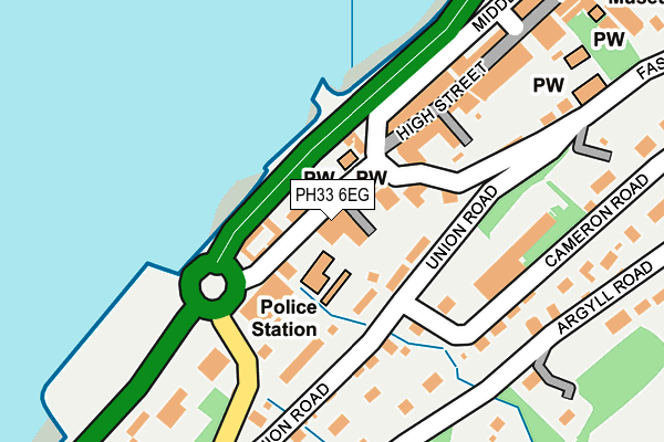
PH33 6EG is located in the Fort William and Ardnamurchan electoral ward, within the council area of Highland and the Scottish Parliamentary constituency of Ross, Skye and Lochaber. The Community Health Partnership is Highland Health and Social Care Partnership and the police force is Scotland. This postcode has been in use since January 1980.


GetTheData
Source: OS OpenMap – Local (Ordnance Survey)
Source: OS VectorMap District (Ordnance Survey)
Licence: Open Government Licence (requires attribution)
| Easting | 209983 |
| Northing | 773696 |
| Latitude | 56.815824 |
| Longitude | -5.114742 |
GetTheData
Source: Open Postcode Geo
Licence: Open Government Licence
| Country | Scotland |
| Postcode District | PH33 |
| ➜ PH33 open data dashboard ➜ See where PH33 is on a map ➜ Where is Fort William? | |
GetTheData
Source: Land Registry Price Paid Data
Licence: Open Government Licence
| Ward | Fort William And Ardnamurchan |
| Constituency | Ross, Skye And Lochaber |
GetTheData
Source: ONS Postcode Database
Licence: Open Government Licence
| Police Station (High Street) | Fort William | 8m |
| Police Station (High Street) | Fort William | 43m |
| Camusnagaul Ferry Pier (A82) | Fort William | 102m |
| Linnhe Road (Middle Street) | Fort William | 221m |
| Braeside House (Argyll Road) | Fort William | 264m |
| Fort William Station | 0.7km |
| Corpach Station | 3km |
| Banavie Station | 3.3km |
GetTheData
Source: NaPTAN
Licence: Open Government Licence
GetTheData
Source: ONS Postcode Database
Licence: Open Government Licence


➜ Get more ratings from the Food Standards Agency
GetTheData
Source: Food Standards Agency
Licence: FSA terms & conditions
| Last Collection | |||
|---|---|---|---|
| Location | Mon-Fri | Sat | Distance |
| Fort William Delivery Office | 17:15 | 14:15 | 462m |
| Royal Mail Delivery Office | 17:15 | 14:15 | 462m |
| Alma Road | 15:30 | 12:45 | 598m |
GetTheData
Source: Dracos
Licence: Creative Commons Attribution-ShareAlike
The below table lists the International Territorial Level (ITL) codes (formerly Nomenclature of Territorial Units for Statistics (NUTS) codes) and Local Administrative Units (LAU) codes for PH33 6EG:
| ITL 1 Code | Name |
|---|---|
| TLM | Scotland |
| ITL 2 Code | Name |
| TLM6 | Highlands and Islands |
| ITL 3 Code | Name |
| TLM63 | Lochaber, Skye and Lochalsh, Arran and Cumbrae, and Argyll and Bute |
| LAU 1 Code | Name |
| S30000037 | Lochaber |
GetTheData
Source: ONS Postcode Directory
Licence: Open Government Licence
The below table lists the Census Output Area (OA), Lower Layer Super Output Area (LSOA), and Middle Layer Super Output Area (MSOA) for PH33 6EG:
| Code | Name | |
|---|---|---|
| OA | S00118146 | |
| LSOA | S01010516 | Fort William South - 01 |
| MSOA | S02001980 | Fort William South |
GetTheData
Source: ONS Postcode Directory
Licence: Open Government Licence