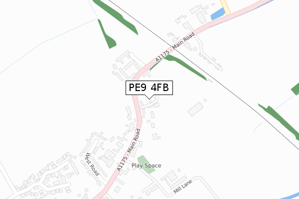
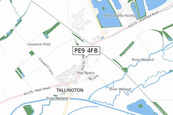
PE9 4FB is located in the Casewick electoral ward, within the local authority district of South Kesteven and the English Parliamentary constituency of Grantham and Stamford. The Sub Integrated Care Board (ICB) Location is NHS Lincolnshire ICB - 71E and the police force is Lincolnshire. This postcode has been in use since September 2019.


GetTheData
Source: OS Open Zoomstack (Ordnance Survey)
Licence: Open Government Licence (requires attribution)
Attribution: Contains OS data © Crown copyright and database right 2024
Source: Open Postcode Geo
Licence: Open Government Licence (requires attribution)
Attribution: Contains OS data © Crown copyright and database right 2024; Contains Royal Mail data © Royal Mail copyright and database right 2024; Source: Office for National Statistics licensed under the Open Government Licence v.3.0
| Easting | 509483 |
| Northing | 308378 |
| Latitude | 52.662095 |
| Longitude | -0.382638 |
GetTheData
Source: Open Postcode Geo
Licence: Open Government Licence
| Country | England |
| Postcode District | PE9 |
| ➜ PE9 open data dashboard ➜ See where PE9 is on a map ➜ Where is Tallington? | |
GetTheData
Source: Land Registry Price Paid Data
Licence: Open Government Licence
| Ward | Casewick |
| Constituency | Grantham And Stamford |
GetTheData
Source: ONS Postcode Database
Licence: Open Government Licence
| June 2022 | Anti-social behaviour | On or near West Road | 296m |
| April 2022 | Burglary | On or near Searson Close | 139m |
| March 2022 | Violence and sexual offences | On or near West Road | 296m |
| ➜ Get more crime data in our Crime section | |||
GetTheData
Source: data.police.uk
Licence: Open Government Licence
| Village Hall (Main Road) | Tallington | 193m |
| Demand Responsive Area | Tallington | 200m |
| Village Hall (Main Road) | Tallington | 206m |
| Pumping Station (Barholm Road) | Tallington | 420m |
| Pumping Station (Barholm Road) | Tallington | 430m |
GetTheData
Source: NaPTAN
Licence: Open Government Licence
GetTheData
Source: ONS Postcode Database
Licence: Open Government Licence


➜ Get more ratings from the Food Standards Agency
GetTheData
Source: Food Standards Agency
Licence: FSA terms & conditions
| Last Collection | |||
|---|---|---|---|
| Location | Mon-Fri | Sat | Distance |
| Tallington Post Office | 16:30 | 08:00 | 198m |
| West Deeping | 16:45 | 09:00 | 1,638m |
| Bainton | 16:30 | 07:00 | 2,263m |
GetTheData
Source: Dracos
Licence: Creative Commons Attribution-ShareAlike
| Facility | Distance |
|---|---|
| Tallington Lakes Leisure Park Barholm Road, Tallington, Stamford Ski Slopes, Outdoor Tennis Courts | 820m |
| Copthill School Barnack Road, Uffington, Stamford Artificial Grass Pitch, Grass Pitches, Studio | 3.1km |
| Barnack C Of E Primary School School Road, Barnack, Stamford Grass Pitches | 3.8km |
GetTheData
Source: Active Places
Licence: Open Government Licence
| School | Phase of Education | Distance |
|---|---|---|
| Copthill Independent Day School & Nursery Barnack Road, Uffington, Stamford, PE9 3AD | Not applicable | 3.1km |
| The Uffington Church of England Primary School School Lane, Uffington, Stamford, PE9 4SU | Primary | 3.3km |
| John Clare Primary School West Street, Helpston, Peterborough, PE6 7DX | Primary | 3.7km |
GetTheData
Source: Edubase
Licence: Open Government Licence
The below table lists the International Territorial Level (ITL) codes (formerly Nomenclature of Territorial Units for Statistics (NUTS) codes) and Local Administrative Units (LAU) codes for PE9 4FB:
| ITL 1 Code | Name |
|---|---|
| TLF | East Midlands (England) |
| ITL 2 Code | Name |
| TLF3 | Lincolnshire |
| ITL 3 Code | Name |
| TLF30 | Lincolnshire CC |
| LAU 1 Code | Name |
| E07000141 | South Kesteven |
GetTheData
Source: ONS Postcode Directory
Licence: Open Government Licence
The below table lists the Census Output Area (OA), Lower Layer Super Output Area (LSOA), and Middle Layer Super Output Area (MSOA) for PE9 4FB:
| Code | Name | |
|---|---|---|
| OA | E00133924 | |
| LSOA | E01026363 | South Kesteven 012D |
| MSOA | E02005487 | South Kesteven 012 |
GetTheData
Source: ONS Postcode Directory
Licence: Open Government Licence
| PE9 4RF | Searson Close | 133m |
| PE9 4RP | Main Road | 249m |
| PE9 4RN | Main Road | 251m |
| PE9 4RS | West Road | 275m |
| PE9 4RG | Red House Paddock | 390m |
| PE9 4RH | St Lawrence Way | 412m |
| PE9 4RT | Bainton Road | 514m |
| PE9 4RU | Church Lane | 575m |
| PE6 9HU | Church Lane | 1389m |
| PE6 9JA | Stamford Road | 1630m |
GetTheData
Source: Open Postcode Geo; Land Registry Price Paid Data
Licence: Open Government Licence