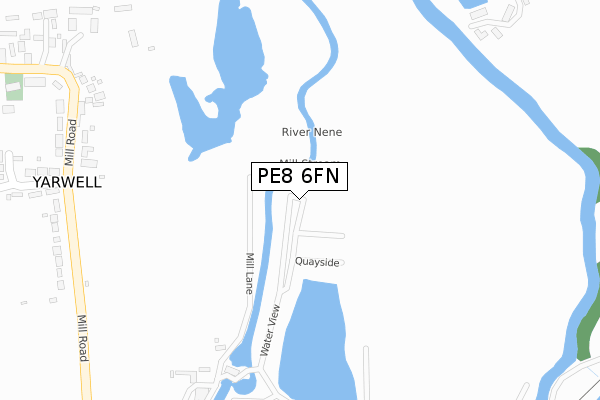
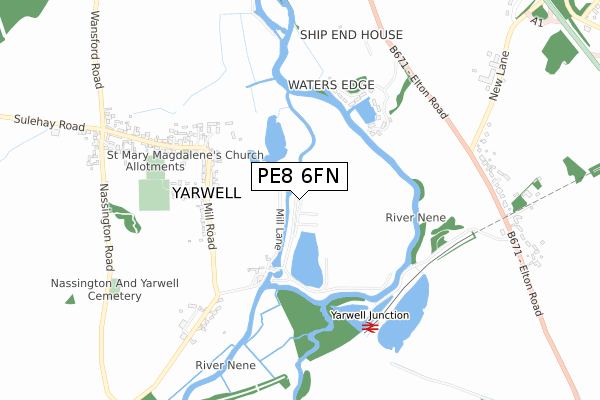
PE8 6FN is located in the Oundle electoral ward, within the unitary authority of North Northamptonshire and the English Parliamentary constituency of Corby. The Sub Integrated Care Board (ICB) Location is NHS Northamptonshire ICB - 78H and the police force is Northamptonshire. This postcode has been in use since November 2019.


GetTheData
Source: OS Open Zoomstack (Ordnance Survey)
Licence: Open Government Licence (requires attribution)
Attribution: Contains OS data © Crown copyright and database right 2025
Source: Open Postcode Geo
Licence: Open Government Licence (requires attribution)
Attribution: Contains OS data © Crown copyright and database right 2025; Contains Royal Mail data © Royal Mail copyright and database right 2025; Source: Office for National Statistics licensed under the Open Government Licence v.3.0
| Easting | 507643 |
| Northing | 297503 |
| Latitude | 52.564736 |
| Longitude | -0.413367 |
GetTheData
Source: Open Postcode Geo
Licence: Open Government Licence
| Country | England |
| Postcode District | PE8 |
➜ See where PE8 is on a map ➜ Where is Yarwell? | |
GetTheData
Source: Land Registry Price Paid Data
Licence: Open Government Licence
| Ward | Oundle |
| Constituency | Corby |
GetTheData
Source: ONS Postcode Database
Licence: Open Government Licence
| Dovecote Close (Mill Road) | Yarwell | 474m |
| Dovecote Close (Mill Road) | Yarwell | 478m |
| Village Hall (Main Street) | Yarwell | 667m |
| Demand Responsive Area | Yarwell | 687m |
| Village Hall (Main Street) | Yarwell | 709m |
GetTheData
Source: NaPTAN
Licence: Open Government Licence
GetTheData
Source: ONS Postcode Database
Licence: Open Government Licence


➜ Get more ratings from the Food Standards Agency
GetTheData
Source: Food Standards Agency
Licence: FSA terms & conditions
| Last Collection | |||
|---|---|---|---|
| Location | Mon-Fri | Sat | Distance |
| Elton Road | 17:00 | 07:00 | 710m |
| Wansford Post Office | 17:00 | 11:40 | 1,386m |
| Stibbington Manor | 17:00 | 07:45 | 1,675m |
GetTheData
Source: Dracos
Licence: Creative Commons Attribution-ShareAlike
| Risk of PE8 6FN flooding from rivers and sea | High |
| ➜ PE8 6FN flood map | |
GetTheData
Source: Open Flood Risk by Postcode
Licence: Open Government Licence
The below table lists the International Territorial Level (ITL) codes (formerly Nomenclature of Territorial Units for Statistics (NUTS) codes) and Local Administrative Units (LAU) codes for PE8 6FN:
| ITL 1 Code | Name |
|---|---|
| TLF | East Midlands (England) |
| ITL 2 Code | Name |
| TLF2 | Leicestershire, Rutland and Northamptonshire |
| ITL 3 Code | Name |
| TLF25 | North Northamptonshire |
| LAU 1 Code | Name |
| E07000152 | East Northamptonshire |
GetTheData
Source: ONS Postcode Directory
Licence: Open Government Licence
The below table lists the Census Output Area (OA), Lower Layer Super Output Area (LSOA), and Middle Layer Super Output Area (MSOA) for PE8 6FN:
| Code | Name | |
|---|---|---|
| OA | E00137597 | |
| LSOA | E01027050 | East Northamptonshire 001C |
| MSOA | E02005629 | East Northamptonshire 001 |
GetTheData
Source: ONS Postcode Directory
Licence: Open Government Licence
| PE8 6PZ | Old Mill Lane | 124m |
| PE8 6PS | Mill Road | 457m |
| PE8 6LH | Waters Edge | 535m |
| PE8 6PT | Dovecote Close | 585m |
| PE8 6PY | Locks Green | 604m |
| PE8 6QA | Mill Road | 637m |
| PE8 6PR | Main Street | 737m |
| PE8 6JU | New Lane | 777m |
| PE8 6JX | Elton Road | 781m |
| PE8 6PJ | Prebendal Green | 910m |
GetTheData
Source: Open Postcode Geo; Land Registry Price Paid Data
Licence: Open Government Licence