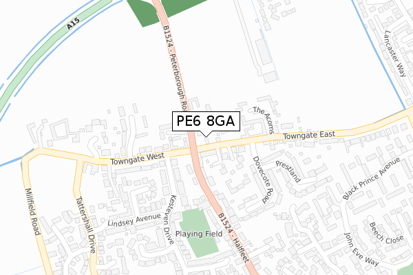
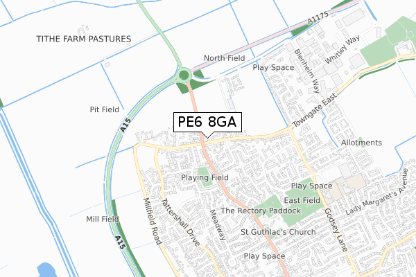
PE6 8GA is located in the Market & West Deeping electoral ward, within the local authority district of South Kesteven and the English Parliamentary constituency of South Holland and The Deepings. The Sub Integrated Care Board (ICB) Location is NHS Lincolnshire ICB - 71E and the police force is Lincolnshire. This postcode has been in use since January 2020.


GetTheData
Source: OS Open Zoomstack (Ordnance Survey)
Licence: Open Government Licence (requires attribution)
Attribution: Contains OS data © Crown copyright and database right 2024
Source: Open Postcode Geo
Licence: Open Government Licence (requires attribution)
Attribution: Contains OS data © Crown copyright and database right 2024; Contains Royal Mail data © Royal Mail copyright and database right 2024; Source: Office for National Statistics licensed under the Open Government Licence v.3.0
| Easting | 513339 |
| Northing | 310844 |
| Latitude | 52.683463 |
| Longitude | -0.324803 |
GetTheData
Source: Open Postcode Geo
Licence: Open Government Licence
| Country | England |
| Postcode District | PE6 |
| ➜ PE6 open data dashboard ➜ See where PE6 is on a map ➜ Where is Market Deeping? | |
GetTheData
Source: Land Registry Price Paid Data
Licence: Open Government Licence
| Ward | Market & West Deeping |
| Constituency | South Holland And The Deepings |
GetTheData
Source: ONS Postcode Database
Licence: Open Government Licence
| October 2023 | Vehicle crime | On or near Chestnut Way | 369m |
| October 2023 | Anti-social behaviour | On or near Chestnut Way | 369m |
| July 2023 | Anti-social behaviour | On or near Chestnut Way | 369m |
| ➜ Get more crime data in our Crime section | |||
GetTheData
Source: data.police.uk
Licence: Open Government Licence
| Towngate East (Halfleet) | Market Deeping | 33m |
| Towngate Tavern (Towngate East) | Market Deeping | 40m |
| Towngate East (Halfleet) | Market Deeping | 83m |
| 44 Towngate East (Towngate East) | Market Deeping | 224m |
| Forge Court (Halfleet) | Market Deeping | 294m |
GetTheData
Source: NaPTAN
Licence: Open Government Licence
GetTheData
Source: ONS Postcode Database
Licence: Open Government Licence


➜ Get more ratings from the Food Standards Agency
GetTheData
Source: Food Standards Agency
Licence: FSA terms & conditions
| Last Collection | |||
|---|---|---|---|
| Location | Mon-Fri | Sat | Distance |
| Towngate | 16:15 | 11:00 | 42m |
| Joan Wake Close | 16:30 | 11:00 | 356m |
| Lancaster Way | 16:30 | 11:00 | 540m |
GetTheData
Source: Dracos
Licence: Creative Commons Attribution-ShareAlike
| Facility | Distance |
|---|---|
| Market Deeping Bmx Track Godsey Lane, Market Deeping, Peterborough Cycling | 739m |
| William Hildyard C Of E Primary And Nursery School Godsey Lane, Market Deeping, Peterborough Grass Pitches | 799m |
| Market Deeping Community Primary School Willoughby Avenue, Willoughby Avenue, Market Deeping, Peterborough Grass Pitches | 880m |
GetTheData
Source: Active Places
Licence: Open Government Licence
| School | Phase of Education | Distance |
|---|---|---|
| William Hildyard Church of England Primary and Nursery School Godsey Lane, Market Deeping, PE6 8HZ | Primary | 808m |
| Market Deeping Community Primary School Willoughby Avenue, Market Deeping, PE6 8JE | Primary | 900m |
| Linchfield Academy Crowson Way, Deeping St James, Peterborough, PE6 8EY | Primary | 1.5km |
GetTheData
Source: Edubase
Licence: Open Government Licence
The below table lists the International Territorial Level (ITL) codes (formerly Nomenclature of Territorial Units for Statistics (NUTS) codes) and Local Administrative Units (LAU) codes for PE6 8GA:
| ITL 1 Code | Name |
|---|---|
| TLF | East Midlands (England) |
| ITL 2 Code | Name |
| TLF3 | Lincolnshire |
| ITL 3 Code | Name |
| TLF30 | Lincolnshire CC |
| LAU 1 Code | Name |
| E07000141 | South Kesteven |
GetTheData
Source: ONS Postcode Directory
Licence: Open Government Licence
The below table lists the Census Output Area (OA), Lower Layer Super Output Area (LSOA), and Middle Layer Super Output Area (MSOA) for PE6 8GA:
| Code | Name | |
|---|---|---|
| OA | E00133773 | |
| LSOA | E01026336 | South Kesteven 013C |
| MSOA | E02005488 | South Kesteven 013 |
GetTheData
Source: ONS Postcode Directory
Licence: Open Government Licence
| PE6 8DP | Towngate East | 103m |
| PE6 8UF | The Acorns | 129m |
| PE6 8EE | Wheatsheaf Court | 144m |
| PE6 8DG | Towngate West | 191m |
| PE6 8DS | Dovecote Road | 193m |
| PE6 8DX | Lincoln Close | 201m |
| PE6 8DQ | Lime Tree Avenue | 203m |
| PE6 8DR | Towngate East | 225m |
| PE6 8DT | Prestland | 242m |
| PE6 8DB | Halfleet | 247m |
GetTheData
Source: Open Postcode Geo; Land Registry Price Paid Data
Licence: Open Government Licence