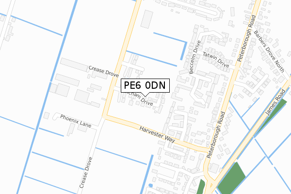
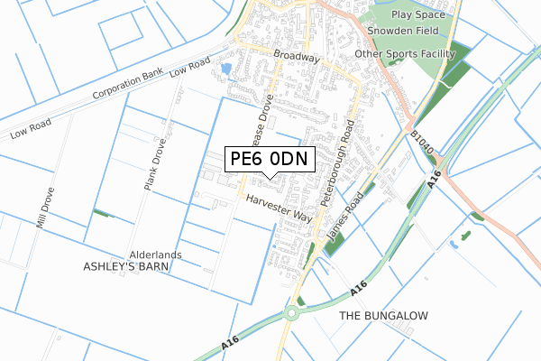
PE6 0DN maps, stats, and open data
PE6 0DN is located in the Crowland and Deeping St Nicholas electoral ward, within the local authority district of South Holland and the English Parliamentary constituency of South Holland and The Deepings. The Sub Integrated Care Board (ICB) Location is NHS Lincolnshire ICB - 71E and the police force is Lincolnshire. This postcode has been in use since November 2019.
PE6 0DN maps


Licence: Open Government Licence (requires attribution)
Attribution: Contains OS data © Crown copyright and database right 2025
Source: Open Postcode Geo
Licence: Open Government Licence (requires attribution)
Attribution: Contains OS data © Crown copyright and database right 2025; Contains Royal Mail data © Royal Mail copyright and database right 2025; Source: Office for National Statistics licensed under the Open Government Licence v.3.0
PE6 0DN geodata
| Easting | 523713 |
| Northing | 309398 |
| Latitude | 52.668203 |
| Longitude | -0.171962 |
Where is PE6 0DN?
| Country | England |
| Postcode District | PE6 |
Politics
| Ward | Crowland And Deeping St Nicholas |
|---|---|
| Constituency | South Holland And The Deepings |
House Prices
Sales of detached houses in PE6 0DN
2025 10 JAN £305,000 |
2023 3 MAR £330,000 |
2022 16 NOV £300,000 |
2022 29 APR £425,000 |
32, FINCHAM DRIVE, CROWLAND, PETERBOROUGH, PE6 0DN 2020 23 JUL £360,000 |
2020 10 JUL £262,000 |
34, FINCHAM DRIVE, CROWLAND, PETERBOROUGH, PE6 0DN 2020 9 JUN £262,000 |
2020 22 MAY £262,000 |
31, FINCHAM DRIVE, CROWLAND, PETERBOROUGH, PE6 0DN 2020 15 MAY £287,000 |
6, FINCHAM DRIVE, CROWLAND, PETERBOROUGH, PE6 0DN 2020 17 APR £250,000 |
Licence: Contains HM Land Registry data © Crown copyright and database right 2025. This data is licensed under the Open Government Licence v3.0.
Transport
Nearest bus stops to PE6 0DN
| 63 Peterborough Road (Peterborough Road) | Crowland | 266m |
| 48 Peterborough Road (Peterborough Road) | Crowland | 276m |
| Barbers Drove North (Peterborough Road) | Crowland | 408m |
| Barbers Drove North (Peterborough Road) | Crowland | 430m |
| South View Primary School (Broadway) | Crowland | 596m |
Broadband
Broadband access in PE6 0DN (2020 data)
| Percentage of properties with Next Generation Access | 100.0% |
| Percentage of properties with Superfast Broadband | 100.0% |
| Percentage of properties with Ultrafast Broadband | 0.0% |
| Percentage of properties with Full Fibre Broadband | 0.0% |
Superfast Broadband is between 30Mbps and 300Mbps
Ultrafast Broadband is > 300Mbps
Broadband limitations in PE6 0DN (2020 data)
| Percentage of properties unable to receive 2Mbps | 0.0% |
| Percentage of properties unable to receive 5Mbps | 0.0% |
| Percentage of properties unable to receive 10Mbps | 0.0% |
| Percentage of properties unable to receive 30Mbps | 0.0% |
Deprivation
33.8% of English postcodes are less deprived than PE6 0DN:Food Standards Agency
Three nearest food hygiene ratings to PE6 0DN (metres)

➜ Get more ratings from the Food Standards Agency
Nearest post box to PE6 0DN
| Last Collection | |||
|---|---|---|---|
| Location | Mon-Fri | Sat | Distance |
| Peterborough Road | 16:45 | 09:45 | 428m |
| Broadway | 16:30 | 09:45 | 588m |
| Albion Street | 16:45 | 09:45 | 727m |
Environment
| Risk of PE6 0DN flooding from rivers and sea | Very Low |
PE6 0DN ITL and PE6 0DN LAU
The below table lists the International Territorial Level (ITL) codes (formerly Nomenclature of Territorial Units for Statistics (NUTS) codes) and Local Administrative Units (LAU) codes for PE6 0DN:
| ITL 1 Code | Name |
|---|---|
| TLF | East Midlands (England) |
| ITL 2 Code | Name |
| TLF3 | Lincolnshire |
| ITL 3 Code | Name |
| TLF30 | Lincolnshire CC |
| LAU 1 Code | Name |
| E07000140 | South Holland |
PE6 0DN census areas
The below table lists the Census Output Area (OA), Lower Layer Super Output Area (LSOA), and Middle Layer Super Output Area (MSOA) for PE6 0DN:
| Code | Name | |
|---|---|---|
| OA | E00133253 | |
| LSOA | E01026240 | South Holland 011B |
| MSOA | E02005475 | South Holland 011 |
Nearest postcodes to PE6 0DN
| PE6 0DA | Harvester Way | 161m |
| PE6 0AG | Beccelm Drive | 189m |
| PE6 0DG | Harvester Way | 190m |
| PE6 0AE | Tatwin Drive | 266m |
| PE6 0AQ | Penwald Close | 316m |
| PE6 0BS | Alderlands Close | 334m |
| PE6 0AT | Harrington Drive | 349m |
| PE6 0BB | Peterborough Road | 358m |
| PE6 0BA | Peterborough Road | 359m |
| PE6 0BN | Crease Drove | 372m |