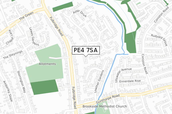
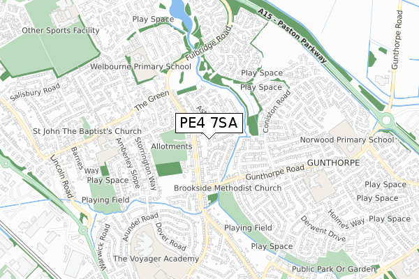
PE4 7SA is located in the Gunthorpe electoral ward, within the unitary authority of Peterborough and the English Parliamentary constituency of Peterborough. The Sub Integrated Care Board (ICB) Location is NHS Cambridgeshire and Peterborough ICB - 06H and the police force is Cambridgeshire. This postcode has been in use since August 2018.


GetTheData
Source: OS Open Zoomstack (Ordnance Survey)
Licence: Open Government Licence (requires attribution)
Attribution: Contains OS data © Crown copyright and database right 2024
Source: Open Postcode Geo
Licence: Open Government Licence (requires attribution)
Attribution: Contains OS data © Crown copyright and database right 2024; Contains Royal Mail data © Royal Mail copyright and database right 2024; Source: Office for National Statistics licensed under the Open Government Licence v.3.0
| Easting | 517706 |
| Northing | 303123 |
| Latitude | 52.613155 |
| Longitude | -0.262983 |
GetTheData
Source: Open Postcode Geo
Licence: Open Government Licence
| Country | England |
| Postcode District | PE4 |
| ➜ PE4 open data dashboard ➜ See where PE4 is on a map ➜ Where is Peterborough? | |
GetTheData
Source: Land Registry Price Paid Data
Licence: Open Government Licence
| Ward | Gunthorpe |
| Constituency | Peterborough |
GetTheData
Source: ONS Postcode Database
Licence: Open Government Licence
2022 11 NOV £320,000 |
2019 31 AUG £220,000 |
5, MUSA DRIVE, PETERBOROUGH, PE4 7SA 2018 17 DEC £235,000 |
4, MUSA DRIVE, PETERBOROUGH, PE4 7SA 2018 10 DEC £229,995 |
6, MUSA DRIVE, PETERBOROUGH, PE4 7SA 2018 31 OCT £235,000 |
2, MUSA DRIVE, PETERBOROUGH, PE4 7SA 2018 13 AUG £220,000 |
3, MUSA DRIVE, PETERBOROUGH, PE4 7SA 2018 13 AUG £225,000 |
GetTheData
Source: HM Land Registry Price Paid Data
Licence: Contains HM Land Registry data © Crown copyright and database right 2024. This data is licensed under the Open Government Licence v3.0.
| January 2024 | Anti-social behaviour | On or near Ambleside Gardens | 446m |
| January 2024 | Anti-social behaviour | On or near Ambleside Gardens | 446m |
| December 2023 | Criminal damage and arson | On or near Baron Court | 476m |
| ➜ Get more crime data in our Crime section | |||
GetTheData
Source: data.police.uk
Licence: Open Government Licence
| Fulbridge Road | Werrington | 85m |
| Fulbridge Road | Werrington | 95m |
| Aster Drive (Fulbridge Road) | Werrington | 111m |
| Aster Drive (Fulbridge Road) | Werrington | 122m |
| Aster Drive (Fulbridge Road) | Werrington | 123m |
| Peterborough Station | 4.3km |
GetTheData
Source: NaPTAN
Licence: Open Government Licence
➜ Broadband speed and availability dashboard for PE4 7SA
| Percentage of properties with Next Generation Access | 100.0% |
| Percentage of properties with Superfast Broadband | 100.0% |
| Percentage of properties with Ultrafast Broadband | 0.0% |
| Percentage of properties with Full Fibre Broadband | 0.0% |
Superfast Broadband is between 30Mbps and 300Mbps
Ultrafast Broadband is > 300Mbps
| Median download speed | 22.5Mbps |
| Average download speed | 22.0Mbps |
| Maximum download speed | 34.63Mbps |
| Median upload speed | 3.7Mbps |
| Average upload speed | 3.7Mbps |
| Maximum upload speed | 6.53Mbps |
| Percentage of properties unable to receive 2Mbps | 0.0% |
| Percentage of properties unable to receive 5Mbps | 0.0% |
| Percentage of properties unable to receive 10Mbps | 0.0% |
| Percentage of properties unable to receive 30Mbps | 0.0% |
➜ Broadband speed and availability dashboard for PE4 7SA
GetTheData
Source: Ofcom
Licence: Ofcom Terms of Use (requires attribution)
GetTheData
Source: ONS Postcode Database
Licence: Open Government Licence


➜ Get more ratings from the Food Standards Agency
GetTheData
Source: Food Standards Agency
Licence: FSA terms & conditions
| Last Collection | |||
|---|---|---|---|
| Location | Mon-Fri | Sat | Distance |
| Coniston Road Near Bala Court | 18:15 | 12:30 | 326m |
| Werrington Village Post Office | 17:45 | 11:30 | 478m |
| Amberly Slope | 17:45 | 12:30 | 510m |
GetTheData
Source: Dracos
Licence: Creative Commons Attribution-ShareAlike
| Facility | Distance |
|---|---|
| The Voyager School Playing Fields (Closed) Brookside, Peterborough Grass Pitches | 331m |
| Paston Ridings School Football Pitch Storrington Way, Peterborough Grass Pitches | 349m |
| Campbell Drive Campbell Drive, Peterborough Grass Pitches | 693m |
GetTheData
Source: Active Places
Licence: Open Government Licence
| School | Phase of Education | Distance |
|---|---|---|
| Gunthorpe Primary School The Pentlands, Hallfields Lane, Gunthorpe, Peterborough, PE4 7YP | Primary | 575m |
| Werrington Primary School Amberley Slope, Werrington, Peterborough, PE4 6QG | Primary | 599m |
| Welbourne Primary Academy Goodwin Walk, Werrington, Peterborough, PE4 6NR | Primary | 666m |
GetTheData
Source: Edubase
Licence: Open Government Licence
The below table lists the International Territorial Level (ITL) codes (formerly Nomenclature of Territorial Units for Statistics (NUTS) codes) and Local Administrative Units (LAU) codes for PE4 7SA:
| ITL 1 Code | Name |
|---|---|
| TLH | East |
| ITL 2 Code | Name |
| TLH1 | East Anglia |
| ITL 3 Code | Name |
| TLH11 | Peterborough |
| LAU 1 Code | Name |
| E06000031 | Peterborough |
GetTheData
Source: ONS Postcode Directory
Licence: Open Government Licence
The below table lists the Census Output Area (OA), Lower Layer Super Output Area (LSOA), and Middle Layer Super Output Area (MSOA) for PE4 7SA:
| Code | Name | |
|---|---|---|
| OA | E00079323 | |
| LSOA | E01015684 | Peterborough 003D |
| MSOA | E02003239 | Peterborough 003 |
GetTheData
Source: ONS Postcode Directory
Licence: Open Government Licence
| PE4 7SY | Camelia Close | 103m |
| PE4 7TL | Blackdown Garth | 104m |
| PE4 6SB | Fulbridge Road | 140m |
| PE4 7TJ | Lowther Gardens | 148m |
| PE4 7SX | Aubretia Avenue | 151m |
| PE4 7RZ | Aster Drive | 168m |
| PE4 7TH | Donegal Close | 173m |
| PE4 6SD | Fulbridge Road | 174m |
| PE4 7SZ | Larkspur Walk | 190m |
| PE4 7RY | Aster Drive | 191m |
GetTheData
Source: Open Postcode Geo; Land Registry Price Paid Data
Licence: Open Government Licence