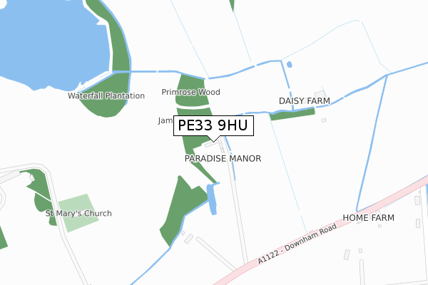
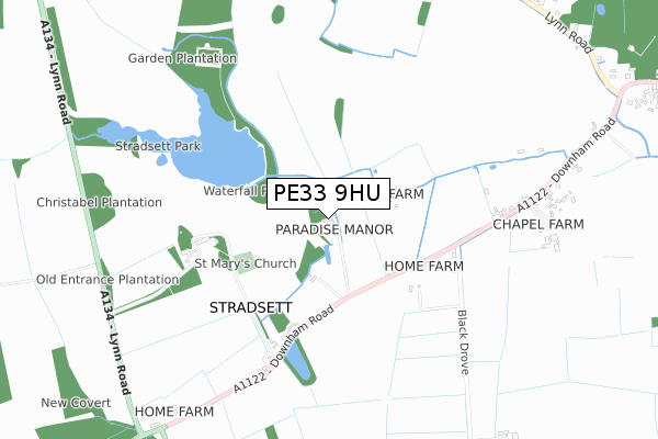
PE33 9HU is located in the Airfield electoral ward, within the local authority district of King's Lynn and West Norfolk and the English Parliamentary constituency of South West Norfolk. The Sub Integrated Care Board (ICB) Location is NHS Norfolk and Waveney ICB - 26A and the police force is Norfolk. This postcode has been in use since October 2017.


GetTheData
Source: OS Open Zoomstack (Ordnance Survey)
Licence: Open Government Licence (requires attribution)
Attribution: Contains OS data © Crown copyright and database right 2024
Source: Open Postcode Geo
Licence: Open Government Licence (requires attribution)
Attribution: Contains OS data © Crown copyright and database right 2024; Contains Royal Mail data © Royal Mail copyright and database right 2024; Source: Office for National Statistics licensed under the Open Government Licence v.3.0
| Easting | 567154 |
| Northing | 305812 |
| Latitude | 52.624356 |
| Longitude | 0.468066 |
GetTheData
Source: Open Postcode Geo
Licence: Open Government Licence
| Country | England |
| Postcode District | PE33 |
| ➜ PE33 open data dashboard ➜ See where PE33 is on a map | |
GetTheData
Source: Land Registry Price Paid Data
Licence: Open Government Licence
| Ward | Airfield |
| Constituency | South West Norfolk |
GetTheData
Source: ONS Postcode Database
Licence: Open Government Licence
| Home Farm (Downham Road) | Stradsett | 961m |
| Home Farm (Downham Road) | Stradsett | 967m |
| Rose's Wood Layby (A134) | Stradsett | 1,027m |
| Rose's Wood Layby (A134) | Stradsett | 1,030m |
| The Foldgate (Lynn Road) | Stradsett | 1,053m |
GetTheData
Source: NaPTAN
Licence: Open Government Licence
| Percentage of properties with Next Generation Access | 100.0% |
| Percentage of properties with Superfast Broadband | 0.0% |
| Percentage of properties with Ultrafast Broadband | 0.0% |
| Percentage of properties with Full Fibre Broadband | 0.0% |
Superfast Broadband is between 30Mbps and 300Mbps
Ultrafast Broadband is > 300Mbps
| Percentage of properties unable to receive 2Mbps | 0.0% |
| Percentage of properties unable to receive 5Mbps | 0.0% |
| Percentage of properties unable to receive 10Mbps | 50.0% |
| Percentage of properties unable to receive 30Mbps | 100.0% |
GetTheData
Source: Ofcom
Licence: Ofcom Terms of Use (requires attribution)
GetTheData
Source: ONS Postcode Database
Licence: Open Government Licence


➜ Get more ratings from the Food Standards Agency
GetTheData
Source: Food Standards Agency
Licence: FSA terms & conditions
| Last Collection | |||
|---|---|---|---|
| Location | Mon-Fri | Sat | Distance |
| Stradsett | 16:55 | 10:00 | 531m |
| Barton Bendish | 16:50 | 07:30 | 751m |
| High Street | 16:55 | 10:00 | 1,354m |
GetTheData
Source: Dracos
Licence: Creative Commons Attribution-ShareAlike
| Facility | Distance |
|---|---|
| Fincham Memorial Field High Street, Fincham, King's Lynn Grass Pitches | 1.5km |
| King George V Playing Field (Shouldham) Fairstead Drove, Shouldham Grass Pitches | 3.7km |
| Downham Stow Cc Hall Drive, Stow Bardolph, King's Lynn Grass Pitches | 4km |
GetTheData
Source: Active Places
Licence: Open Government Licence
| School | Phase of Education | Distance |
|---|---|---|
| St Martin At Shouldham Church of England Primary Academy Lynn Road, Shouldham, King's Lynn, PE33 0BU | Primary | 3.1km |
| Downham Preparatory School and Montessori Nursery The Old Rectory, Stow Bardolph, Nr King's Lynn, Norfolk, PE34 3HT | Not applicable | 4.3km |
| Holy Cross Church of England Primary School School Road, Runcton Holme, King's Lynn, PE33 0EL | Primary | 5.5km |
GetTheData
Source: Edubase
Licence: Open Government Licence
The below table lists the International Territorial Level (ITL) codes (formerly Nomenclature of Territorial Units for Statistics (NUTS) codes) and Local Administrative Units (LAU) codes for PE33 9HU:
| ITL 1 Code | Name |
|---|---|
| TLH | East |
| ITL 2 Code | Name |
| TLH1 | East Anglia |
| ITL 3 Code | Name |
| TLH16 | North and West Norfolk |
| LAU 1 Code | Name |
| E07000146 | King's Lynn and West Norfolk |
GetTheData
Source: ONS Postcode Directory
Licence: Open Government Licence
The below table lists the Census Output Area (OA), Lower Layer Super Output Area (LSOA), and Middle Layer Super Output Area (MSOA) for PE33 9HU:
| Code | Name | |
|---|---|---|
| OA | E00135847 | |
| LSOA | E01026727 | King's Lynn and West Norfolk 018B |
| MSOA | E02005568 | King's Lynn and West Norfolk 018 |
GetTheData
Source: ONS Postcode Directory
Licence: Open Government Licence
| PE33 9HQ | Black Drove | 480m |
| PE33 9HH | 667m | |
| PE33 9HF | Downham Road | 772m |
| PE33 9HE | Lynn Road | 1179m |
| PE33 9HD | High Street | 1288m |
| PE33 9EL | High Street | 1471m |
| PE33 9HL | 1631m | |
| PE33 9EJ | High Street | 1690m |
| PE33 9UR | Swan Lane | 1703m |
| PE33 9EN | Chapel Lane | 1729m |
GetTheData
Source: Open Postcode Geo; Land Registry Price Paid Data
Licence: Open Government Licence