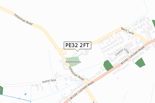
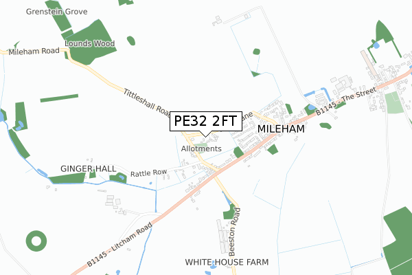
PE32 2FT is located in the Hermitage electoral ward, within the local authority district of Breckland and the English Parliamentary constituency of Mid Norfolk. The Sub Integrated Care Board (ICB) Location is NHS Norfolk and Waveney ICB - 26A and the police force is Norfolk. This postcode has been in use since February 2020.


GetTheData
Source: OS Open Zoomstack (Ordnance Survey)
Licence: Open Government Licence (requires attribution)
Attribution: Contains OS data © Crown copyright and database right 2024
Source: Open Postcode Geo
Licence: Open Government Licence (requires attribution)
Attribution: Contains OS data © Crown copyright and database right 2024; Contains Royal Mail data © Royal Mail copyright and database right 2024; Source: Office for National Statistics licensed under the Open Government Licence v.3.0
| Easting | 590918 |
| Northing | 319266 |
| Latitude | 52.737332 |
| Longitude | 0.826506 |
GetTheData
Source: Open Postcode Geo
Licence: Open Government Licence
| Country | England |
| Postcode District | PE32 |
| ➜ PE32 open data dashboard ➜ See where PE32 is on a map ➜ Where is Mileham? | |
GetTheData
Source: Land Registry Price Paid Data
Licence: Open Government Licence
| Ward | Hermitage |
| Constituency | Mid Norfolk |
GetTheData
Source: ONS Postcode Database
Licence: Open Government Licence
1, SIZELAND DRIVE, MILEHAM, KING'S LYNN, PE32 2FT 2020 20 NOV £310,000 |
2, SIZELAND DRIVE, MILEHAM, KING'S LYNN, PE32 2FT 2020 9 JUL £290,000 |
3, SIZELAND DRIVE, MILEHAM, KING'S LYNN, PE32 2FT 2020 29 MAY £335,000 |
GetTheData
Source: HM Land Registry Price Paid Data
Licence: Contains HM Land Registry data © Crown copyright and database right 2024. This data is licensed under the Open Government Licence v3.0.
| June 2022 | Anti-social behaviour | On or near Claxton Close | 276m |
| May 2022 | Violence and sexual offences | On or near Burghwood Drive | 268m |
| May 2022 | Criminal damage and arson | On or near Burghwood Drive | 268m |
| ➜ Get more crime data in our Crime section | |||
GetTheData
Source: data.police.uk
Licence: Open Government Licence
| Litcham Road | Mileham | 410m |
| Litcham Road | Mileham | 438m |
GetTheData
Source: NaPTAN
Licence: Open Government Licence
GetTheData
Source: ONS Postcode Database
Licence: Open Government Licence


➜ Get more ratings from the Food Standards Agency
GetTheData
Source: Food Standards Agency
Licence: FSA terms & conditions
| Last Collection | |||
|---|---|---|---|
| Location | Mon-Fri | Sat | Distance |
| High Street Post Office | 16:45 | 10:30 | 4,049m |
GetTheData
Source: Dracos
Licence: Creative Commons Attribution-ShareAlike
| Facility | Distance |
|---|---|
| Mileham Playing Field The Street, Mileham, King's Lynn Grass Pitches | 1.2km |
| Litcham School (Back Lane Playing Fields) Back Lane, Litcham, King's Lynn Grass Pitches | 2.5km |
| Litcham School (Secondary Site) Church Street, Litcham, King's Lynn Sports Hall, Studio | 2.7km |
GetTheData
Source: Active Places
Licence: Open Government Licence
| School | Phase of Education | Distance |
|---|---|---|
| Litcham School Church Street, Litcham, King's Lynn, PE32 2NS | All-through | 2.8km |
| Beeston Primary School Chapel Lane, Beeston, King's Lynn, PE32 2NQ | Primary | 3.4km |
| Brisley Church of England Primary Academy School Road, Brisley, Dereham, NR20 5LH | Primary | 4.5km |
GetTheData
Source: Edubase
Licence: Open Government Licence
The below table lists the International Territorial Level (ITL) codes (formerly Nomenclature of Territorial Units for Statistics (NUTS) codes) and Local Administrative Units (LAU) codes for PE32 2FT:
| ITL 1 Code | Name |
|---|---|
| TLH | East |
| ITL 2 Code | Name |
| TLH1 | East Anglia |
| ITL 3 Code | Name |
| TLH17 | Breckland and South Norfolk |
| LAU 1 Code | Name |
| E07000143 | Breckland |
GetTheData
Source: ONS Postcode Directory
Licence: Open Government Licence
The below table lists the Census Output Area (OA), Lower Layer Super Output Area (LSOA), and Middle Layer Super Output Area (MSOA) for PE32 2FT:
| Code | Name | |
|---|---|---|
| OA | E00134483 | |
| LSOA | E01026462 | Breckland 002D |
| MSOA | E02005504 | Breckland 002 |
GetTheData
Source: ONS Postcode Directory
Licence: Open Government Licence
| PE32 2PX | Tittleshall Road | 187m |
| PE32 2PU | Manor Terrace | 197m |
| PE32 2PR | Burghwood Close | 243m |
| PE32 2PY | Rattlerow | 250m |
| PE32 2RU | Claxton Close | 286m |
| PE32 2PT | Litcham Road | 287m |
| PE32 2PS | Litcham Road | 349m |
| PE32 2PP | Back Lane | 351m |
| PE32 2QY | The Paddocks | 450m |
| PE32 2TR | Redbricks Drive | 479m |
GetTheData
Source: Open Postcode Geo; Land Registry Price Paid Data
Licence: Open Government Licence